The Hadrian’s Wall path walk is a world-famous walk and one of England’s national trails, it is situated in the North of England.
Hadrian’s Wall path is one of the most popular National Trail. National trails are a number of long-distance walks across England and Wales. In total, there are 15 of these walks, which are routinely tackled by hikers from all across the world.
The Hadrian’s Wall Path walk takes hikers through farms, pastures, fields, and cities across a distance of 135km. But what makes this hike unique is its Roman origins. The entire walk runs close to the original route of Hadrian’s Wall, a structure built by Emperor Hadrian. He began building the wall in AD 122 to separate the Romans from the Northern Barbarians.
Much of Hadrian’s original wall, which is the largest Roman archaeological feature in Britain, can be seen along the route. Some sections of the route actually run alongside the original wall – and bring hikers into contact with original Roman forts and milestones.
Hadrian’s Wall was designated as a UNESCO World Heritage Site in 1987.
Many people walk the Hadrian’s Wall route for its historical significance. But many others, like myself, walk the route for other reasons. For me, I was motivated by three factors – the views, the challenge, and the chance to take a 6-day trip with Tom, one of my oldest and best friends.
People come from all across the world to undertake the hike. But Tom and I are from Cramlington, a town just 16km from one of the walk’s starting points. Lucky us!
Which Way to Hike Hadrian’s Wall Path?
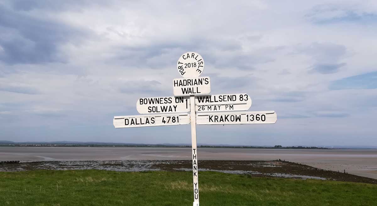
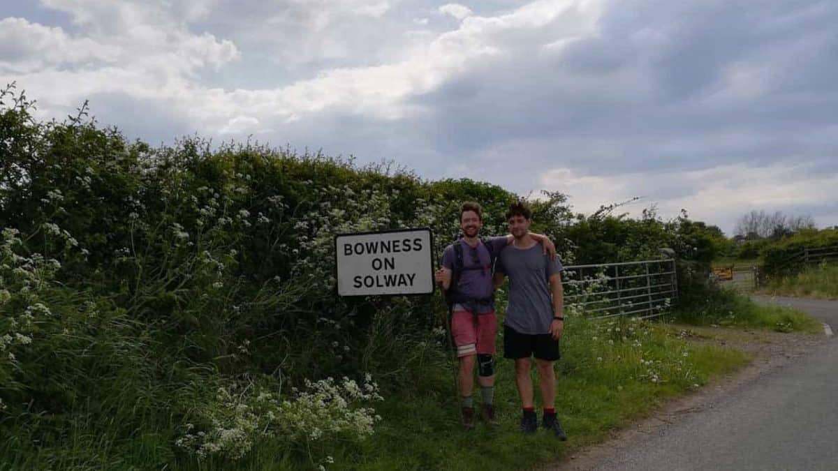
The most eastern point of Hadrian’s Wall is in Wallsend, a town 5.6 kilometres east of Newcastle city centre, the northernmost city in England. The most western point of the hike is situated at Bowness-on-Solway, a village with a population of fewer than 1,200 people. The village sits on the western coast of England.
Hadrian’s Wall walk can be undertaken in both directions. But most people prefer to walk east to west. This is mainly due to where this direction of the route ends. Bowness-on-Solway is a much more beautiful place to end than Wallsend. The peace and solitude of a small village is a lovely way to reflect upon the end of your walk. Walking east to west also means you get a better tan, assuming you walk in the summer months. But this direction isn’t without negatives.
Walking Hadrian’s Wall path east to west will force you against the prevailing wind, (though this shouldn’t be a concern in the summer). It’s also important to note that, if you walk from east to west, your first big stretch will be on paved paths, which have the potential to mash your feet (and joints) into submission. More on that later.
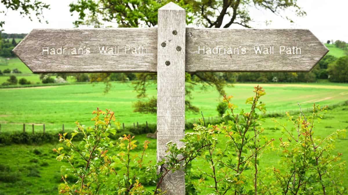
Whichever way you take the walk, Hadrian’s Wall path is very easy to follow. It’s marked by acorn symbols, which you’ll find with surprising regularity. These markings allow you to enjoy the views and vistas without fretting over navigation. Though I wouldn’t necessarily recommend doing so, the trail is so well-marked that Tom and I didn’t even carry a map. But we did carry plenty of snacks. We chose to walk east to west, as most people do.
When is the Best Time to Walk Hadrian’s Wall Path?
Undoubtedly, the best months to walk Hadrian’s Wall are from April to September. During any other time of the year, you’re likely to be greeted with poor weather. April – September offers three distinct periods:
- April – May: sunny and temperate without too much heat. In my opinion, this is the best time to do the hike. Tom and I tackled the trek in May.
- June – August: these are the summer months, making them the warmest option.
- September: it’ll be cooler in September, perfect if you want to miss the hotter summer months. But this month does bring quite a big risk of rain.
What do I Need to Take with Me?
This depends on the amount of time you want to spend on the hike, and how and where you plan to sleep. But here are some things you’ll need to think about:
- Food: you’ll want plenty of snacks. There are many villages and towns along the route, but some stretches offer little in the way of replenishment.
- A tent and the best sleeping bag you can afford if you want to camp, also if you are camping you will likely need a very good sleeping pad and a lightweight backpacking stove. Tom and I chose not to camp because we didn’t want to carry too much weight. Many people do camp, and it would be a beautiful way to make the experience more remote, more intimate and even more peaceful. But it also means carrying more weight and a little less luxury.
- The best hiking shoes and a lightweight rain jacket and quick drying clothes.
- A hiking water bottle (check out our Hydro Flask vs Klean Kanteen comparison) .
- You might want to take a map and compass, but as mentioned, the trail is so well-marked that we didn’t think that necessary.
Hadrian’s Wall Path Itinerary
Unlike some other walks, the Hadrian’s Wall walk has only one route. So your itinerary is determined not by where you want to walk, but simply by how long you want to walk. Tom and I decided to do the walk over 6 days, which is pretty much the maximum time anyone chooses to do it in.
Most people do the walk in 3 or 4 days. Some even run the whole thing in one day! We chose to walk over 6 days mainly because we wanted to treat the hike as a fun vacation rather than solely as a challenge. We wanted to relax, eat good food and drink good beer – all without the pressure of having to move on more quickly than necessary. Our itinerary looked like this:
- Day 1: Wallsend to Heddon-on-the-Wall – 26km
- Day 2: Heddon-on-the-Wall to Greencarts Farm – 28km
- Day 3: Greencarts Farm to Once Brewed – 19km
- Day 4: Once Brewed to Walton – 27km
- Day 5: Walton to Carlisle – 20km
- Day 6: Carlisle to Bowness-on-Solway – 23km
The above distances may vary slightly to distances shown in guidebooks, according to the specific places we decided to sleep. I’ll talk about those specific places later in this article. These overnight stops were a mixture of bunkhouses, hostels, and guesthouses.
Day 1: Wallsend to Heddon-on-the-Wall – 26km
The first day began at Segedunum, the eastern start of the trail. Segedunum is an ancient Roman fort, which is now the site of a museum. For those interested in Roman history, it’s a great resource for learning more about Roman culture – and about the significance of the north-east of England in relation to the Roman Empire.
We arrived at Segedunum early, ready to begin our first day at around 8 am. Tom’s dad, Lol (short for Lawrence, not for ‘laugh out loud’) gave us a ride to the starting point. Thanks, you’re a hero! We only spent a few minutes in the museum.
As I said, we weren’t tackling the hike because of any interest in the wall’s history. And being from the local area, we’d been to the site before as kids. Visiting the museum as a schoolkid is a (frankly boring) rite of passage for children across the northeast of England. And we were off! The first half of the first day takes walkers along the famous River Tyne.
This section of Hadrian’s Wall goes through the Quayside area of Newcastle, a beautiful, recently-regenerated part of the city. This stretch is an excellent way to see the stark contrasts of what the city once was compared to what it now is – it sets the industrial history of the city’s old shipyards alongside the relative affluence of riverside bars, restaurants, and cafes.
This part of Newcastle is also famous for its many bridges and traditional pubs. This is a lovely, trendy introduction to Newcastle life. Once we were out of the city centre, blisters were already voicing their niggling threats, I wanted to avoid any blister trouble as soon as possible, so we stopped for a while. I adjusted my shoes, applied some bandaids and decided to rest in a pub (any excuse). We stopped off at The Keelman pub, next door to Big Lamp Brewery, halfway along today’s route.
They have their own range of tasty beers, brewed on-site – a perfect place to stop off for a couple of deserved pints, especially if you have an interest in traditional British beer! A word of warning on the blister situation – although much of this trek is on grass, this first stretch is almost completely on the tarmac.
So heavy walking boots aren’t a great choice of footwear, as I learned the hard way. For this day at least, you should wear lightweight shoes which, unless the weather is terrible, are actually sufficient for the entire trek. After food and beer, we made our way towards Heddon-on-the-Wall.
After lunch, the landscape changed a lot – the city makes way to fields, woodland, and serenity. Upon arriving at Heddon-on-the-Wall, we checked into our bunkhouse. We stayed at Hadrian Hideout, a unique little dwelling in a converted garage. A local woman called Mandy has converted her garage for hikers to sleep in. She’s a lovely woman, and the bunkhouse is right on the trail. Thoroughly recommended! We ate, drank, and slept, ready for an early, long day tomorrow.
Day 2: Heddon-on-the-Wall to Greencarts Farm – 28km
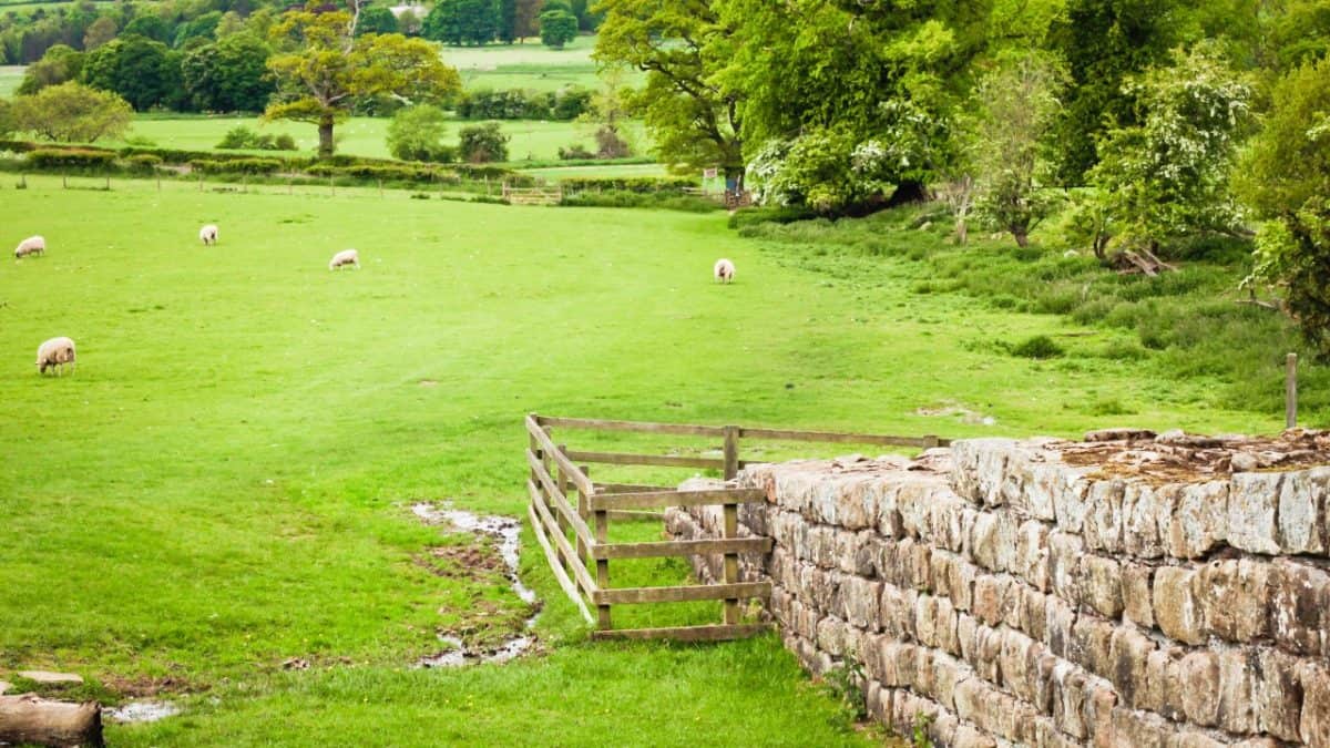
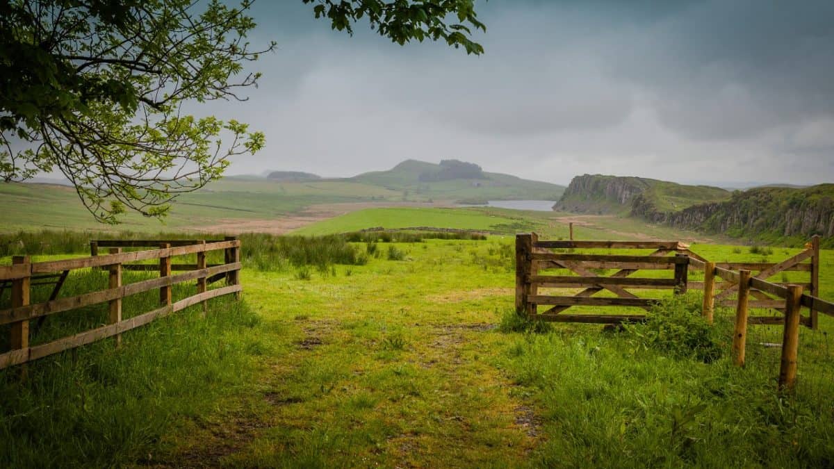
Today marked movement into more rural land, full of farms and fields. Early in today’s section of the Hadrian’s Wall Path, we were greeted by lambs, keen to make friends. Luckily, they were old enough that their sheepish mothers weren’t too protective, which allowed us to spend a long time petting every happy little lamb that came our way. Today also marked the start of a niggling knee, which unpleasantly persevered throughout the duration of the entire trek.
As I’ve already mentioned, I stupidly decided to wear rugged hiking boots on the first tarmac-ridden day. These boots had no bounce, leaving my angry knees to absorb all the impact. So, again – don’t wear heavy boots on the first day! From this point onwards, I started using tree branches for support throughout the walk. My knees were relieved, Tom was embarrassed.
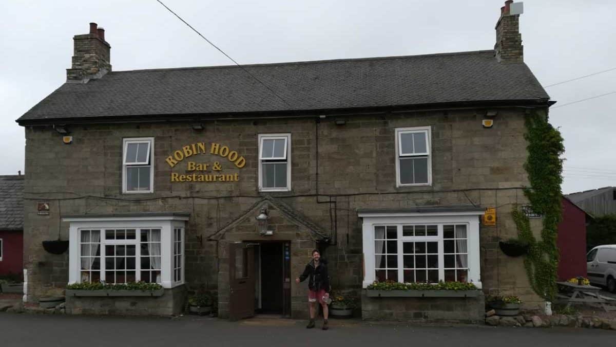
That’s what you get for not bringing hiking poles! For lunch, we stopped at Robin Hood Inn, where pretty much every Hadrian’s hiker stops. The pub is situated right on the trail, and it has fantastic food and beer. It’s another great example of a traditional English pub. Wherever you’re from, you should absolutely use this hike as a useful excuse to explore England’s pub culture. And as a useful excuse to drink loads of beer. After some lovely food, we moved onwards once more.
Almost the whole entirety of today takes you alongside the B6318 road. But don’t let that deter you – it’s a relatively quiet road, and it doesn’t diminish or distract from the lovely farmland around you. We reached the village of Chollerford, where many hikers spend the night.
But instead, we stopped for food and drink before then pushing on a further 4km to Greencarts Farm, a working farm with a bunkhouse, a camping barn, and a campsite. It’s a great place to stay – remote, rural and rustic. It gives a great insight into local farm life. My knees were grateful for the rest.
Day 3: Greencarts Farm to Once Brewed – 19km
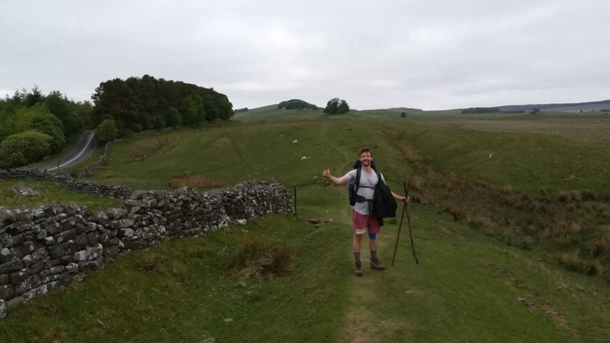
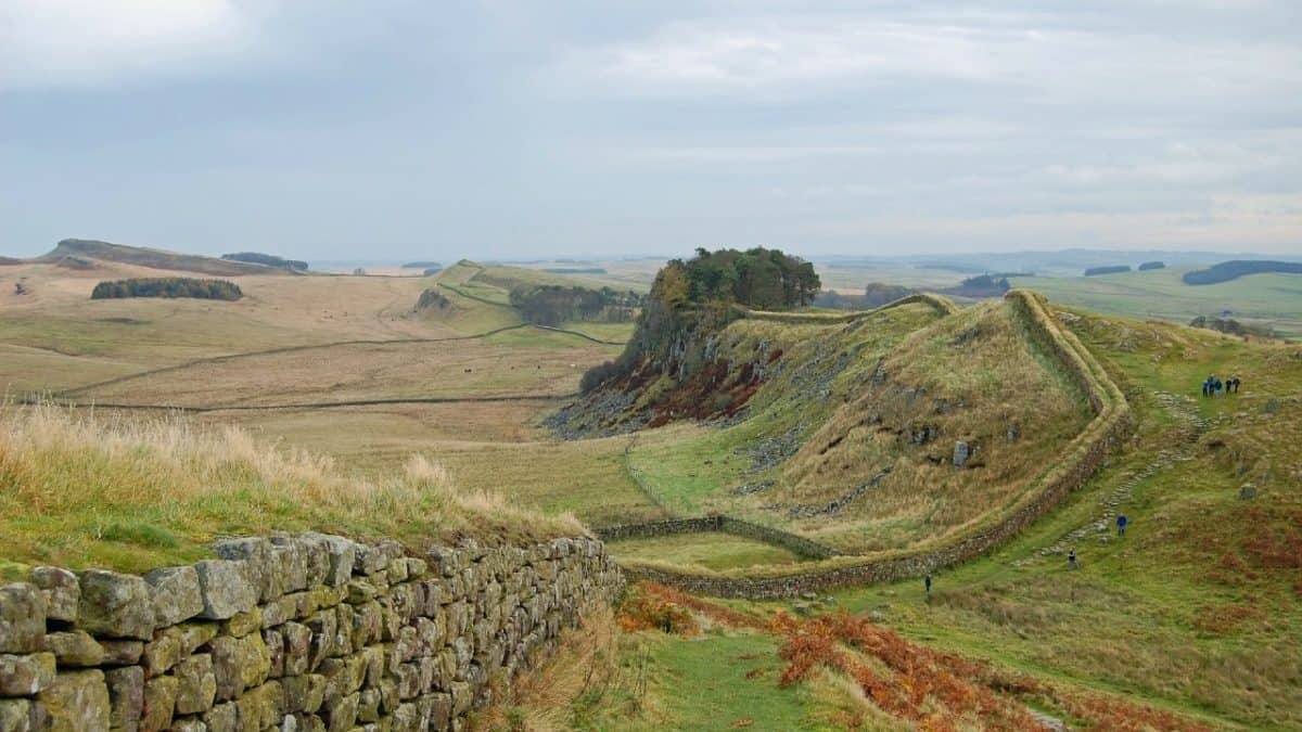
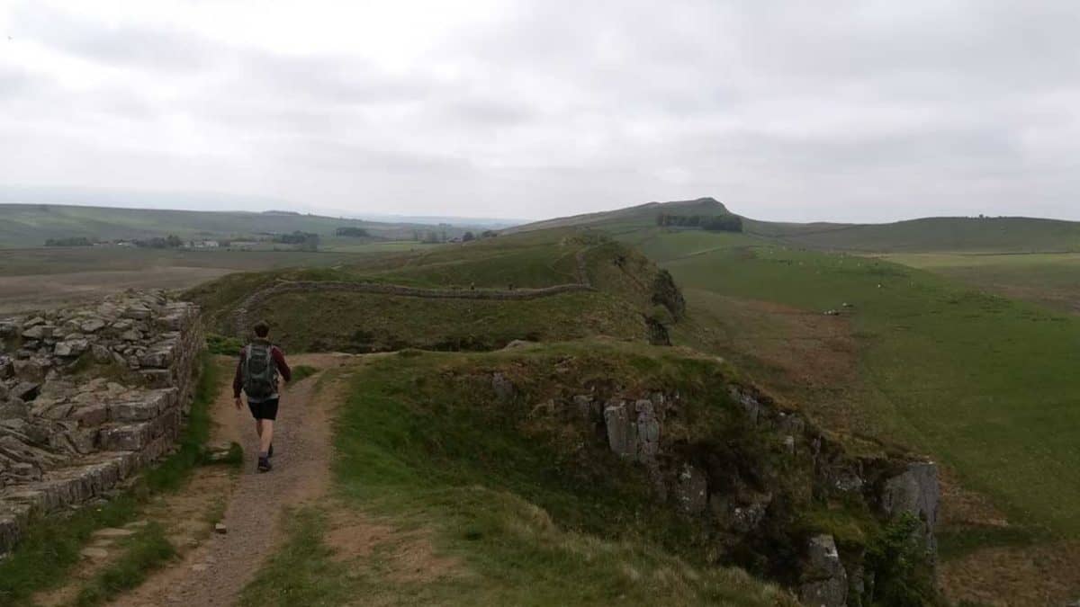
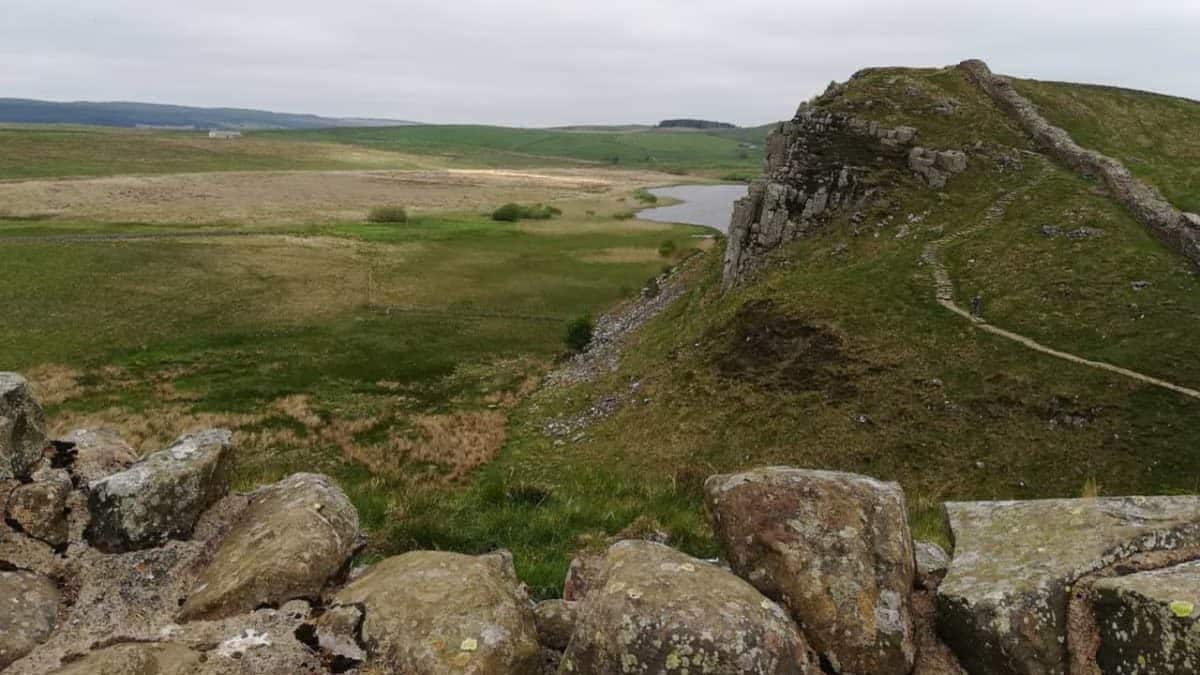
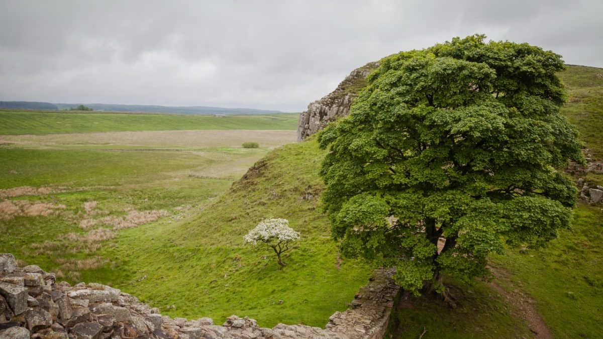
This the central section of the hike is where Hadrian’s Wall walk really gets good. And it’s the part during which you’ll pass through many of the walk’s iconic sights. You’ll pass Housesteads, perhaps the best-preserved Roman fort in the region. It’s an impressive sight, even for those (like me) who aren’t particularly interested in the historical side of the hike. You’ll also see Sycamore Gap, which is surely the most photographed section of the entire Hadrian’s Wall walk. It’s a famous spot in which stands one solitary tree.
The tree sits in a mini-valley, where the trail dips briefly before rising back up. This entire day is full of these ups and downs, which makes the day a little more challenging compared to the flat landscapes of previous days. But that brings with it much more rewarding views, as the elevation offers beautiful panoramas all around. This stretch also has lots of crags, lakes, and ridges, all of which provide perfect picnic spots. So much so that Tom and I decided simply to eat en route.
We stopped off a couple of times to gobble down the snacks we’d brought with us. Throughout the whole walk, we were very lucky with the weather. And today was probably the best day of the bunch, with lovely temperatures and views, but enough cloud cover to keep us comfortable. We stayed in YHA Youth Hostel in Once Brewed, a great hostel for meeting other hikers.
We ate and drank at Twice Brewed Inn, just a few steps from where we were sleeping. This is another great pub for food and drink – and they brew their own beer on-site. The trip was quickly turning into a beer-tasting trip rather than a hiking one. But food and drink isn’t all this pub offers – you’ll find that many, many hikers stop here, so it’s a perfect place to meet other walkers.
Day 4: Once Brewed to Walton – 27km
Today was one of our longest days. Because of that, waking up with a hangover wasn’t ideal. But that’s exactly what happened. The landscapes from this day were similar to those we’d experienced the day before. But that was a great thing – this day and the previous were the most beautiful of the entire trek. Again, the rolling hills offered up plenty of different panoramas. Many people who aren’t ready or willing to do the whole hike – for whatever reason – ask about the best small section to do.
Without a doubt, my advice to anyone who only wants to do a short section is as follows: the approx 45km from Greencarts Farm to Walton is absolutely the best stretch – and absolutely offers the best views. Today featured more crags, more lakes, more farms. And it marked the day we entered the county of Cumbria.
A couple of asides for this part of the trail… Firstly, the House of Meg cafe in Gisland filled my mouth and my belly with maybe the best sandwich I’ve ever had (brie, chicken, and bacon). You should absolutely go there for a lunch stop. Secondly, we spent the night at Low Rigg Farm, another lovely rural stopover. It’s a warm, hospitable, friendly place to spend the night.
Day 5: Walton to Carlisle – 20km
Today was a big step towards civilization. After days of scenes and serenity, our fifth day took us to the city of Carlisle. Today marked the return of flatter landscapes and was reminiscent of day two of our trip. Generally speaking, that’s an easy way to categorize the entire walk – the first third and final third give you flat land, fields, farms, pastures, and cities.
Meanwhile, the middle third of the journey gives you ups, downs, peaks, troughs, and more interesting views. That said, this day was still a beautiful one. We saw lots of farms, farm animals and wildlife. We then reached Carlisle, as life gradually became busier, noisier and more bustling.
Though we were in Newcastle only a meagre four days ago, this felt like a step towards civilization, and it was strange to be back in a city, albeit a very small one with a population of less than 80,000. But that’s not all bad news. Cities offer conveniences that previous days hadn’t, so we had plenty of access to food, drinks, supplies, snacks and more.
Tom was embarrassed because I spent my entire time in Carlisle hobbling around with a bandaged knee and two tree branches. He had more sympathy for his own shame than he did for my joints. But I needed all the support I could get (even if none of the moral variety was on offer), so I limped on regardless. We ate some food, we drank some beer, we slept.
Day 6: Carlisle to Bowness-on-Solway – 23km
The final day! We left Carlisle, knowing we’d be returning by bus later that day. In our hostel, we’d made friends with a girl from the Netherlands (whose name I can’t remember now – but if you’re reading this, hello!), so we continued on in her company. The early part of the walk took us along the River Eden, then into some woodland. In this woodland, the three of us met Derek, a funny and friendly Scottish man with who I’m still in fairly close contact.
Since completing this walk, I’ve stayed with him and his wife in their home in Stranraer. They’re a lovely couple. We then walked through some church grounds in the small village of Burgh-By-Sands before hitting the final stretch of the salt marshes.
These salt marshes are strangely compelling in their starkness, and they gradually change from green to grey as they reach the sea. As the ocean comes into view, the change in scenery represents the end of the trek. This point felt bittersweet – the end of the walk brings with it pride and relief, but in some ways, it’s a shame to be done.
The very endpoint of the walk, on the shores of the sea, is oddly anticlimactic. But there’s a famous pub in Bowness-on-Solway called The Kings Arms, which makes for a proper ending. It was under renovation when I was there, with no frills but plenty of fun. It made for an excellent way to end my walk.
Tom and I had a couple of pints with our two new friends along with a man called Andrew, who we’d crossed paths with a few times along the walk. This pub is a great place to end your walk (or even to start it if you’re walking east!).
You’ll encounter many other hikers, and it has a perpetually celebratory atmosphere, excellent for basking in the glory that inevitably comes at the end of a long walk. We then took a bus from Bowness on Solway back to Carlisle from just outside of the pub.
We’d planned to go on a big pub crawl to celebrate finishing the hike. So that’s exactly what we did. Upon reaching Carlisle, we ate loads of food, drank loads of beer, and went out to a nightclub. I can’t remember the end of the night, but I’ll always remember the walk.
Final Thoughts on Hadrian’s Wall Path
The Hadrian’s Wall Path hike is incredible and makes a great walking holiday. For me the highlights are:
- Views: the panoramas during the middle section of the hike are fantastic. They’re varied, they’re beautiful and they’re archetypally British.
- People: people from the northeast of England have a reputation for being some of the nicest people on the planet. And it’s a reputation rooted in fact. You’ll meet plenty of lovely local people along the way. The walk is a lovely, life-affirming way to experience this part of the world.
- Pubs: the hike offers lots of traditional pubs, traditional food, and traditional beer. If you’ve got an interest in any of those three things, you’ll really enjoy the various stops and snacks along the way.
- Challenge: challenges are good for the soul. Upon completing the hike, I was proud of myself for achieving the feat, especially since my knee seems determined to give up and go home since day two. But I’d made it, and that’s always an achievement I can look back on and be proud of.
- Friendship: Tom and I have been friends for twenty years. The hike allowed me to spend six days with one of my best friends in the world. That alone was enough of a reason to undertake the trek.
If you’ve ever wanted to take on a trekking challenge, Hadrian’s Wall walk is a great one to go for. It’s not too difficult compared to other longer, tougher, more technical challenges, and it’s fairly flat, so it’s a good adventure for a casual hiker. That said, it’s still adventurous enough to deserve respect. You’ll encounter beauty, tradition, and great food and drink – and it might just bring you closer to the people you do it with.
Other UK long distance walking routes:
- South Downs Way
- Cotswold Way Guide
- Cleveland Way Guide
- Coast to Coast Walk Guide
- Pennine Way Guide
- Thames Path Guide
All the way back in the second century, Emperor Hadrian began building a wall to protect Roman England from its Northern neighbours. But he inadvertently did so much more than that – he crafted a trekking trail replete with fun, friendship, and fresh air. If you’re considering taking the hike, I would 100% recommend it. In spite of a few negatives along the way, it’s still one of the most enjoyable, rewarding and fulfilling things I’ve ever done.
I love hiking, backpacking, and camping. From the Camino de Santiago to the West Highland Way in Scotland or simply a great day hike on the weekend. Hiking refreshes me, my mind, and keeps my body reasonably fit. So far I have walked three Camino routes and many other long distance hikes in the UK, Canada, and around the rest of Europe. One of the best was my hike up Ben Nevis.