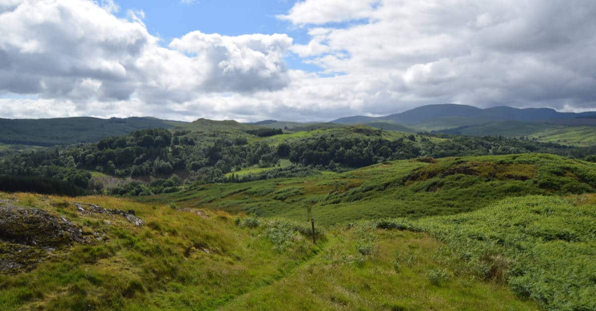
Stretching from Portpatrick, on the west coast of Scotland, all the way to Cockburnspath on the east, the Southern Upland Way just might be the most serene trail in the country. The Southern Upland Way is far from the most popular walk I’ve completed, but it’s definitely among the ones I’ve enjoyed the most.
The trail offers some of the best views of the Scottish countryside, and yet, very few hikers walk across this part of Scotland. Even though I loved the social aspect of both the Camino and the West Highland Way, there’s still something lovely about knowing that you’re probably the only person enjoying the stunning views around you; as there are so few people out there.
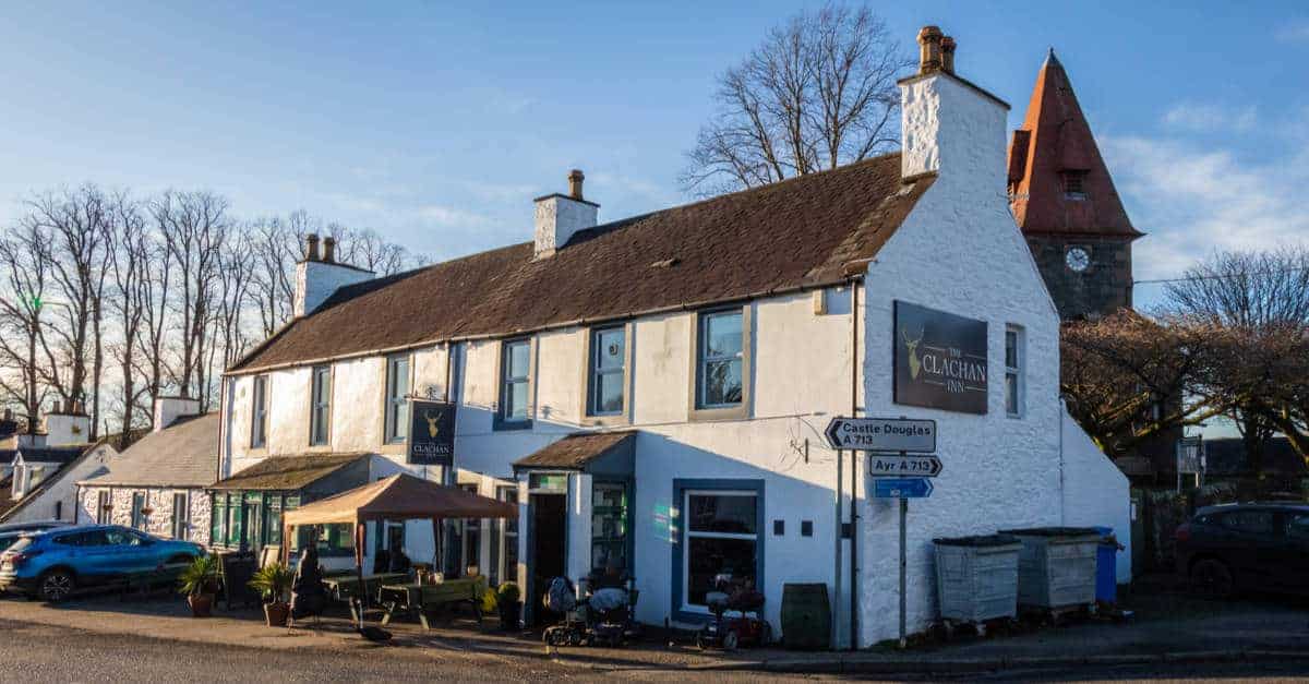
If you like camping or staying in bothies, the Southern Upland Way is an ideal walk for you. And, even though several sections of the Way offer very few accommodation options, you can easily arrange to stay in a nice B&B every night, thanks to public transport links and local taxi services. With just a little bit of organization, you will easily be able to find a pub and a shop close to (almost) every section of the trail.
Overview of the Southern Upland Way
Opened in 1985, the Southern Upland Way is now one of Scotland’s Great Trails. It’s the first officially recognised coast-to-coast long-distance route in the United Kingdom and one of the four original official long-distance walks in Scotland.
- Length: 212 miles
- Region: South Scotland
- Start: Portpatrick, Dumfries and Galloway, West Coast
- Finish: Cockburnspath, Scottish Borders, East Coast
- Time required: 12 to 18 days
- When to Walk: May to October
- Difficulty: Medium-hard
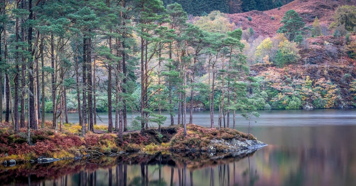
As mentioned, The Southern Upland Way provides a wide scenic variety. It includes rolling moorlands as well as some loch and river-side walking. Although the route takes you through a few towns and villages most of the walk is spent walking through quiet, often isolated, areas. It’s not rare to spend a whole day walking without bumping into another person.
It starts in the west leading you north along the edge of rocky cliffs before turning east towards sheep pastures, moorlands, and forests. The route ends with a stunning cliff-top walk similar to that at the start and takes around 12 to 16 days to complete. While the terrain is manageable, some of the longer stages (30 to 40 km per day) can be too much for less experienced distance hikers.
Thankfully, you can arrange to be collected half way through the stage, driven to closest accommodation and be dropped off at the same spot the next morning. Also, if you are short on time, you can split the route into two parts from Portpatrick to Moffat and from Moffat to Cockburnspath. Each part can be done in 6-8 days.
What Is It Like To Walk the Southern Upland Way?
With a wide range of scenery, the SUW is a varied walk. The trail encounters a wide range of dramatic landscapes, conquering high moorland, expansive lochs, quiet forests, epic mountains, and valleys teeming with life. The Southern Upland Way also passes through several areas rich in historical and archaeological interest.
The first section of the trail runs along the edge of rugged cliffs. But, the rest of the western section is low. It will take you across low moorland, forests, and sheep pastures. You will see the first big hills when you reach Glen Trool, but the trail will remain low until you get to St. John’s Town of Dalry. Then, you will traverse higher, rougher hills, until you get to the final cliff-top walk that mirrors the start.
Most hikers walk the Southern Upland Way west to east, from the Irish Sea, across Southern Uplands, over the foothills of the Lammermuir Hills, to the North Sea. If you walk the path in this direction, you’ll be looking away from the sun and the prevailing winds will be behind you.
Difficulty
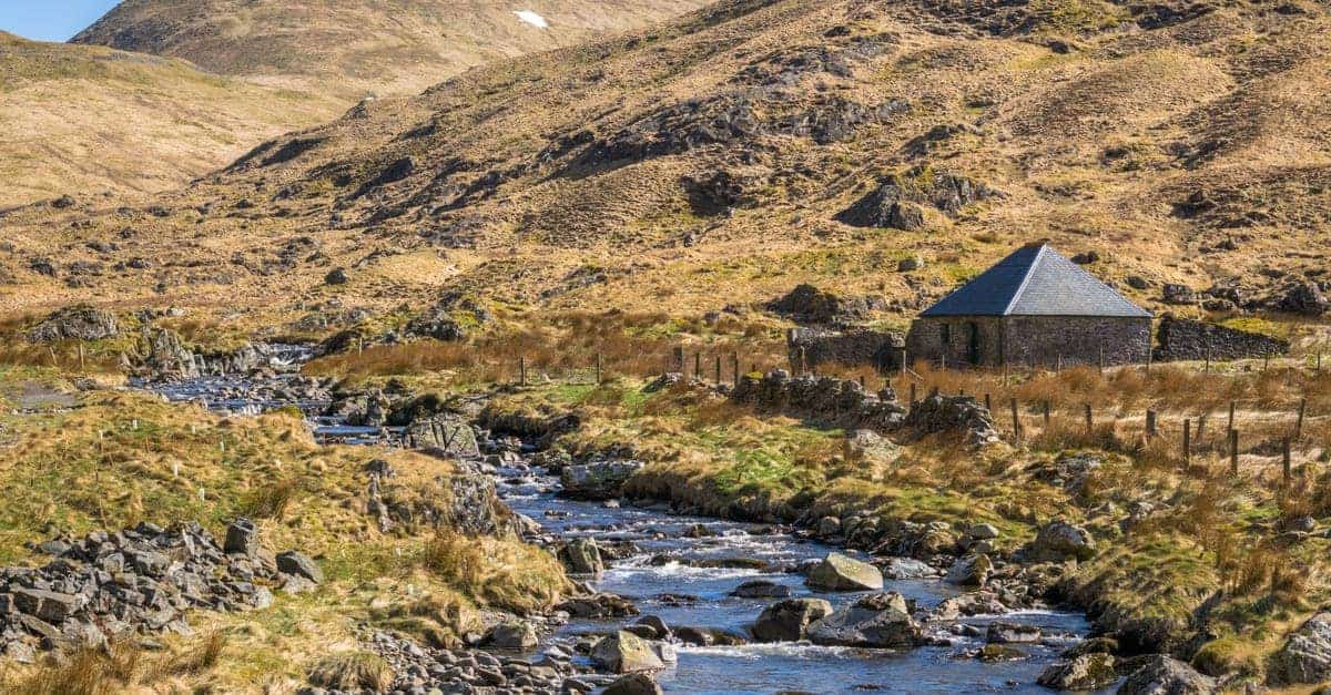
The walk is not too difficult for the most part. You will not have to conquer any peaks above 3000ft (914m). Nonetheless, the terrain rises above 2000ft (610m) on around 80 occasions making for delightful hill walking. Rougher climbs can be expected leading up to St Mary’s Loch after which the trail takes you through heather-clad hills and big rivers.
The quality of the path can be varied, with some boggy and muddy sections, but there aren’t too many steep climbs. And, while there isn’t an abundance of accommodation options, you will be able to find a place to sleep at the end of each day’s hike. Still, if you are yet to do your first long-distance adventure, I recommend you find an easier long-distance route.
The Dava Way and Formartine and Buchan Way are also designated as Scotland’s Great Trails, but they are more suitable for beginners. The Southern Upland Way is a unique challenge. Walking an entire day without seeing another person is not uncommon on the Southern Upland Way. You should be prepared and well-equipped for emergencies because there are a few long, difficult stretches in exposed open upland. Make sure to pack the right layers and enough food.
I always had a few meal kits and some dried food on me. You will also need a torch and a first aid kit. Most walkers complete the Southern Upland Way within 16 days. I worked a couple of half days into my itinerary, so it took me a bit longer. There are a few sections that were too long for me to walk in a day. So, I split them up and stayed in bothies. A couple of times, I set up a wild camp. If you don’t have a tent and a sleeping bag, you can always arrange a lift to the nearest accommodation.
If you want to challenge yourself a bit more, on the other hand, you can divide the route into 12 stages and complete it in 12 days. But, unless you are a really experienced hiker, I wouldn’t recommend this.
Navigation
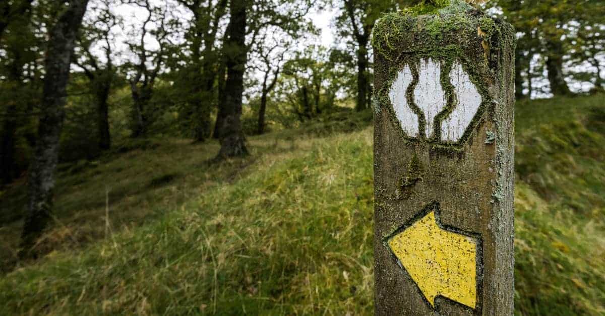
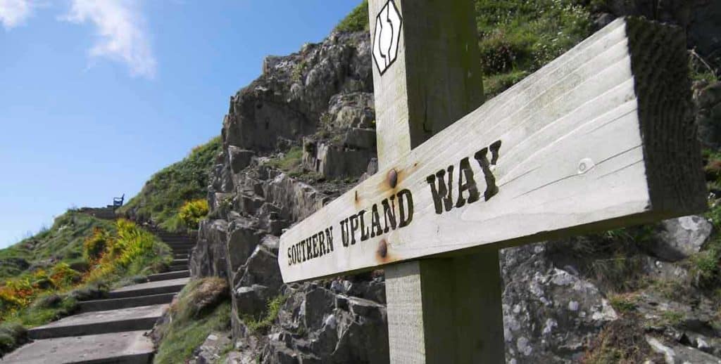
It might come as a surprise considering that the route is relatively unknown, but the entire path, from the east coast to the west coast, is well-waymarked. You probably won’t need to use a map, but make sure to learn how to read one, just in case. Visibility can be a problem along some stretches.
Most walkers recommend using OS maps, but I found the Harvey Map to be an impressive alternative. It isn’t bulky, and provides more useful information for walkers compared to OS maps. I also used the revised edition of Alan Castle’s Cicerone guidebook. It divides the walk into 13 stages, provides you with maps of the trial and accommodation, travel and health and safety information. It’s hard to get hold of in a store, so it’s probably best to purchase it online from the official Cicerone Press website. It’s available in a printed, electronic, and Kindle versions.
The countryside rangers do a great job of maintaining and improving the route. If you need help with anything, or if you run into some problems along the Southern Upland Way, don’t hesitate to contact them. Dumfries and Galloway Countryside Ranger Service (Portpatrick to Ettrickhed, east of Moffat):
- Email: southernuplandway@dumgal.gov.uk
- Tel: 03033 3000
Scottish Borders Council Ranger Service (Ettrickhead to Cockburnspath)
- Email: rangers@scotborders.gov.uk
- Tel: 01835 825070
How Do I Get to the Southern Upland Way?
Getting to Portpatrick can be a bit of a challenge, depending on where you are coming from. The town doesn’t have a railway station, and the closest one is in Stranraer. There are regular trains from Kilmarnock to Stranraer. There is also a train from Ayr to Stranraer, but it runs just a few times a day. The trains in the area are a bit slow, so it can take a while to get there.
When you get to Stranraer, you can catch a bus to Portpatrick. If you are coming from Glasgow, there are a few train lines that run directly to Stranraer. There’s no railway station in Cockburnspath either, but there is a bus service to Berwick (for trains south) and Dunbar (for trains north). Both towns have great railway links to the rest of the country.
What Is the Best Time of Year to Walk the Southern Upland Way?
The Southern Upland Way is open year-round. But, you’d really want to avoid walking the route in winter. Much of the route will be covered in snow for several months. Moreover, most services and facilities are closed this time of year. There could be snow or harsh weather even in late autumn or early spring. You should only do the Southern Upland Way at this time of year if you are an experienced hiker who has already completed several long-distance winter walks.
Generally, I don’t recommend people to walk a long-distance path in Scotland at the height of summer, but the Southern Upland Way is an exception. While most of the great trails in the country are buzzing with activity during school holidays, the Southern Upland Way is quiet and serene throughout the whole year—even when the weather is perfect.
I walked the trail in July and only saw a handful of fellow walkers. But, there can be a lot of midges in Scotland in summer. If you ask me, they are not as big a problem as people make them out to be. If you bring midge-repellent, a midge net, and citronella candles (for the evenings), they won’t spoil your adventure.
The Southern Upland Way is exceptionally beautiful in late spring. The wildflowers are at their best and the birds are in full song. The temperatures are a bit cool, but still pleasant for walking. The same goes for autumn. No matter the season, you should be prepared for rainy spells. Make sure to bring waterproofs.
Check out our post on the best time to visit Scotland as well.
Planning an Itinerary
Considering that the Southern Upland Way is a relatively isolated path, camping is your best bet. Wild camping is perfectly legal in Scotland, thanks to the Outdoor Access Code. I brought a lightweight tent with me, and, while it did increase my load, it gave me a wonderful level of flexibility. The local rangers divided the route into 12 stages. Even though some are way longer than others, the idea is still for each section to be manageable in one day. But, in my opinion, this might be too much, even for a reasonably fit walker. You can see for yourself:
12-Day Itinerary
- 1st Stage: Portpatrick to Castle Kennedy — 13.5 miles
- 2nd Stage: Castle Kennedy to Bargrennan — 26.5 miles
- 3trd Stage: Bargrennan to St John’s Town of Dalry — 26 miles
- 4th Stage: St John’s Town of Dalry to Sanquhar — 26 miles
- 5th Stage: Sanquhar to Wanlockhead — 8 miles
- 6th Stage: Wanlockhead to Beattock —20 miles
- 7th Stage: Beattock to Saint Mary’s Lock —21 miles
- 8th Stage: Saint Mary’s Loch to Traquair — 12 miles
- 9th Stage: Traquair to Melrose —18 miles
- 10th Stage: Melrose to Lauder — 10 miles
- 11th Stage: Lauder to Longformacus — 15 miles
- 12th Stage: Longformacus to Cockburnspath — 18 miles
I wasn’t fit enough for such an endeavour, nor was I in a hurry, so I found some alternative itinerary suggestions on a hiking forum, took it easy, and completed the walk in 18 days. This is what my adventure looked like:
18-Day Itinerary
- 1st Stage: Portpatrick to Stranraer — 9.5 miles
- 2nd Stage: Stranraer to New Luce — 11.5 miles
- 3rd Stage: New Luce to Bargrenan — 20 miles
- 4th Stage: Bargrenan to Loch Trool (White Laggan Bothy) — 11 miles
- 5th Stage: White Laggan Bothy to Dalry — 11 miles
- 6th Stage: Dalry to Polskeoch (Chalk Memorial Bothy) —16.5 miles
- 7th Stage: Chalk Memorial Bothy to Sanquhar — 9.5 miles
- 8th Stage: Sanquhar to Wanlockhead — 8 miles
- 9th Stage: Wanlockhead to Beattock — 20 miles
- 10th Stage: Beattock to Saint Mary’s Loch — 21 miles
- 11th Stage: Saintt Mary’s Loch to Traquair — 12 miles
- 12th Stage: Traquair to Galashiels — 12.5 miles
- 13th Stage: Galashiels to Melrose — 4.5 miles
- 14th Stage: Melrose to Lauder — 10 miles
- 15th Stage: Lauder to Longformacus — 14.5 miles
- 16th Stage: Longformacus to Ellemford Bridge — 4 miles
- 17th Stage: Ellemford Bridge to Edgar’s Clough — 3 miles
- 18th Stage: Edgar’s Clough to Cockburnspath — 8 miles
There are railway stations in Stranraer, Kirkconnel, Sanquhar, Galashiels, Berwick upon Tweed (south of Cockburnspath), and Dunbar (north of Cockburnspath). I was able to find a shop and a pub in almost every village or town. Almost! So, there are a few things I must note:
- There’s a modest selection of shops in Portpatrick and Stranraer, but there are no shops en route.
- There weren’t any open pubs in New Luce. However, Kenmuir Arms is supposed to reopen, so be sure to check before your walk.
- There are no shops in Bargrennan, but there is one in Glentrool. Accommodation in Bargrennan is limited. There is a designated camping and caravan site in Glentrool, but it’s closed from October to March.
- At St Mary’s Loch, Tibbie Shiels Inn is the only campsite with facilities. The Inn itself is closed.
The closest accommodation options, the Gordon Arms Hotel and Hartleap B&B, are a few miles away. But no matter which place you choose, they can send someone to pick you up at the Glen Cafe which lies along the route.
- There are no shops between St Mary’s Loch and Traquair. The closest shops are 1.5 miles off route in Innerleithen.
- There are no pubs or shops in Longformacus, and there is only one B&B.
- No shops in Ellemford Bridge and accommodation is limited. There are a B&Bs and Guesthouses at Duns. There is no public transport in Ellemford, so you’ll have to arrange for someone to pick you up.
- There’s no pub in Cocksburnspath, so my celebratory dinner and pint had to wait. There were no accommodation options in Cockburnpath when I finished my walk. Now, there’s a luxury glamping site and a newly-opened B&B.
Since I had enough of camping at this point, I hitched a ride to Dunbar and stayed at a lovely guesthouse. There are plenty of accommodation options in the town.
Bargrennan to Sanquhar
I broke up this long section into a few shorter stages and I strongly advise you to do the same, unless you fancy walking 26 miles for 3 days in a row. There are a couple of ways you can do this. The first one is to follow my itinerary and walk the section over four days. But forget about sleeping in a proper bed. Your only option is to stay in bothies.
These are basic shelters with almost no facilities (not even toilets). There’s the White Laggan bothy between Bargrennan and Darly and the Chalk Memorial Bothy at Poslkeoch. I had my sleeping bag and hiking stove with me since I was mostly camping on the SUW, so I quite enjoyed staying at bothies. But it won’t be such an enjoyable experience for you if you don’t have any camping gear. So, if you are staying at B&Bs, you may want to split this stretch over three days.
You can use vehicle support and stay in Dalry for two nights in a row. There are two official, clearly marked pick-up points along this section. You won’t have a hard time finding an accommodation provider in Darly that will collect you from the main route and drop you off at the same spot the next day so that you won’t skip a single mile of the Southern Upland Way. If you go with this option, your itinerary might look something like this:
- Bargrennan to Craigenbay/Clatteringshaws Loch — 16.5 miles
- Craigenbay/Clatteringshaws Loch to Stroanpatrick — 15 miles
- Stroanpatrick to Sanquhar — 18.5 miles
Camping on the Southern Upland Way
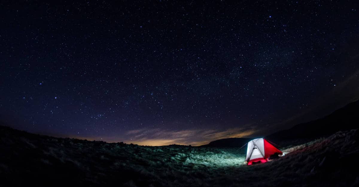
As mentioned, camping is the perfect solution if you want to have a more flexible itinerary. There is a list of designated campsites, bothies, and hotels on the official website of the route. You can search for campsites on this website as well. Since the trail goes through plenty of wild and remote areas, I thought the SUW was a great walk for wild campers.
I wasn’t wrong, but finding a place in the wild to pitch a tent wasn’t always easy, mostly due to nearby buildings and livestock grazing. I always like to camp on the route, where there is clean water nearby. The locals made things much easier for me. The people living on the route corridor really are a friendly bunch.
Almost every farmer I ran into invited me to use their water tap and offered me refreshments. A few of them invited me to pitch a tent on their lawn, and I did exactly that a couple of times. However, you can’t always count on the generosity of the locals as civilization is often many miles away.
But, if you bring a backpacking water filter and a stainless steel water bottle such as the Hydro Flask or Yeti, you will always be able to wild camp away from a freshwater source. In any case, you won’t be out of options. Although I mostly stayed at designated campsites and boothies (and well-kept farmland, thanks to the goodwill of the local people) I always kept an eye out for the perfect camping spot in the wild.
I found it just a few steps past Stroanpatrick Farm. However, rain was expected that evening, so I didn’t want to take my chances. After a short but idyllic picnic, I made my way to the Chalk Memorial Bothy. I did set up camp just outside Abbey St Bathans, at a fantastic wild campground called Edgar’s Clough.
I couldn’t pick a better spot to spend my last night in a tent. If you need help finding the campsite, here is its exact location on the map. If you plan on wild camping on the Southern Upland Way, it’s best to avoid the lambing season.
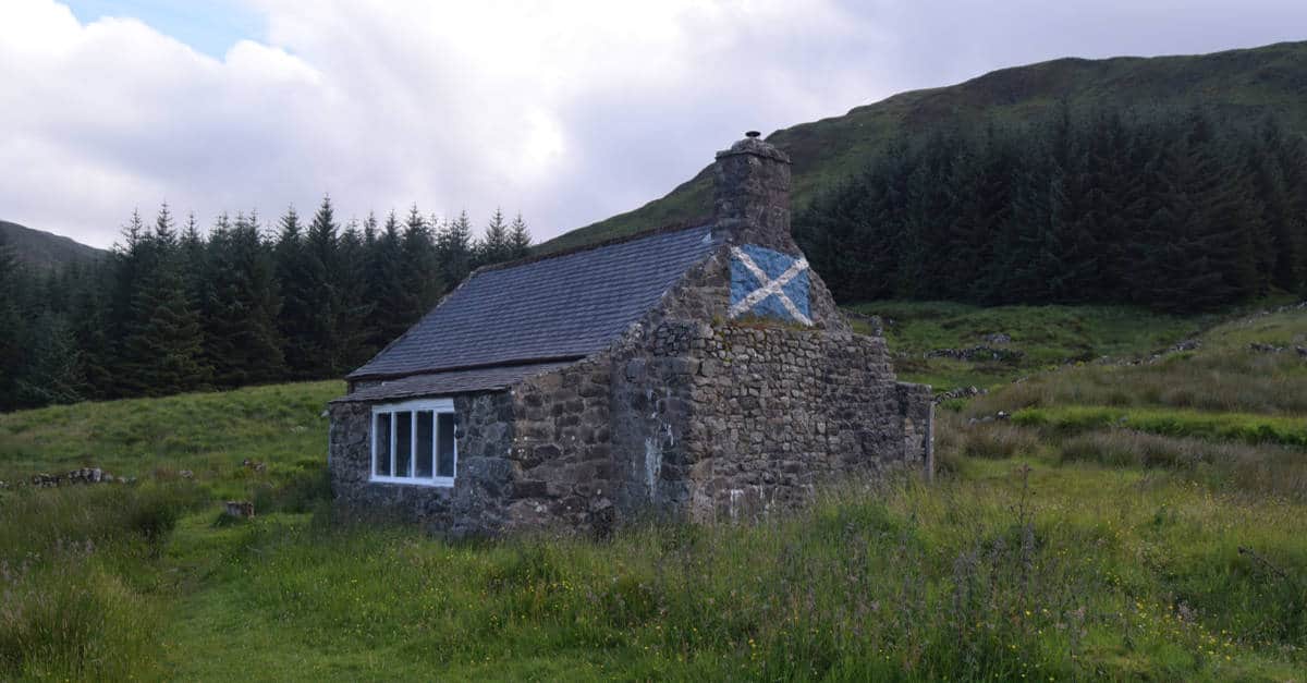
Bothies
Bothies are a unique feature of this coast-to-coast long-distance trail. En route, you will come across 5 unmanned and unlocked shelters. If you plan on wild camping on the Southern Upland Way, you will undoubtedly appreciate them. It’s important to note that all of them are along the west leg of the Southern Upland Way.
The local rangers are in charge of maintenance, so you’ll find them to be in good shape. If you want to stay in a bothy, simply let yourself in. But you are expected to tidy up the place before you leave. If you’re staying in a bothy and other walkers show up, you are supposed to welcome them inside—in normal circumstances. But, due to social distancing rules, only one group of walkers can use a bothy at a time. Bothies don’t have running water or toilets. Make sure to bring a trowel so that you can dispose of your waste properly.
The Beehive
The first bothie is located in the heart of Kilgallioch Forest, between New Luce and Bargrennan. It offers 6 sleeping benches for sleeping. Outside, you’ll find a picnic bench and a fire area.
White Laggan
This one is located halfway between Bargennan and Dalry. It has a fireplace, a kitchen, and two rooms. Even though it’s not directly on the route, It’s quite easy to spot from afar. You’d want to get there while there’s still daylight. The bothy offers a gorgeous view of Merrick, the highest hill in the Southern Uplands, as well as Loch Dee.
Chalk Memorial Bothy
The Chalk Memorial Bothy lies directly on the route, near Polskeoch. It has a wood-burning stove. It had started raining by the time I got there, so I was ecstatic when I found dry firewood and kindling sitting next to it.
Brattleburn
This lovely bothy is located between Wanlockhead and Beattock. There are two small rooms downstairs, each one has a wood-burning stove. Upstairs, you’ll find a large loft area. It is located about half a mile from the route.
Over Phawhope
This one has two buildings. The main one has a wood-burning stove and two separate rooms. There are picnic benches outside. Over Phawhope sits directly on the route, between Beattock and St Mary’s Loch.
Accommodation
You can find accommodation options on the official website (the same map that displays the campsites, services, and facilities along the route). The map is a bit difficult to navigate; you need to zoom in on every section of the route to see all the options. Accommodation options along the eastern section of the path are very limited. So, even though SUW isn’t as popular as the rest of Scotland’s Great Trails, you should still book accommodation well in advance.
Baggage Transfer
Many accommodation providers will offer to transport your luggage for you to your next stop. However, there are no baggage transfer services that operate along the entire path. At best, you will find a baggage transfer company that covers a few stages of the trail. There’s a list of baggage transfer providers on the official website of the Southern Upland Way.
Even if you are wild camping along the Southern Upland Way, you still may want to use a baggage transfer service every now and then. There’s a pick off and drop off zone near every major stage of the Way, so you can plan your itinerary accordingly. I mostly carried my own gear, trekking poles really helped, but I could have used a baggage transport service near the end of my adventure.
Highlights
Along the route, there are multiple artifacts and sites ranging from prehistoric standing stones to impressive Victorian mansions and rich natural heritage. Don’t miss visiting the lovely Castle Kennedy Gardens, Traquair House (Scotland’s oldest inhabited house), Wanlockhead Lead Mining Museum, Melrose Abbey as well as Thirlestane Castle and gardens.
Also, keep an eye out for John Dippie’s Well. It hides in the Lammermuir Hills, near the small village of Longformacus, near where the route crosses the River Watch Water. It’s marked by a carved headstone which tells the travelers that there is no sweeter water than here in Lammermuir Hills. John Dippie was a local gamekeeper. The secret behind the sweet water of his well was that he added some good old whiskey to it before people satisfied their thirst.
Some of my favorite attractions along the route include:
Loch Trool, St Mary’s Loch and the River Tweed
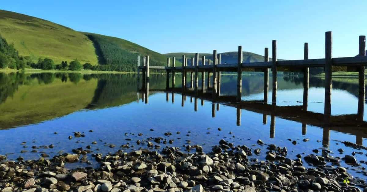
There are a few lochs along this section of the trail that are a perfect place to stop and enjoy the lovely views and the tranquil atmosphere.
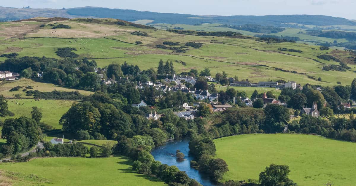
St John’s Town of Dalry
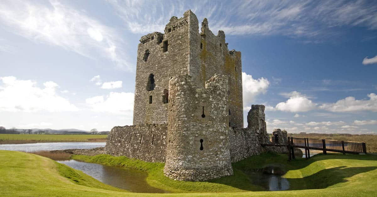
This picturesque village is named after the Knights of St John. Threave Castle is just 16 miles from the village; it makes for a great day trip.
Melrose

The historic Melrose Abbey is definitely worth a visit. The National Trust for Scotland also has two gardens here, the Priorwood Garden and Fried Flower Shop and the Harmony Garden. Other long distance walking routes in Scotland:
- West Highland Way Guide
- Rob Roy Way
- Great Glen Way Guide
- Ayrshire Coastal Path Guide
- Arran Coastal Way Guide
- Annandale Way Guide
- Fife Coastal Path Guide
- St Cuthbert’s Way Guide
- Speyside Way Guide
And long distance hiking routes in England:
- South Downs Way
- Hadrian’s Wall
- Cotswold Way
- C2C Walk
- Pennine Way Guide
- Thames Path
Takeaway
For a picturesque trail that links the southwest coast and the majestic Southern Uplands and the lovely village of Cockburnspath on the east, where the Lammermuir Hills Meet the North Sea, the Southern Upland Way deserves to get much more attention.
But, thanks to the great work of the countryside rangers, the generosity of the locals, and the dedicated family businesses along the Southern Upland Way, I am quite sure that it will be much more popular—very soon. My advice is to walk this unique trail while it’s still an unspoiled, hidden gem.
I love hiking, backpacking, and camping. From the Camino de Santiago to the West Highland Way in Scotland or simply a great day hike on the weekend. Hiking refreshes me, my mind, and keeps my body reasonably fit. So far I have walked three Camino routes and many other long distance hikes in the UK, Canada, and around the rest of Europe. One of the best was my hike up Ben Nevis.