The Rob Roy Way starts in Drymen and heads northeast through Loch Lomond and the Trossachs national park. As you come out of the park, the way continues along the side of Loch Tay. Halfway along Loch Tay, there is the option of a spur out to Amulree, though it is little used. The last section is walked along the River Tay before your final destination at Pitlochry.
The main Rob Roy Way is 79 miles (126 km). You can easily extend this to 95 miles by walking via Amulree. It is also possible to add another day by starting on the West Highland Way in Milngavie, walking to Drymen, and then starting the RRW.
The Rob Roy Way is a good alternative to the West Highland Way, though the WHW is better underfoot with fewer forest roads in the Queen Elizabeth Forest Park and less walking on tarmac.
Who Was Rob Roy, Exactly?
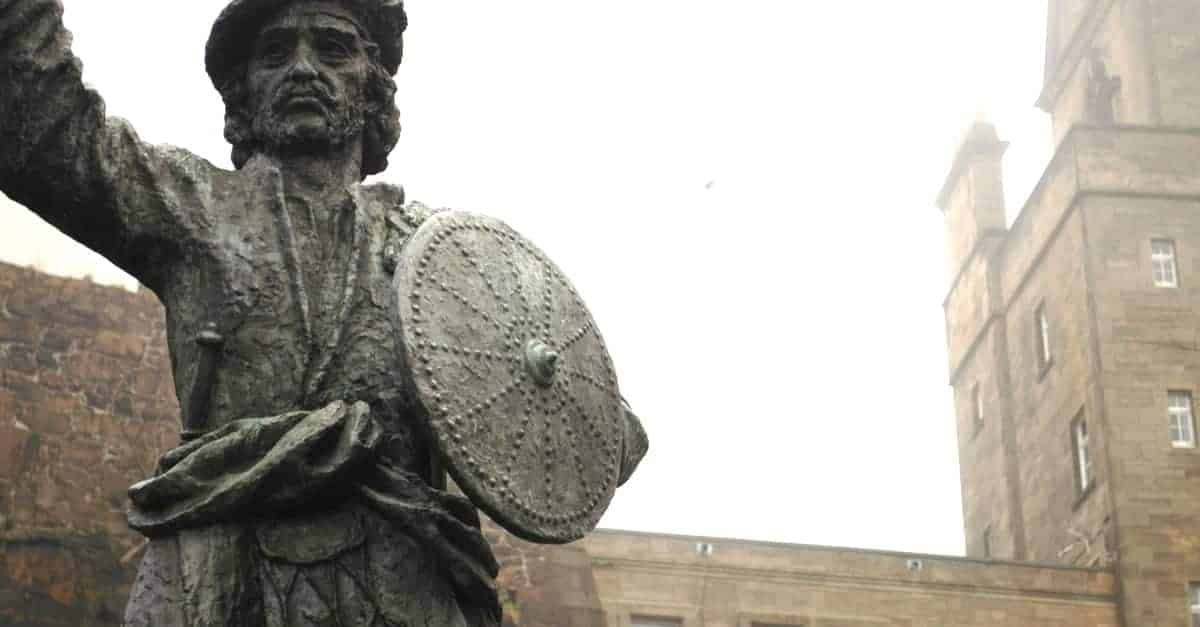
Rob Roy MacGregor, byname of Robert MacGregor, was an outlaw, businessman, loyal Jacobite, swordsman, extortioner, thief, and cattle rustler. But above all, he was a folk hero – a legend in his own lifetime.
This notorious outlaw was born in the southern Highlands in 1671 and was given the nickname Ruadh at an early age because of the red colour of his hair. As you may already guess, Ruadh was later anglicized to Roy.
He earned his reputation as the Scottish Robin Hood by engaging in banditry, theft, and cattle-rustling, doing all of these things as a part of his pursuit of vendetta against the Duke of Montrose, who had seized his lands and had him outlawed.
Rob Roy MacGregor died in 1734 (peacefully, in his bed) but was already a legend even in his lifetime. Several books have been written about his wild life. The most famous book is “Rob Roy” by Sir Walter Scott. Today, many people know about this folk hero because of the 1995 movie, in which he was played by Liam Neeson.
What is The Rob Roy Way Like?

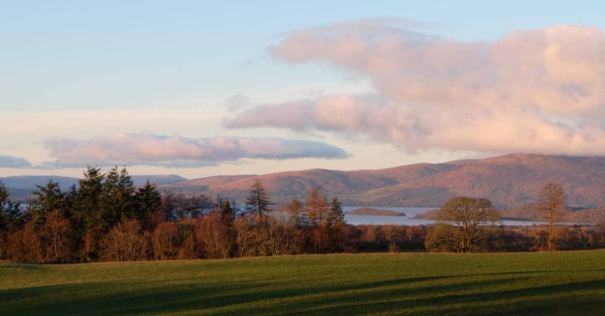
Starting in Drymen, a small village in central Scotland, the trail passes through the country’s prettiest national park and one that offers some truly stunning scenery – the Loch Lomond and The Trossachs National Park – and then finishes in the town of Pitlochry, which lies on the River Tummel in northeastern Scotland.
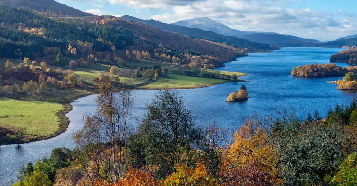
The route’s total distance stands at 79 miles (126 kilometres), and it follows paths used by Rob Roy – hence the name. It also goes through many places Rob Roy is said to have been in during his tumultuous life, such as Aberfeldy, Killin, Strathyre, Callander, and Aberfoyle (these are villages and towns) plus Loch Tay, Loch Lubnaig, and Loch Venachar (these are lakes) as well as Ben Chonzie, Ben Lawers, and Ben Ledi (these are mountains).
The trail opened back in 2002. Besides the already mentioned national park, the trail crosses the Highland Boundary Fault and therefore offers truly stunning views.
However, the main route passes through many towns and villages as well so there are plenty of opportunities for taking great photos of all types – from wildlife in the magical Loch Ard Forest to calming waters on the southern shores of Loch Tay (or the River Tay, for that matter) to the medieval streets of the attractive little town of Pitlochry, where the route ends.
Despite the fact that the Rob Roy Way includes some mountain hiking, the whole route is actually reasonably straightforward. From Drymen to Pitlochry, the route follows minor roads in the glens, cycle routes, tracks, and paths.
This turns it into a suitable choice for beginners and those who like to walk at their own pace and enjoy the scenery. It’s a fantastic road-walking experience for solo walkers as well – I spent one of my walking holidays on my own on the Rob Roy Way, and yes, it was a great walking holiday – I met some genuinely interesting people and saw some truly spectacular sights on this route.
Map of the Rob Roy Way
You can zoom in on the map below and see where you need to carry food each day and where there are places to eat. There are lots of Bed & Breakfasts and campsites along the way, you can also wild camp.
Rob Roy Way Itinerary
Stage One – Drymen to Aberfoyle 11 Miles (17.5 km)
The Rob Roy Way begins in the village of Drymen, which was once a popular stopping spot for cattle drovers. There are lots of signs for the WHW but few for the RRW. The route then rises above Loch Lomond into rough highland scenery and then slowly descends through the magical Loch Ard Forest as a forest track. You will climb to a high point between the forest and the Garadhban at the Muir Park Reservoir.
One detour I have to point out here is the Doon Hill fairy forest. While this short-distance detour does add a few miles to the overall Drymen to Pitlochry distance, it will lead you to a place where fairies, fauns, and elves have “thrived” for millennia.
This first stage of the Rob Roy Way has its end in the village of Aberfoyle. I was pretty surprised to find that this place doesn’t have very limited accommodation options – there are plenty of places to stay, drink, eat, and shop at.
Stage Two – Aberfoyle to Strathyre 19 Miles (30 km)
This was the longest stage of my trip. Here, I encountered some mighty fine highland scenery – the route takes walkers next to the spectacular Falls of Leny, as well as two Highland lochs.
During this stage, I walked for about eight hours in total (18.5 miles) and had to do quite a bit of climbing. It was the longest stage of the entire route and one that, in my opinion, should be undertaken only by experienced trekkers.
Those wishing to split the stage will be pleased to know that the town of Callander, where the River Teith splits into Garbh Uisge and Eas Gobhain, marks the midpoint of this stage.
What is more, there is plenty of accommodation available in Callander, allowing you to spend an extra night (or extra nights) and spend some time resting, eating, drinking, and taking route notes. After all, rest days are absolutely essential on a long-distance hiking route such as this one.
To get to Callander, you will have to climb the forestry tracks of the Menteith Hills. After that, you will get to Loch Venachar and then simply follow the River Eas Gobhain to the aforementioned town.
After Callander, I had to cross River Garbh Uisge and follow Cycle Path 7. After a couple of miles, I finally got to the Falls of Leny, which was probably one of the most unforgettable moments on my journey. This charming cascade waterfall is hidden in the forest and is just one of the many sights that turn the Rob Roy Way into one of Scotland’s great trails.
After that, you’ll be able to climb for a better view of Loch Lubnaig (like I did) and then follow its lovely south side to the village of Strathyre. Those who love to eat local produce and buy souvenirs on their walking holidays will be able to do so in Strathyre. There’s also a pretty good choice of accommodation.
Stage Three – Strathyre to Killin 13.5 miles (21.5 km)
After the somewhat challenging previous stage, you’ll have a lot more opportunities for exploration during this stage – it is shorter and more manageable.
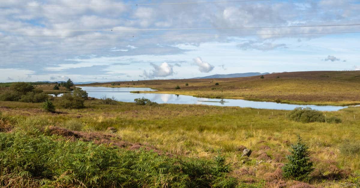
However, this part of the walk starts with a climb. You’ll be climbing through the enchanting Strathyre Forest, which has some open hillside sections that reveal truly magnificent views. As I was going through the woods, I picked up on Kendrum Burn and followed it all the way to Loch Earn. With the path rising by the village of Lochearnhead, I was once again able to soak in some magnificent Scottish scenery along the way.
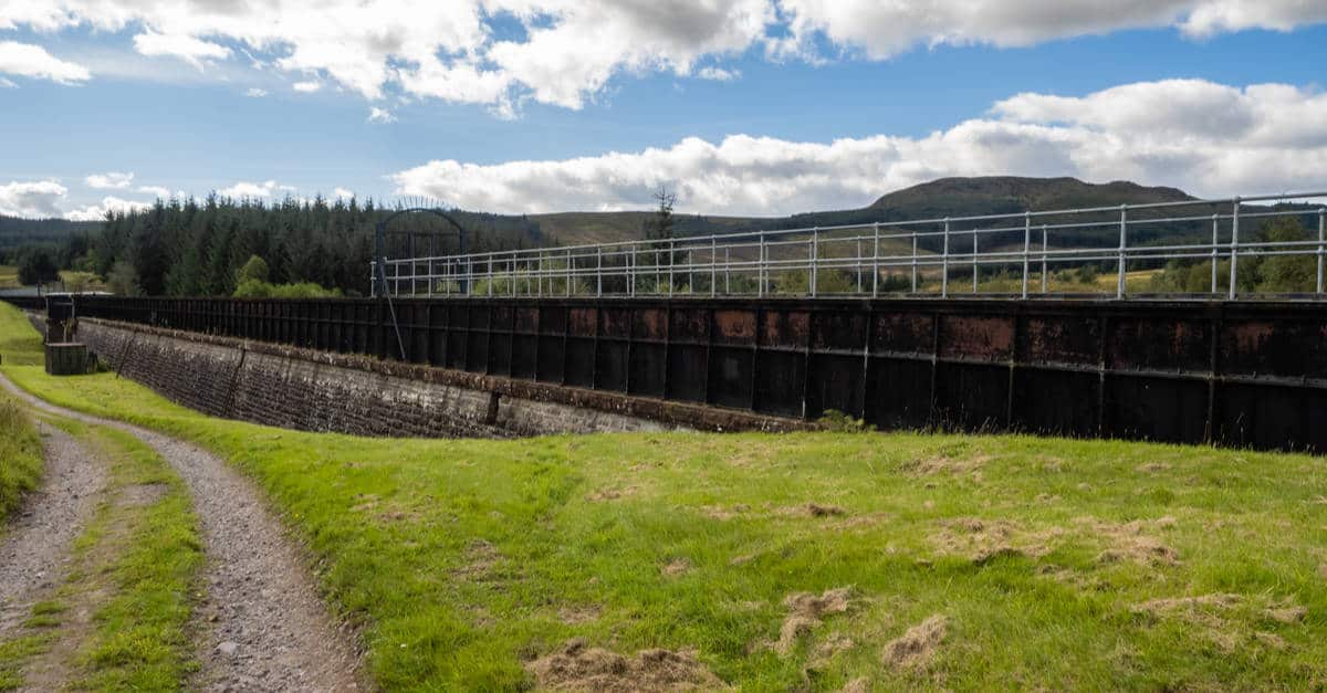
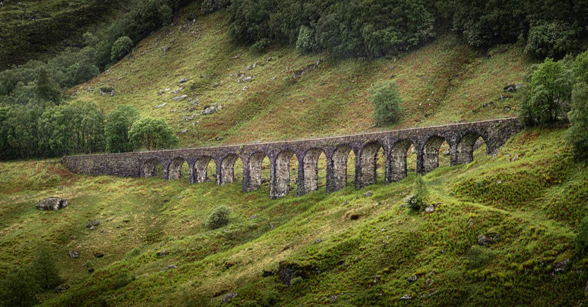
Rob Roy Way then climbs along Glen Ogle (following an old railway viaduct), reaching a particularly high point after a small lake called Lochan Lairig Cheile. Here I slowly descended to the village of Killin, following the River Dochart. In Killin, I paid a visit to the ruins of the Finlarig Castle and found a few places to drink and eat (great evening meals at The Courie Inn!). There’s also a good range of accommodation in the village.
Stage Four – Killin to Ardtalnaig 12 Miles (19 km)
During this stage, I got some great views of the beautiful Loch Tay and even paid a visit to a prehistoric stone circle.
Before you depart from Killin, make sure to go and see the Kinnel Stone Circle. This is a short detour that will lead you into the pleasant countryside where you’ll be able to see a landmark that dates all the way back to the Bronze Age. The circle itself comprises six slabs that are up to two meters tall.
From there, I climbed the Rob Roy Way to Lochan Breaclaich and walked a quiet road through a pretty bleak region until I reached Ardeonaig, a small hamlet situated on the shore of Loch Tay. After that, I followed Cycle Path 7 until I reached the endpoint of stage four, which is the hamlet of Ardtalnaig.
Truth be told, there’s not much to see in this hamlet – you and your friends will be glad that you’ve brought packed lunches. Still, you should be able to find some accommodation options nearby.
Stage Five – Ardtalnaig to Aberfeldy 15 Miles (24 km)

What’s there to see on the next-to-last stage of the Rob Roy Way? The Rob Roy Way is beautiful all the way through, but there are some truly stunning sights between Ardtalnaig and Aberfeldy, such as the quirky cave, breathtaking waterfalls, as well neverending Highland beauty.
From Ardtalnaig, I set off on my onward journey along Loch Tay while following Cycle Route 7 until I reached the hamlet of Acharn. Here, I turned right and went for a walk to the Hermit’s Cave. Built at the end of the 18th century, the cave leads trekkers down a dark, long tunnel until they reach a truly breathtaking view of the Acharn Falls (I can assure you that you won’t forget this one anytime soon).
Since this is your walking holiday, after all, make sure to make another detour and pay a visit to the Acharn Stone Circle. As you can see, there are lots of prehistoric monuments on the Rob Roy Way.
Rob Roy Way will then continue over woodland terrain and undulating highland to Moness Burn, which is the location of yet another waterfall – the Moness Falls. This charming, cascading waterfall is located in a woodland called Birks of Aberfeldy, which was the main theme of Robert Burns’ world-famous poem.
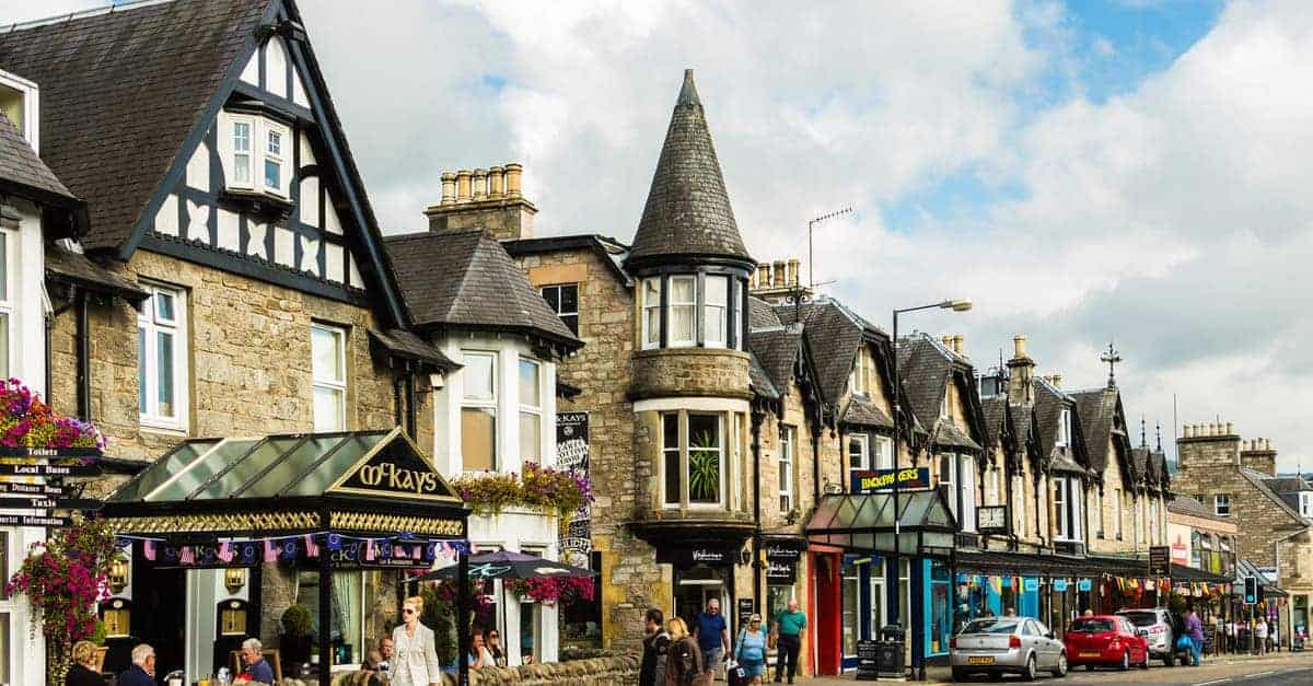
The fifth stage of the official Rob Roy Walk will end in Aberfeldy, a small market town. Those with lots of free time could easily spend a few days here – there are shops, attractions, guest houses, as well as places to drink and eat.
Stage Six – Aberfeldy to Pitlochry 9.5 Miles (15 km)
The journey’s end is a true celebration of the Scottish Highlands, as it starts with the beautiful Castle Menzies and finishes by the smallest distillery in Scotland – the Edradour Distillery. With this stage being pretty short, make the most out of it and take all the detours you can. (And this little town takes me back to my youth, as it was the first place I went to on an overnight school trip at the tender age of eleven)
From Aberfeldy, I went straight to the Castle Menzies, which I noticed on the larger map of the trail I brought with me. To get there, I walked across the old Tay Bridge and immediately noticed the marriage stone above the castle’s entrance – it was installed there all the way back in the 16th century to mark the marriage between James Menzies and Barbara Stewart.
After that, I returned to the Tay River and followed it all the way to the village of Grandtully. There, I went for the final climb through the mesmerizing Tay Forest Park – definitely one of the prettiest sections of the Rob Roy Way. The Rob Roy Way then goes next to Lochan na Moine Mòire, and then there’s just an easy walk to the River Tummel and the endpoint of the route – the town of Pitlochry.
Once there, I realized I still had some strength in my legs and went to see both the Edradour Distillery and the Black Spout waterfall. Both of these are definitely worth visiting, and I recommend you do so.
The town of Pitlochry itself has shops, attractions, as well as places to drink and eat – it’s a great place to finish this historical, scenic walk.
Frequently Asked Questions About the Rob Roy Way
When is the Best Time to Walk the Rob Roy Way?
Even though the trail is open year-round, the best time to walk is during the spring and autumn months. If you can, opt for spring, as there will be fewer midges.
If you decide to walk the trail in winter, make sure to adequately prepare yourself – hiking in remote sections with snow on the ground is not a joke. On the other hand, if you decide to walk this trail in the summer and autumn need to take a good midge repellent.
Check out our post on the best time of year to visit Scotland as well.
How Do I Get To and From the Rob Roy Way?
It takes less than an hour to get from Glasgow to Drymen by car. If you prefer public transport, you’ll be pleased to know that there are regular bus services going from Scotland’s most populous city to this small, picturesque village.
Pitlochry is also well-served by bus transport and also has a train station. Do not opt out from the railway transport – I decided to take the train from Pitlochry to Glasgow (the journey takes about two hours) and soaked even more of Scotland’s beautiful, wild scenery on the way.
3 Best Guidebooks
The Rob Roy Way map book by Footprint is a great little introduction to everything you would want to see and do along the Way. In an era when apps and sat nav seem to be everywhere, you look, there’s a lot to be said for a compact guide you can take with you in your map file.
Jacquetta Megarry’s The Rob Roy Way: From Drymen to Pitlochry is also highly recommended if you want to get the most out of your week away. It offers keen insights into the local history and gives you plenty of ideas about where you might think about stopping off along the Way.
Finally, take a look at the Rob Roy Way: XT40 by Harvey Map Services. It offers highly detailed maps that cover every step you’ll take, and it’s a great companion to take with you. Perfect if you want to get back to the basics and leave your phone in your rucksack all day long.
Do I Need to be an Experienced Hiker to Walk the Rob Roy Way?
No, you don’t – folks of all abilities can enjoy this historic trail. The flatter sections are easy for beginners to walk, while those looking for a challenge are bound to find plenty of chances for some hill climbing. Don’t forget that you can also use baggage transfer services if you don’t want to carry all of your gear along the way.
Is the Rob Roy Way Well-Signposted?
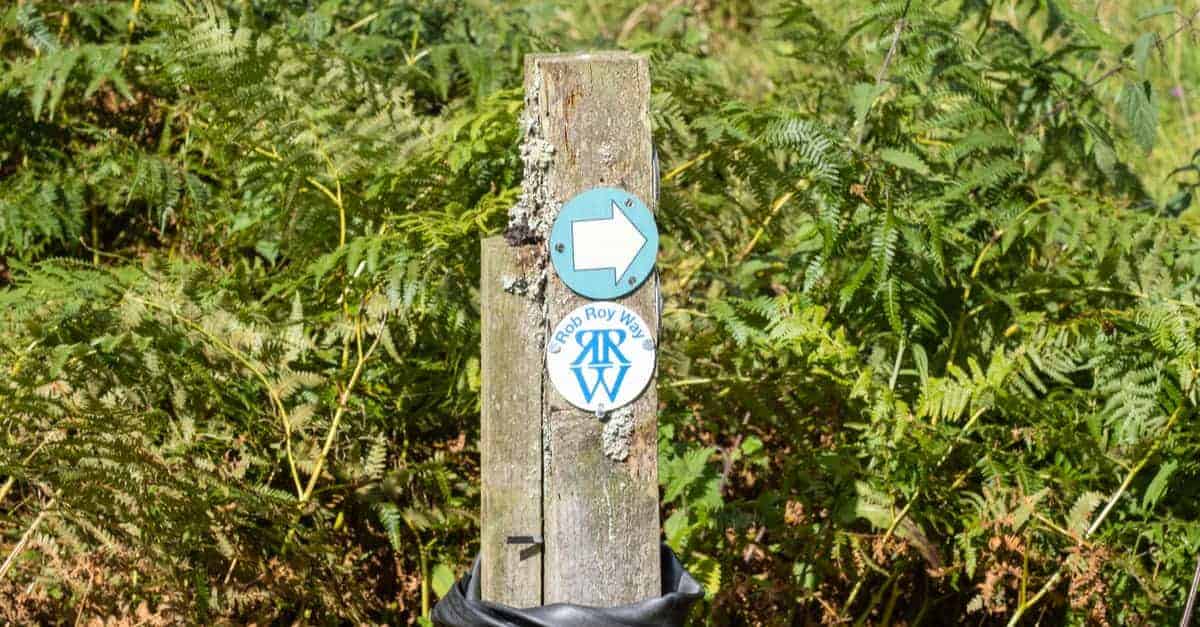
Yes, this historical trail is marked with signposts. Still, I found that the trail is not clearly waymarked all the way through. It is worth carrying a map or guidebook. That will provide you with the necessary peace of mind as well as inform you about attractions, lodgings, eateries, pubs, and other important places.
Can I Wild Camp Along the Rob Roy Way?
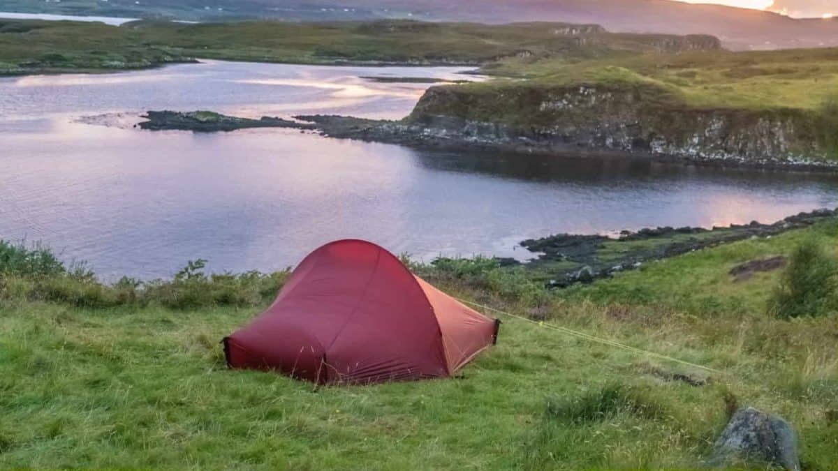
Wild camping in Scotland is legal – so yes, you can wild camp along this trail. However, keep in mind that you’re expected to abide by the Scottish Outdoor Access Code, which states that wild camping should be done only by smaller groups of people who should never stay in one place for more than three nights.
One particularly important thing to mention here is that wild camping in Loch Lomond & The Trossachs National Park can be done only between March and September and will require you to obtain a special permit.
Are There Guided Tours for the Rob Roy Way?
This historical trail can be hiked as self-guided (or, in other words, on your own – like I did) or guided.
While it’s true that organizing this journey by yourself isn’t particularly difficult (there are plenty of accommodation options along the way), guided tours can still be extremely useful for beginners. Agencies will gladly take care of the logistics, which typically includes baggage transfers – all you have to do is enjoy the journey.
Other long-distance walking trails in Scotland:
- Southern Upland Way Guide
- Great Glen Way Guide
- Ayrshire Coastal Path Guide
- Arran Coastal Way Guide
- Annandale Way Guide
- Fife Coastal Path Guide
- St Cuthbert’s Way Guide
- Speyside Way Guide
I’ve had the privilege of hiking the Camino de Santiago twice, walking up Ben Nevis, and spending three weeks hiking in the Candian Rockies. I love the peace that comes from getting out of the cities I have lived in to enjoy hikes of all lengths in various countries.
Hi Leslie
Very Informative post
Thank you
I’m looking to do the rrw in October and 1 will surely be reading your post again
Best budget sleeping bag?
Graham