The boots were still damp from two days of Aubrac rain, and I was sitting on a stone wall in Conques, watching the abbey catch the first proper sunlight in what felt like a week. A Dutch pilgrim I’d been walking near (not with, exactly; we kept a respectful distance of about forty minutes between us) appeared around the corner, saw the same light hitting the same tympanum, and said, simply, “Ah.” That was the whole conversation. It was enough.
That moment sits at the heart of why the Le Puy Camino exists as a walking route: it is quiet enough to hold moments like that without someone’s Bluetooth speaker ruining them.
What Is the Le Puy Camino?

The Le Puy Camino, also known as the Via Podiensis or Le Chemin du Puy, is one of the four historic pilgrimage routes through France leading to Santiago de Compostela in northwest Spain. It follows the GR65 trail markings (white over red, the standard French grande randonnee blazing) from the town of Le Puy-en-Velay in the Auvergne region of southern France to Saint-Jean-Pied-de-Port in the foothills of the Pyrenees, where it joins the Camino Frances for the final stretch into Spain.
The route covers approximately 735 km (around 457 miles). It takes most pilgrims between four and six weeks to walk the full distance, depending on pace and rest days.
This is old ground. In 951 AD, Bishop Godescalc of Le Puy became the first recorded French pilgrim to walk to Santiago de Compostela, setting out from the same cathedral steps where pilgrims still gather each morning for the blessing. The route was later documented in the 12th-century Codex Calixtinus. In 1998, UNESCO inscribed the paths of Saint-Jacques-de-Compostelle in France as a World Heritage Site, and the Notre-Dame Cathedral in Le Puy-en-Velay is one of the key monuments on that list.
So when you stand in front of that cathedral at dawn, sleep still clinging to the corners of your eyes, you’re standing where people have stood with the same intention for over a thousand years. Whether that gives you chills or makes you slightly self-conscious about your new hiking trousers is between you and your maker.
Why Walk the Le Puy Camino Instead of Other Routes?

The Camino Frances across Spain gets roughly 60% of all pilgrims walking to Santiago de Compostela. The Le Puy route gets a fraction of that. This matters more than you might think.
Fewer pilgrims means smaller gites, more personal conversations with hosts, and villages where your arrival is still a small event rather than a logistical problem. You will walk through places where the baker knows the gite owner who knows the pharmacist, and all three of them will ask where you started and where you’re going.
Here is what sets the Le Puy Camino apart from other Camino de Santiago routes:
- Quieter trails. You will regularly walk for hours without seeing another pilgrim, especially outside peak season. On the Aubrac plateau, it is possible to walk an entire day and count your human encounters on one hand.
- Deep immersion in rural France. This is not tourist France. These are working villages with stone fountains, one-room churches, and communal bread ovens. The route passes through four French regions and crosses landscapes that shift from volcanic highlands to river valleys to rolling farmland.
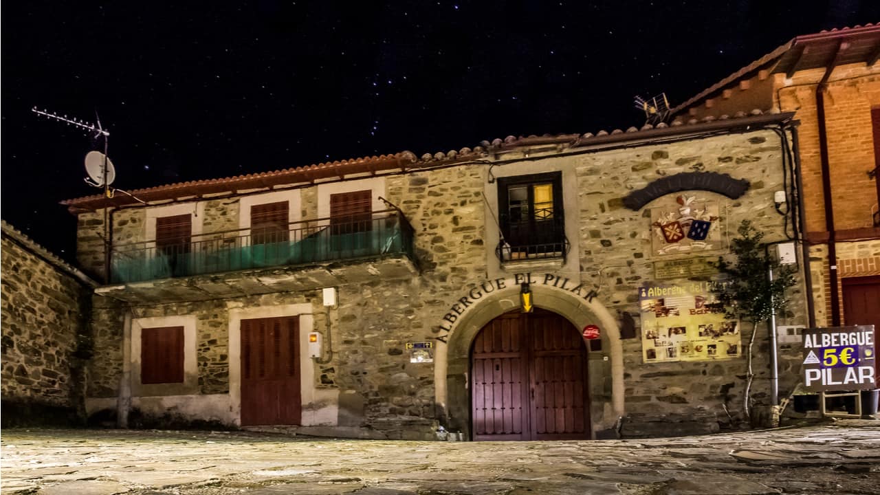
- The gite culture. Most accommodation along the route is in gites d’etape, pilgrim hostels that often serve a communal evening meal. Dinner is served at a shared table, wine included, and the food is regional. I once ate an aligot (a potato-and-cheese dish from the Aubrac) so rich it could have been classified as a controlled substance.
- Manageable difficulty. The terrain is varied but not extreme. There are steep days, but nothing that requires scrambling or technical gear. If you can walk 20 km on a hilly trail with a pack, you can walk this route.
- A natural lead-in to the Camino Frances. Many pilgrims choose to walk the Le Puy route as a way of arriving at Saint-Jean-Pied-de-Port with their legs, minds, and feet already in walking shape before crossing the Pyrenees into Spain.
The Le Puy Camino suits first-time pilgrims wanting structure without crowds, returning pilgrims looking for something slower, and anyone who considers a three-course dinner with strangers a reasonable motivation for walking 25 km.
Where Does the Le Puy Camino Route Go?

The route begins in Le Puy-en-Velay, a town built around volcanic plugs in the Haute-Loire department of south-central France. Two landmarks define the skyline: the Notre-Dame Cathedral, perched on a volcanic outcrop, and the Chapel of Saint-Michel d’Aiguilhe, balanced on a needle of rock like something from a fever dream.
From there, the GR65 winds southwest through a series of distinct landscapes. Here is a simplified overview of the major sections:
| Section | Key Towns | Distance (approx.) | Character |
| Le Puy to Conques | Saint-Privat-d’Allier, Saugues, Aumont-Aubrac, Saint-Come-d’Olt | 290 km | Volcanic highlands, Aubrac plateau, gorges |
| Conques to Cahors | Figeac, Cajarc | 170 km | Aveyron hills, Lot Valley, limestone causse |
| Cahors to Moissac | Lauzerte, Montcuq | 100 km | Quercy farmland, bastide towns, Tarn-et-Garonne |
| Moissac to Saint-Jean-Pied-de-Port | Lectoure, Aire-sur-l’Adour, Navarrenx | 175 km | Rolling Gascony, Armagnac vineyards, Basque foothills |
The route is well marked throughout. You follow the red-and-white GR65 blazes, supplemented by the occasional scallop shell marker. Getting lost is possible (I managed it twice, both times within 2 km of a village), but genuine route-finding problems are rare.
Highlights Along the Way
Some places on this route will stop you in your tracks:
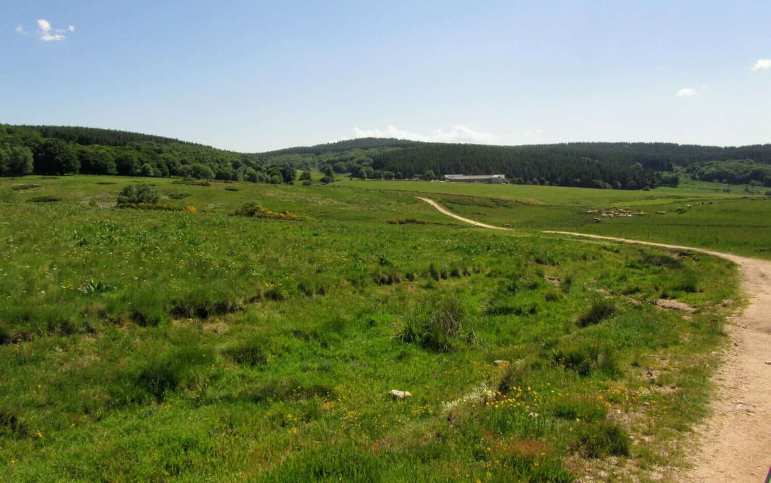
- The Aubrac plateau. A high, windswept grassland above 1,000 metres, dotted with granite crosses and free-roaming Aubrac cattle. In spring, the wildflowers are startling. In autumn, the light goes golden and the wind carries the smell of wet heather.
- Conques. A medieval village clustered around the Romanesque Abbey Church of Sainte-Foy, with its extraordinary Last Judgement tympanum. Arriving on foot, dropping down through the forest into the valley where the village appears below, is one of those moments that earns its reputation honestly.
- The Lot Valley and Cahors. The 14th-century fortified Pont Valentre in Cahors, with its three towers, is strikingly beautiful. The walking along the Lot River is gentle and green after the austerity of the Aubrac.
- Moissac. The Abbey of Saint-Pierre has a Romanesque cloister that art historians cross continents to study. You will walk right through it, possibly with blisters.
- The approach to the Pyrenees. The last days of the route, as the mountains come into view across the Basque countryside, carry a particular anticipation. The landscape shifts. The architecture changes. Something is about to happen.
How Long Does It Take to Walk the Le Puy Camino?

The full route from Le Puy-en-Velay to Saint-Jean-Pied-de-Port takes most pilgrims between 30 and 35 walking days, covering roughly 20 to 25 km per day. With rest days (and you will want rest days), plan for five to six weeks.
Not everyone walks the full distance. Many pilgrims choose to walk a shorter section, and the route lends itself well to this. The stages between towns with good transport links make it possible to walk for one, two, or three weeks and still have a complete experience.
Popular section options include:
- Le Puy to Conques (roughly 290 km, 12 to 14 days). The most walked section. Covers the volcanic landscapes, the Aubrac, and finishes with the descent into Conques.
- Le Puy to Cahors (roughly 460 km, 18 to 22 days). A longer commitment that adds the Lot Valley and Cahors to the itinerary.
- Conques to Cahors (roughly 170 km, 7 to 9 days). A compact section through some of the route’s most varied terrain.
- Moissac to Saint-Jean-Pied-de-Port (roughly 175 km, 7 to 9 days). The Gascon and Basque section, ending at the gateway to Spain.
The stages are flexible. The traditional stage towns are spaced to match accommodation options, but you can adjust based on your fitness, the weather, and how long you linger over coffee.
When Is the Best Time to Walk the Le Puy Camino?

The walking season on the Via Podiensis runs from April to October. Outside this window, snow on the Aubrac plateau and limited accommodation availability make the route difficult and, in places, inadvisable.
The best months are May, June, and September. Here is what to expect:
| Month | Weather | Crowds | Notes |
| April | Cool, wet, possible snow on Aubrac | Very quiet | Some gites may not yet be open |
| May | Mild, wildflowers, occasional rain | Moderate | Excellent walking conditions |
| June | Warm, long days, settled weather | Moderate to busy | Peak wildflower season on the Aubrac |
| July | Hot, especially in lower sections | Busy | Heat can be challenging south of Conques |
| August | Very hot, French holiday season | Very busy | Limited services in some areas; extreme heat possible |
| September | Warm, drier, golden light | Moderate | Often considered the best month overall |
| October | Cooling, shorter days, autumn colour | Quiet | Some gites begin closing mid-month |
A practical note about the Aubrac: this high plateau sits above 1,000 metres and has its own weather. Even in June, mornings can be cold and fog can roll in without warning. In April or October, conditions on the Aubrac can feel like a different season entirely from the valleys below.
If you are flying from the United States, bear in mind that jet lag takes a couple of days to fade. Arriving in Le Puy-en-Velay two or three days before your planned start gives you time to adjust, explore the town, attend the pilgrim blessing at the cathedral, and sort out any last-minute gear issues.
How Difficult Is the Le Puy Camino?

The Via Podiensis is a moderately difficult long-distance walk. It is harder than the Camino Frances (which has more flat sections and more road walking) but easier than mountain routes like the GR20 in Corsica.
The terrain includes:
- Farm tracks and forest paths (the majority of the route)
- Rocky descents and ascents, particularly in the first week between Le Puy and Conques
- Exposed high ground on the Aubrac plateau, where wind and weather demand respect
- Gentle river valleys through the Lot and Tarn-et-Garonne sections
- Minor road walking in a few sections, especially approaching larger towns
Total elevation gain across the full route is substantial, somewhere around 14,000 to 16,000 metres cumulatively, though no single day involves anything like alpine climbing. The hardest days tend to be the steep descents rather than the climbs; knees take more punishment than lungs.
Preparing Your Body
If you can comfortably walk 15 to 20 km on hilly terrain with a 7 to 8 kg pack, you are ready for this route. If you cannot do that yet, a training programme of six to eight weeks, focused on building distance and hill walking, will get most reasonably fit people there.
Key preparation tips:
- Walk in your actual boots or trail shoes for at least 100 km before departure
- Practice walking with your loaded pack
- Include hills or stairs in your training, both up and down
- Do not neglect your feet; learn basic blister prevention before you need it
Trekking poles are worth their weight on the Le Puy route. The descents are steep enough and frequent enough that poles genuinely reduce knee strain. I started my first Camino thinking poles were for the elderly. I ended it knowing they were for the intelligent.
How Much Does the Le Puy Camino Cost?

The Via Podiensis is one of the more affordable long-distance walks in western Europe, thanks to the gite system and the prevalence of demi-pension (half-board) options.
Here is a realistic breakdown of daily costs in euros:
| Budget Level | Accommodation | Meals | Daily Total |
| Budget | Municipal gites (18 to 25 euros), self-catering | Picnic lunches, simple dinners | 30 to 40 euros |
| Mid-range | Private gites with demi-pension (38 to 50 euros) | Cafe stops, occasional restaurant | 50 to 65 euros |
| Comfortable | Chambres d’hotes or small hotels (50 to 80 euros) | Full restaurant meals | 75 to 110 euros |
Over a full 35-day walk, most pilgrims spend between 1,200 and 2,200 euros on accommodation and food, depending on their choices. Budget-conscious pilgrims who stay in municipal gites and buy food from shops and markets can manage on 35 euros per day. Those choosing demi-pension at private gites, which includes dinner, bed, and breakfast, typically spend closer to 55 to 60 euros per day.
Accommodation Types
The Le Puy Camino has a well-developed accommodation network along the route:
- Municipal gites d’etape. Run by local communes. Simple dormitory bunks, shared kitchens, basic facilities. Typically 18 to 25 euros per night.
- Private gites d’etape. Run by individual hosts. Often warmer, better maintained, and offering demi-pension with home-cooked regional food. Typically 25 to 35 euros for bed only, or 38 to 50 euros for demi-pension.
- Gites paroissial (church-run gites). Sometimes donation-based, sometimes fixed price. Occasionally in remarkable buildings; an abbey dormitory, a converted priory. Availability varies.
- Chambres d’hotes. French B&Bs. Private rooms, often lovely, typically 50 to 70 euros per night.
- Hotels. Available in larger towns like Cahors, Figeac, and Moissac. Useful for rest days or when you want a door that locks and a bath that fills.
A note about cash: many smaller gites do not accept cards. Carry enough cash for two to three nights of accommodation at all times, and withdraw from ATMs in towns with banks (Conques, Figeac, Cahors, Moissac). This is improving gradually, but rural France remains a cash economy in many places.
Demi-Pension: The Heart of Gite Culture
The demi-pension model deserves special mention because it shapes the rhythm of life on this Camino. You arrive at a gite in the late afternoon, shower, do your laundry, and then sit down at a communal table for a dinner that is often genuinely excellent: a starter, a main course (cassoulet, duck, local sausage, aligot), cheese, dessert, and a bottle of wine shared between the table. Breakfast the next morning is included. Coffee, bread, jam, perhaps yoghurt.
The meal matters. Not just nutritionally, though after 25 km it matters that way too. It matters because you sit with strangers and talk. You pass the bread. You learn where people walked from. You discover that the German man you thought was unfriendly is simply quiet, and that when he does speak, he’s very funny. The Le Puy Camino, more than most Camino routes, is shaped by these evenings.
What Should I Pack for the Le Puy Camino?

Pack light. Then remove a third of what you packed. The ideal base weight (pack plus contents, minus water and food) for the Le Puy Camino is 7 to 8 kg. Every gram matters by day three.
Essential items for walking the Via Podiensis:
- Footwear. Trail runners or lightweight hiking shoes are the most common choice among experienced pilgrims. Break them in thoroughly. Carry lightweight sandals for evenings.
- Rain gear. A waterproof jacket is non-negotiable. Rain trousers or a poncho for heavy rain days. The route crosses regions with significant rainfall, especially in spring and on the Aubrac.
- Layers. A merino wool base layer, a fleece or insulated mid-layer, and your waterproof. Mornings are cool even in summer; the Aubrac can be cold at any time of year.
- Sun protection. Hat, sunscreen, sunglasses. The exposed sections between Cahors and Moissac can be surprisingly hot.
- First aid basics. Blister plasters (Compeed or similar), anti-inflammatory gel, tape, basic medications. Pharmacies are available in larger towns but not in small villages.
- Sleeping bag liner or lightweight sleeping bag. Most gites provide blankets, but not all. A silk liner weighs almost nothing and adds warmth and hygiene.
- Phone, charger, adapter. France uses Type C/E sockets. Download offline maps (the IGN app or Mapy.cz both work well) as mobile signal is patchy in rural areas.
- Credential (pilgrim passport). Available from the cathedral office in Le Puy-en-Velay. You collect stamps (tampons) at each stopping point, which serve as a record of your pilgrimage.
What not to pack: a second pair of trousers, a “just in case” jumper, more than two changes of underwear, a full-size towel, or a hardback book. A travel towel, a paperback you can swap at a gite bookshelf, and the discipline to do laundry every evening will serve you better.
How Do I Get to Le Puy-en-Velay?

Le Puy-en-Velay is in south-central France, in the Haute-Loire department of the Auvergne region. It is not on a major transport hub, which is part of its charm and part of its logistical challenge.
The most common approach from abroad:
- Fly to Paris or Lyon, then take the train to Le Puy-en-Velay. From Paris Gare de Lyon, the train takes approximately 5 hours with a change at Saint-Etienne-Chateaucreux. From Lyon Part-Dieu, it is roughly 2.5 hours.
- Fly to Lyon-Saint Exupery Airport (LYS), which is the closest major international airport. Train connections to Le Puy-en-Velay run via Lyon Part-Dieu.
- Le Puy has a small regional airport (Le Puy, Loudes) with limited flights, primarily from Paris Orly. This is expensive and not practical for most international travellers.
Book train tickets through SNCF Connect (the French rail booking platform) as far in advance as possible; prices rise significantly closer to departure.
Plan to arrive in Le Puy-en-Velay at least one day before you intend to start walking. Use the time to visit the cathedral, collect your credential from the pilgrim office, attend the morning pilgrim blessing if that appeals to you, and eat your last restaurant meal for a while. The town is worth exploring: the volcanic setting, the chapel of Saint-Michel d’Aiguilhe up its 268 steps, the old quarter. Give it a morning at minimum.
Luggage Transfer and Support Services

Luggage transfer services are available along the Le Puy Camino. The most established is La Malle Postale, which operates on the GR65 from Le Puy-en-Velay to Aire-sur-l’Adour, covering the majority of the route. They collect your bag from your accommodation each morning and deliver it to your next stopping point.
The service typically runs from April to October, matching the walking season. Staff speak English and the booking process is straightforward via their website or by phone.
Whether to use luggage transfer is a personal decision. Walking with a lighter pack reduces strain on knees and feet, which matters on a route with significant daily elevation changes. Some pilgrims use the service for the entire route; others use it selectively for the harder stages (the Aubrac, for instance) or when recovering from an injury. There is no shame in it. Your Camino is your Camino.
Guidebooks, Maps, and Navigation

The GR65 is well marked, but carrying a navigation backup is sensible. Rural France has areas with poor mobile signal, and even well-marked trails can confuse in fog or heavy rain.
Useful resources for navigating the Le Puy Camino:
- The Miam Miam Dodo. The essential guidebook for the Via Podiensis. Updated annually, it lists every accommodation option along the route with contact details, services, and prices. It is in French, but the format is visual enough to use without fluency. An English companion guide exists.
- Cicerone’s “Camino de Santiago: Via Podiensis.” An English-language guidebook with stage descriptions, maps, and practical information.
- IGN maps at 1:25,000 scale, available in the IGN app for offline use. Detailed topographic maps of the entire route.
- Buen Camino app or Gronze for digital stage planning and accommodation information.
- GPS tracks are available from multiple sources in GPX format. Load them onto your phone or a handheld GPS as a backup.
The red-and-white GR65 blazes are repainted regularly and are generally reliable. At junctions, look for the blaze on the side of the path you should take. An X mark means “not this way.” This system works well once you learn to trust it.
Walking Sections: Choosing Your Distance

Not sure whether to walk the full Via Podiensis or just one section? This is a practical question that depends on your available time, your fitness, and what kind of experience you want.
One Week (7 to 9 Days)
Walk Le Puy-en-Velay to Conques (the first 290 km is typically split into 12 to 14 stages, but you can walk the first half, Le Puy to Aumont-Aubrac, in about 7 days, covering roughly 160 km). This gives you the volcanic landscapes, the crossing of the Margeride, and the beginning of the Aubrac. Return transport is available from Aumont-Aubrac by bus or taxi to the nearest train station.
Alternatively, walk Conques to Figeac (roughly 80 km, 3 to 4 days) for a shorter taste of the route’s middle section.
Two Weeks (12 to 16 Days)
Walk Le Puy-en-Velay to Conques. This is the most popular section and arguably the most dramatic: you begin among volcanoes, cross the Aubrac’s wild openness, and descend into one of France’s most beautiful medieval villages. Conques has bus connections to Rodez, which has a train station and a small airport.
Three to Five Weeks (The Full Route)
Walk Le Puy-en-Velay to Saint-Jean-Pied-de-Port. The full 735 km. Each section brings a different France: volcanic Auvergne, austere Aubrac, the gentle Lot, Quercy’s bastide towns, Gascon farmland, and finally the green Basque country with the Pyrenees rising ahead. Many pilgrims who complete this route then continue across the Pyrenees and along the Camino Frances to Santiago de Compostela, though that adds another 780 km and four to five weeks.
Practical Tips for the Trail
A few things I wish someone had told me before my first day on the Le Puy route:
- Start early. Most pilgrims leave between 6:30 and 8:00. The morning light is best, the heat has not arrived, and you reach your destination in time for a proper afternoon rest.
- Learn five French phrases. “Bonjour,” “Merci,” “Est-ce qu’il y a de la place?” (Is there space?), “L’addition, s’il vous plait” (The bill, please), and “Ou sont les toilettes?” (Where is the toilet?). These will solve 90% of your communication needs. Most gite hosts speak some English, but the effort of speaking French is noticed and appreciated.
- Carry lunch. Many villages along the route have no shop or restaurant. Buy bread, cheese, and fruit at the last available epicerie and carry it. A boulangerie at the start of a stage is a gift; do not assume the next village will have one.
- Rest days matter. Plan one rest day for every six or seven walking days. Good rest day towns include Conques (for the abbey and the village), Cahors (for the Pont Valentre and the old town), and Moissac (for the cloister).
- Weather moves fast on the Aubrac. Carry your waterproof layer accessible, not buried at the bottom of your pack. I learned this lesson once. It rained for four hours. My waterproof was underneath my sleeping bag, my lunch, and a book I never read.
- Credential stamps. Get your credential stamped at each stopping point. Gites, churches, mairies (town halls), and even some bars will stamp it. If you plan to continue to Santiago, you will need this record to receive the Compostela certificate.
Frequently Asked Questions
How long does it take to walk the Le Puy Camino from Le Puy-en-Velay to Saint-Jean-Pied-de-Port?
The full route of approximately 735 km takes most pilgrims between 30 and 35 walking days at a pace of 20 to 25 km per day. With rest days factored in, plan for five to six weeks. The most popular section, Le Puy to Conques (290 km), takes 12 to 14 days. If you have only one week, the section from Le Puy to Aumont-Aubrac (roughly 160 km) provides a solid introduction to the route.
Do I need to book accommodation in advance on the Le Puy route?
In peak season (July and August), booking ahead is strongly recommended, particularly for smaller gites with limited beds. In May, June, and September, many pilgrims walk without reservations and find beds each evening, though calling ahead by early afternoon is wise. During April and October, some gites may be closed, so checking availability beforehand is important. As a general rule, phone the gite you plan to stay at by noon on the day you wish to arrive; most hosts are used to this rhythm and will tell you honestly if they are full.
Is the Le Puy Camino well marked, and do I need GPS?
The GR65 is one of the best-marked long-distance trails in France. Red-and-white blazes are painted on trees, rocks, walls, and posts at regular intervals, with an X marking wrong turns. GPS is not essential but is a useful backup for foggy days on the Aubrac or when navigating through towns where markings can be less visible. Download offline maps (the IGN app or Mapy.cz) and carry GPX tracks on your phone as insurance. A guidebook with stage maps, such as the Miam Miam Dodo, is used by the majority of pilgrims on this route.
Can I cycle the Le Puy Camino?
The GR65 is primarily a walking route, and many sections are narrow, rocky, or steep enough that cycling would be difficult and potentially damaging to the trail. However, cycling variants of the Via Podiensis do exist, typically following minor roads that run parallel to the walking path. These are best suited to experienced touring cyclists with bikes equipped for rough surfaces. The route is not beginner-friendly for cyclists due to the significant elevation changes, particularly in the first half between Le Puy and Cahors.
What connects to the Le Puy Camino at either end?
At Le Puy-en-Velay, several feeder routes arrive from other parts of France, including paths from Cluny in Burgundy, Geneva, and Strasbourg. At the other end, Saint-Jean-Pied-de-Port is the traditional starting point of the Camino Frances, the most popular route to Santiago de Compostela (780 km across northern Spain). Many pilgrims walk the Le Puy route as the “French way” of beginning their pilgrimage, joining the Camino Frances at Saint-Jean-Pied-de-Port and continuing all the way to Santiago de Compostela.
The Le Puy Camino changed the way I think about walking. Not in some grand, cinematic way. More in the sense that I stopped treating walking as a way to get somewhere and started treating it as the somewhere. The route through southern France does that, slowly, over days. By the time the Pyrenees appeared on the horizon, I had stopped counting kilometres and started counting conversations, meals, and the number of times a church bell rang in a village I’d never heard of before and will probably never visit again. That felt like enough.