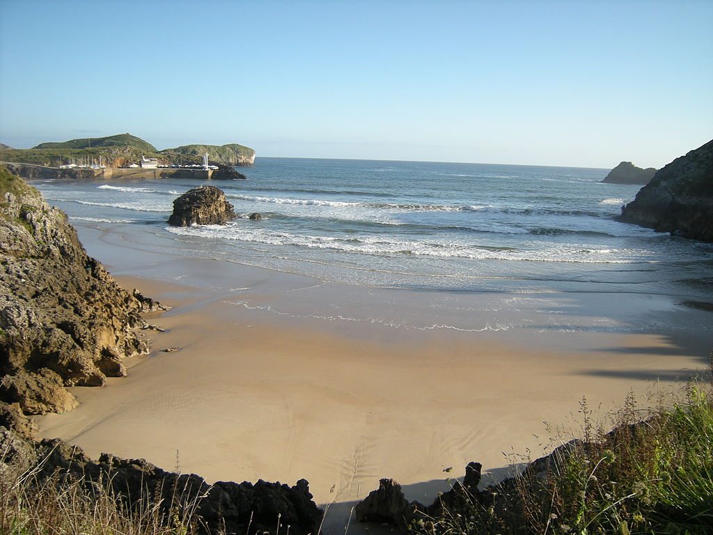
There is a moment, somewhere west of San Sebastián, when you first hear the Cantabrian Sea. Not see it. Hear it. A low, persistent wash of sound that works its way through the eucalyptus and the wet grass and settles into your breathing. You have been walking for hours, perhaps days, and the path has been climbing and falling in a way that makes your knees feel older than the rest of you. Then the trees thin, the ground tilts, and there it is: grey water, white foam, green cliff, and a sky so wide it makes you briefly forget you have a blister the size of a two-pence coin on your left heel.
That is the Camino del Norte. It is not the most famous pilgrimage route to Santiago de Compostela, nor the easiest, nor the most crowded. But it may be the most beautiful, in that unpolished, salt-stung, rain-soaked way that the northern coast of Spain has been beautiful for centuries. This guide is for anyone considering walking it, and for anyone who has already decided and now needs the practical details to make it work.
What is the Camino del Norte, and why do so many pilgrims choose the Northern Way?

The Camino del Norte is one of the historic pilgrimage routes to the Cathedral of Santiago de Compostela in Galicia, northwestern Spain. It follows the northern coastline from Irún, on the French border, westward through the Basque Country, Cantabria, and Asturias before turning south into Galicia. It is sometimes called the Northern Way, or the Coastal Route, though it is not entirely coastal; the path regularly dips inland through farming valleys, over forested ridges, and along river gorges before returning to the sea.
It is older than the Camino Francés, which is the route most people mean when they say “the Camino.” Medieval pilgrims from northern Europe often landed at ports along this coast, and the route developed as a natural corridor linking those harbour towns to Santiago. For centuries it was the primary way. Then the Reconquista pushed the frontier south, the interior routes became safer, and the Francés took over as the dominant path. The Norte became quieter. It stayed quieter.
That quietness is a large part of why people choose it now. The Francés carries the vast majority of pilgrims, and in peak months its albergues and trail sections can feel genuinely crowded. The Norte draws a fraction of that traffic. You will meet other walkers, certainly, and there are days when you will share a dormitory with fifteen snoring strangers, but there are also long stretches where you will not see another pilgrim for hours. Just the sea, and the path, and whatever you have been carrying in your head.
The other reasons are less philosophical. The scenery is extraordinary: a rolling collision of mountains and ocean that never quite settles into a single mood. The food is superb, especially in the Basque Country and Asturias, where the local culture takes eating and drinking with a seriousness that borders on the devotional. The towns have character. The people are warm in a reserved, northern way. And there is something about walking with the sea always somewhere nearby, sometimes visible, sometimes only audible, that changes the rhythm of a pilgrimage.
It is harder than the Francés. The terrain is hillier, the stages longer, the weather less predictable. But if you have reasonable fitness and a willingness to get rained on, it is entirely achievable. More on that shortly.
Where does the Camino del Norte start and end, and what are the main route options?

The traditional starting point is Irún, a border town at the eastern end of the Basque coast, a short walk from the French town of Hendaye. Some pilgrims begin in Hendaye itself, crossing the Bidasoa River on foot. Others start in San Sebastián, about twenty kilometres further west, which saves a day and begins you in one of Europe’s great food cities. Both are valid starting points for the Compostela.
The route ends at the Cathedral of Santiago de Compostela, roughly 825 kilometres to the west. It passes through four distinct regions, each with its own landscape, language, and temperament.
Basque Country (País Vasco / Euskadi): The first section runs from Irún through San Sebastián, Zarautz, Deba, Markina, Gernika, and Bilbao. The terrain is steep and green, with sharp coastal climbs and descents. The Basque language appears on signs and menus. The pintxos bars in San Sebastián and Bilbao are reason enough to walk slowly through this section.
Cantabria: West of Bilbao the path crosses into Cantabria, passing through Castro Urdiales, Laredo, Santander, Santillana del Mar, and Comillas. The coast becomes broader, with long sandy beaches and wide estuaries. The mountains of the Picos de Europa are visible to the south on clear days. Santillana del Mar, despite its name, is not on the sea, but its medieval stone streets are worth the detour the route provides.
Asturias: The longest section runs through Llanes, Ribadesella, Villaviciosa, Gijón, Avilés, and Luarca. Asturias is rugged, green, and culturally proud. The cider houses are a revelation. The coast here is dramatic: high cliffs, hidden coves, and a light that shifts between silver and gold depending on the clouds. Near Villaviciosa, you have the option to leave the Norte and join the Camino Primitivo, an inland route through the mountains to Santiago.
Galicia: The final stretch enters Galicia near Ribadeo, crosses the long bridge over the Eo estuary, and then winds through a landscape of granite, forest, and small farms before joining the Camino Francés at Arzúa for the last stages into Santiago. Galicia feels different from the rest of the route: quieter, mistier, more inward.
There are several variant routes along the way. The most significant is the Primitivo split at Villaviciosa. Some pilgrims also take an inland variant through the Basque mountains rather than following the coast. The main coastal route is the one described in most guidebooks, and the one I will focus on here.
How long is the Camino del Norte, and how many days should you plan for?

The total distance is approximately 825 kilometres, though exact figures vary depending on which variants you take and how many detours you make into towns that sit slightly off the main path. Most guidebooks cite distances between 815 and 835 kilometres.
Walking the full route typically takes between 32 and 38 days. The variation depends on your fitness, your pace, the length of stages you are comfortable with, and how many rest days you take. A fit walker covering 25 to 30 kilometres per day could finish in 30 to 33 walking days. A more moderate pace of 20 to 25 kilometres per day, with occasional rest days, puts you in the 35 to 38 day range.
I would recommend planning for at least 34 to 36 days, including two or three rest days in places worth lingering: San Sebastián, Bilbao, Santander, and perhaps one of the quieter Asturian towns. Rushing the Norte defeats the point of it. The coastline is there to be looked at. The pintxos are there to be eaten. The rain is there to be waited out in a warm bar with a glass of something local.
If you do not have five weeks, you can walk sections of the route and still earn the Compostela if your final section includes at least the last 100 kilometres on foot. Many pilgrims walk the Basque section as a standalone trip and return another year for the rest.
What are the Camino del Norte stages, and how do you plan a stage-by-stage itinerary?

There is no single official set of stages. Guidebooks divide the route differently, and your own itinerary will depend on where you find accommodation, how your body feels, and whether you want long days or short ones. That said, a typical stage on the Norte runs between 20 and 30 kilometres. Some are shorter, especially in the hillier Basque section, and a few are longer where accommodation options are sparse.
When planning stages, consider three things: distance, elevation, and where you will sleep. A 22-kilometre stage with 800 metres of climbing is harder than a 28-kilometre stage on flat terrain. The Norte has a lot of elevation change, particularly in the first third of the route, so reading the profile of each stage matters more than reading the distance.
What does a sample Camino del Norte itinerary look like (with popular segments)?
The following is a representative itinerary. Distances are approximate and will vary slightly depending on the guidebook or GPS track you follow. This is not prescriptive; adjust it to your own pace and preferences.
|
Stage |
From |
To |
Distance (km) |
Notes |
|
1 |
Irún |
San Sebastián |
27 |
Coastal path via Pasaia; steep climbs |
|
2 |
San Sebastián |
Zarautz |
22 |
Beach walking; Getaria detour worthwhile |
|
3 |
Zarautz |
Deba |
22 |
Dramatic cliff path; exposed in wind |
|
4 |
Deba |
Markina-Xemein |
24 |
Moves inland; forested hills |
|
5 |
Markina-Xemein |
Gernika |
25 |
Quiet farming valleys |
|
6 |
Gernika |
Bilbao |
32 |
Long stage; can split at Lezama |
|
7 |
Bilbao |
Pobeña |
22 |
Industrial outskirts, then coast |
|
8 |
Pobeña |
Castro Urdiales |
15 |
Short, scenic stage |
|
9 |
Castro Urdiales |
Laredo |
26 |
Beach and estuary crossing |
|
10 |
Laredo |
Güemes |
29 |
Rolling hills; famous albergue |
|
11 |
Güemes |
Santander |
14 |
Short; ferry crossing option |
|
12 |
Santander |
Santillana del Mar |
37 |
Long; many split at Requejada |
|
13 |
Santillana del Mar |
Comillas |
22 |
Gentle coastal terrain |
|
14 |
Comillas |
Colombres |
29 |
Enters Asturias |
|
15 |
Colombres |
Llanes |
23 |
Pastoral and coastal mix |
|
16 |
Llanes |
Ribadesella |
31 |
Beach sections; tidal awareness needed |
|
17 |
Ribadesella |
Sebrayo |
21 |
Inland hills |
|
18 |
Sebrayo |
Gijón |
35 |
Long; can split at Villaviciosa |
|
19 |
Gijón |
Avilés |
25 |
Urban and industrial stretches |
|
20 |
Avilés |
Muros de Nalón |
23 |
Returns to coast |
|
21 |
Muros de Nalón |
Soto de Luiña |
22 |
Hilly, forested |
|
22 |
Soto de Luiña |
Luarca |
18 |
Beautiful harbour town |
|
23 |
Luarca |
La Caridad |
30 |
Remote stretches |
|
24 |
La Caridad |
Ribadeo |
22 |
Enters Galicia |
|
25 |
Ribadeo |
Lourenzá |
28 |
Inland turn; river valleys |
|
26 |
Lourenzá |
Abadín |
25 |
Quiet Galician countryside |
|
27 |
Abadín |
Vilalba |
21 |
Gentle terrain |
|
28 |
Vilalba |
Baamonde |
20 |
Eucalyptus forests |
|
29 |
Baamonde |
Sobrado dos Monxes |
41 |
Very long; consider splitting |
|
30 |
Sobrado dos Monxes |
Arzúa |
22 |
Joins the Francés route |
|
31 |
Arzúa |
O Pedrouzo |
19 |
Shared with Francés pilgrims |
|
32 |
O Pedrouzo |
Santiago de Compostela |
20 |
Final approach to the Cathedral |
This gives 32 walking days. Adding rest days in San Sebastián, Bilbao, and Santander brings you to 35. Some of the longer stages (Bilbao, Santander to Santillana, Baamonde to Sobrado) are frequently split by walkers who prefer shorter days.
What is the terrain like on the Camino del Norte, and how difficult is it?

Difficult is relative, but the Norte is generally considered harder than the Francés and easier than the Primitivo. The primary challenge is elevation. The route is constantly going up and down, following the corrugated edge of the coast where rivers have cut deep valleys through the hills. You rarely walk on flat ground for more than a few kilometres at a stretch.
The Basque section is the hilliest. The path climbs steeply out of fishing villages, traverses clifftops, drops into the next cove, and climbs again. Some days you will accumulate 800 to 1,000 metres of ascent over a relatively short distance. The legs feel it.
Cantabria is gentler, with wider valleys and longer beach sections, though the approach to Santander involves some urban walking that feels neither coastal nor rural. Asturias brings the hills back, with several significant climbs in the section between Gijón and Luarca. The Galician section is the easiest in terms of terrain, rolling through forests and farmland at a more moderate gradient.
Surfaces vary: paved road, gravel track, forest path, beach sand, rocky coastal trail, and the occasional stretch of mud that seems to have been there since the Pleistocene. Your ankles will work harder than on the Francés, where the paths tend to be wider and more uniform. A good pair of trail shoes or light boots with ankle support is worth the weight.
The overall difficulty is moderate to challenging. If you can comfortably walk 20 to 25 kilometres a day over hilly terrain with a pack, you will manage the Norte. If your longest walk before departure has been to the car park, give yourself extra time and shorter stages in the first week.
When is the best time to walk the Camino del Norte, and what weather should you expect?

The walking season runs from May to October, with June, July, and September being the most popular months. August is busy with Spanish and European holidaymakers, and the coastal towns fill up. May and October are quieter but wetter and cooler.
Weather on the northern coast is maritime and changeable. This is the green part of Spain, and it is green for a reason: it rains. Even in summer, you should expect some rain. July and August are the driest months, but a week without rain in Asturias would be considered a minor meteorological event. Temperatures in summer are pleasant, typically between 15 and 25 degrees Celsius on the coast, sometimes warmer inland. Spring and autumn are cooler, with temperatures between 8 and 18 degrees, and the rain becomes more persistent.
Morning fog is common, especially in Galicia, where it can sit in the valleys until mid-morning before the sun burns it away or it simply decides to stay. Wind is a factor on exposed cliff sections, particularly in the Basque Country.
The honest advice: bring waterproofs and accept that you will use them. The rain on the Norte is not like rain in the Meseta; it is softer, more frequent, and less dramatic. A good rain jacket and pack cover will see you through. Gaiters are unnecessary unless you are walking in deep autumn.
For the best balance of weather, fewer crowds, and open accommodation, aim for mid-June to mid-July or September. September has the advantage of slightly warmer sea temperatures if you fancy a swim, and the light in early autumn along this coast is something you will remember long after the blisters have healed.
Where do you sleep on the Camino del Norte, and do you need to book ahead?

Accommodation falls into several categories:
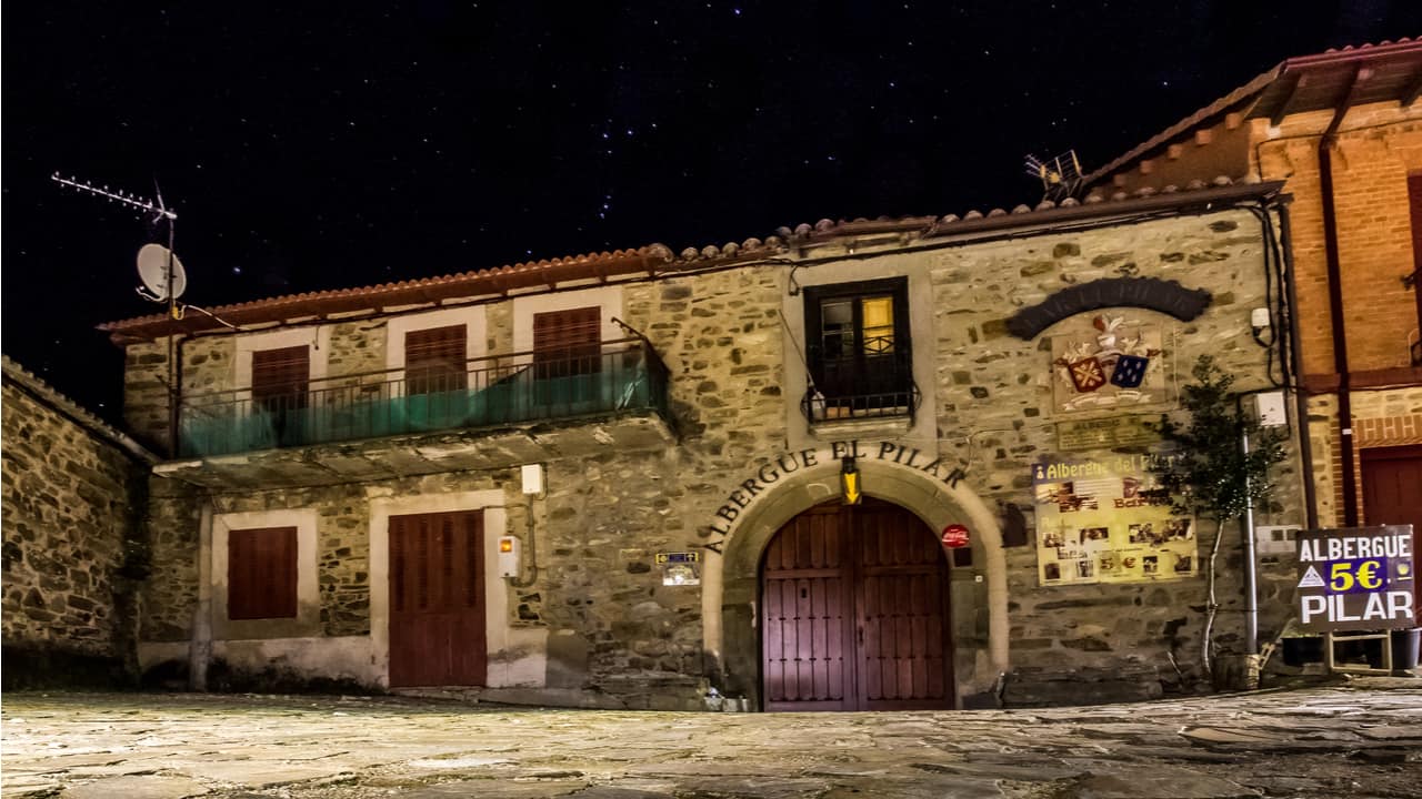
- Albergues (pilgrim hostels): The backbone of Camino accommodation. Municipal albergues are cheapest, typically charging between five and twelve euros for a bunk bed in a shared dormitory. Private albergues cost a little more and sometimes offer private rooms. Most operate on a first-come, first-served basis. Facilities usually include a kitchen, showers, and a place to wash and dry clothes.
- Pensiones and hostales: Small guesthouses with private or semi-private rooms. Prices vary, but expect to pay between 25 and 50 euros for a single or double room. Useful for rest days or when you need a night of uninterrupted sleep.
- Hotels: Available in larger towns. Prices vary widely.
- Casas rurales: Rural guesthouses, sometimes with evening meals. More common in Asturias and Galicia.
The Norte has fewer albergues per stage than the Francés. In some sections, particularly in Cantabria and parts of Asturias, there may be only one albergue option between towns, and it may have limited beds. This means that in peak season (July, August, early September), arriving at your destination by early afternoon is wise. Starting early helps.
Booking ahead is generally not necessary for municipal albergues, which do not accept reservations. For private albergues, pensiones, and hotels, booking a day ahead by phone is sensible in July and August, especially in popular stops like San Sebastián, Bilbao, Santander, Santillana del Mar, and the smaller towns where only one or two options exist.
In the low season (May, October), you will rarely struggle to find a bed, though some smaller albergues may be closed. Check locally or with recent pilgrim reports for current opening dates.
How do waymarking, maps, and guidebooks work on the Camino del Norte?

The route is marked with yellow arrows painted on walls, rocks, posts, and occasionally trees. You will also see the scallop shell symbol and, in some sections, stone waymarkers with distance information. The marking is generally good but less consistent than on the Francés. In towns and cities, arrows can be harder to spot among the visual noise of streets and buildings. In rural areas, there are occasional ambiguous junctions where the arrow has faded or points in a direction that seems improbable.
A guidebook is helpful. The most widely used English-language guidebook is published by Cicerone Press, though others exist. Spanish-language guides by the Confraternity of Saint James and Eroski Consumer are also detailed and reliable. Any current edition (check the publication date; the route occasionally changes where paths are rerouted) will give you stage descriptions, elevation profiles, accommodation listings, and notes on services in each town.
Maps are useful as a supplement. The path is waymarked well enough that you do not need detailed topographic maps, but having a sense of the overall route and its variants helps with planning.
Where can you find GPX tracks and route planning tools?
Digital tools have become indispensable for many pilgrims. GPX tracks for the Norte are available from several sources:
- Gronze.com: A comprehensive Spanish-language Camino resource with downloadable GPX tracks for all routes
- Buen Camino app: Popular smartphone app with offline maps, stage information, and accommodation listings
- Camino Ninja and Wise Pilgrim apps: Both offer GPS tracking and offline route maps
- Wikiloc: Community-uploaded GPS tracks, useful for checking recent route variations
Download GPX tracks to your phone and carry a portable charger. Phone GPS works without a data connection for navigation purposes, which is reassuring in the sections where signposting becomes sparse and the path enters dense forest.
What is the Credencial, and how do you earn the Compostela on the Camino del Norte?

The Credencial del Peregrino is the pilgrim’s credential, a document that you carry and get stamped at albergues, churches, bars, and municipal offices along the way. It serves as proof that you walked the route and is required to receive the Compostela, the certificate of completion, at the Pilgrim’s Office in Santiago.
You can obtain a Credencial before departure from your local confraternity of Saint James, or at the start of your walk in Irún or San Sebastián. Some albergues and churches along the route also issue them, though starting with one already in hand is easier.
To earn the Compostela, you need to have walked at least the last 100 kilometres to Santiago (or cycled the last 200 kilometres) for religious or spiritual reasons, or at least the last 100 kilometres for non-religious reasons (which earns you a certificate of welcome rather than the traditional Compostela). You must have at least two stamps per day for the final 100 kilometres.
On the Norte, the last 100 kilometres begins roughly at Vilalba or Baamonde, depending on how the stages fall. If you are walking the full route from Irún, you will arrive in Santiago with a credencial so thick with stamps it barely folds shut, and you will not need to worry about the minimum distance.
Collect stamps regularly. Most pilgrims get one or two per day, at their overnight stop and perhaps at a church or café along the way. The stamps themselves become a kind of diary: you will look at them months later and remember the tiny village bar where the woman behind the counter stamped your credencial with great solemnity and then poured you a glass of wine without being asked.
What should you pack for the Camino del Norte (and what should you leave at home)?

Pack light. Then take half of it out and leave it. The single most common mistake on any Camino is carrying too much weight, and on the Norte, where the hills are relentless, every extra gram announces itself in your knees and shoulders.
A reasonable base weight (pack plus contents, minus food and water) is between 7 and 9 kilograms. Anything over 10 kilograms will slow you down and increase your risk of injury.
Essentials:
- Backpack, 35 to 40 litres, with a rain cover
- Two sets of walking clothes (wear one, wash one)
- One set of evening clothes (lightweight trousers and a clean shirt)
- Rain jacket (breathable, not a bin bag)
- Fleece or lightweight insulating layer
- Three pairs of walking socks (merino wool dries faster and resists smell)
- Walking shoes or light boots, broken in before departure
- Sandals or lightweight shoes for evenings
- Sleeping bag liner or lightweight sleeping bag (albergues provide blankets but not always sheets)
- Headlamp
- Basic toiletries (small sizes; you can buy more along the way)
- First aid: blister plasters (Compeed or similar), ibuprofen, tape, antiseptic
- Credencial and identification
- Phone and charger; portable battery pack
- Water bottle, one litre minimum
- Sunscreen and hat
Leave at home:
- Anything cotton (it absorbs sweat, takes forever to dry, and chafes)
- More than two books (carry one, swap at albergue book exchanges)
- A towel larger than a small microfibre one
- Jeans
- Anything you are packing “just in case”
The weather on the Norte means your rain jacket is non-negotiable. A warm layer is also essential; coastal mornings can be cool even in summer, and if the fog rolls in, you will want something between your skin and the damp air.
Can you use a backpack transfer service on the Camino del Norte?
Yes, though the service is less widespread than on the Francés. Several companies operate baggage transfer on the Norte, carrying your pack from one town to the next while you walk unencumbered. You typically leave your bag at your accommodation by a set time in the morning, and it arrives at your next stop by afternoon.
The service is available on most stages but may not cover every stop, particularly in remote sections of Asturias and inland Galicia. Ask at your albergue or check with the transfer companies for current coverage and prices. Expect to pay between five and eight euros per stage per bag.
There is a quiet debate among pilgrims about whether using a transfer service is “real” pilgrimage. I will not weigh in on that, except to say that arriving at your destination without a wrecked back is its own form of spiritual practice, and the Camino is long enough to generate plenty of suffering without insisting on unnecessary sources of it.
What are the biggest highlights and local experiences along the Northern Way?

The Norte is generous with its highlights. The difficulty is choosing which to mention.
San Sebastián deserves a full day, at minimum. The old town is a labyrinth of narrow streets lined with pintxos bars, each one displaying a counter spread of small, elaborate bites: salt cod on toast, grilled prawns, croquettes of ham, anchovies draped over peppers. You eat standing up, move to the next bar, eat again. The beach at La Concha curves like a parenthesis around pale sand and green water. If you are there on a clear evening, the sunset over the bay will stop you where you stand.
Bilbao has reinvented itself around the Guggenheim Museum, which gleams like a beached spaceship beside the river, but the old quarter (Casco Viejo) is where the life is: market stalls, more pintxos bars, narrow streets with laundry hanging overhead. The walk into Bilbao is not the prettiest stage on the Norte, but arriving feels earned.
Santillana del Mar is a perfectly preserved medieval village of honey-coloured stone, with a Romanesque collegiate church and streets that echo underfoot. Nearby are the Altamira Caves, home to Paleolithic paintings that are among the oldest art in the world (the original cave is closed, but the museum replica is extraordinary).
Asturian cider country around Villaviciosa introduces you to the ritual of the escanciado: the bartender holds the bottle high above their head and pours a thin stream of natural cider into a wide glass held at hip level, aerating it in flight. You drink quickly, in one or two gulps, while the bubbles are still alive. It tastes of apples and grass and rain. You will want another.
The coast between Llanes and Ribadesella offers some of the most dramatic scenery on the entire route: limestone cliffs dropping into turquoise inlets, hidden beaches accessible only on foot, and green headlands where the wind pushes hard enough to lean into.
Ribadeo and the Praia das Catedrais (Beach of the Cathedrals) sits just off the route, where erosion has carved the rock into soaring arches and flying buttresses that rival anything in stone. It is accessible at low tide; check the tide tables and time your visit.
The final approach to Santiago through Galician hamlets, past hórreos (raised stone granaries) and beneath canopies of oak and chestnut, builds a slow, quiet crescendo. You hear the cathedral bells before you see the spires. The last hour of walking, through the old town and into the Praza do Obradoiro, is a feeling I cannot describe in a way that would be adequate, so I will not try.
There is also the food. The whole route is a long meal with walking between courses. Basque pintxos give way to Cantabrian seafood (the anchoas de Santoña are famous for good reason). Asturias brings fabada, a white bean stew so rich it could fuel you uphill for days, and the local cheeses, especially Cabrales, which smells like a dare and tastes like a revelation. Galicia finishes with pulpo a feira (octopus with paprika and olive oil), empanadas, and Albariño wine that tastes of the sea.
Frequently Asked Questions
How many days do I need to walk the Camino del Norte end-to-end?
Most pilgrims take between 32 and 38 days to walk from Irún to Santiago de Compostela. The variation depends on daily distance, rest days, and fitness. Planning for 34 to 36 days, including two or three rest days, is a comfortable target. Faster walkers have completed it in under 30 days; those walking shorter stages or taking more rest days may need 40 or more.
Is the Camino del Norte well marked, or will I get lost without a guidebook?
The waymarking is generally good, with yellow arrows and shell markers throughout the route. However, it is less consistent than on the Camino Francés, and there are sections, particularly in urban areas and at ambiguous trail junctions, where you may hesitate. A guidebook or GPS app significantly reduces the chances of a wrong turn. I went astray three times on my walk, each time in a town where the arrows disappeared behind a parked van or a construction fence. A quick check of the GPS track on my phone set me right within minutes. You will not become genuinely lost, but you may occasionally become temporarily uncertain, which is a different and less worrying thing.
Do I need to book accommodations in advance on the Camino del Norte?
For most of the route and most of the season, no. Municipal albergues do not accept advance bookings and operate first-come, first-served. In July and August, arriving at your destination by early to mid-afternoon is advisable to secure a bed. Private albergues, pensiones, and hotels can be booked ahead by phone, and doing so is sensible for popular stops during peak weeks. Outside the summer months, availability is rarely a problem, though some smaller albergues close from November to April.
How hard is the Camino del Norte compared to the Camino Francés?
The Norte is harder. It has more elevation gain per stage, more varied and sometimes rougher terrain, and longer distances between services in certain sections. The Francés has its own challenges, particularly the Meseta and the climb over the Pyrenees, but the overall gradient of effort is more consistent and moderate. The Norte rewards fitness and, perhaps more importantly, a tolerance for hills. If you have walked multi-day trails with significant ascent and descent, you are ready. If the Norte will be your first long walk, consider starting with shorter daily stages and building up.
What’s the best time of year to avoid heavy rain and crowds?
July is typically the driest month, but it is also one of the busiest. September offers a good compromise: the summer heat has eased, the rain has not yet turned persistent, and the crowds thin after the August holiday rush. Early to mid-June is another sweet spot, with long days and moderate weather, though some higher-elevation sections may still be cool. October is quiet and atmospheric but wetter, and some accommodation closes for the season. There is no month when you can guarantee dry weather on the northern coast; bringing waterproof layers is simply part of the contract you sign when you choose this route over the sun-baked interior.