There is something faintly absurd about starting a pilgrimage in the middle of a capital city. You step out of your hotel near the Puerta del Sol, pack cinched tight, boots still clean, and you walk north through morning traffic while commuters glance at your scallop shell with mild curiosity. By afternoon you are climbing into the Sierra de Guadarrama, and Madrid is just a smudge of haze behind you. By the second day, you cannot quite believe it was ever real.
The Camino de Madrid is not the route most people picture when they think of walking to Santiago de Compostela. It has no cathedrals made famous by Paulo Coelho, no sprawling albergues with fifty bunks and a communal kitchen full of Australians making pasta. What it has instead is solitude, stone-walled villages where the bar doubles as the shop and the post office, and a particular quality of Castilian light that flattens the meseta into something almost lunar. It is a route for people who have walked a Camino before and want less noise, or for people walking their first and wanting to feel genuinely alone with the question of why they are doing this at all.
This guide covers everything I know about planning and walking the Camino de Madrid: the route from the capital to Sahagún, where it meets the Camino Francés, and all the practical details that sit between the idea of walking and the act of actually doing it.
What is the Camino de Madrid and why would you choose this route?

The Camino de Madrid is a pilgrimage route running roughly 320 kilometres from Madrid north and then northwest to Sahagún, a quiet town on the meseta in the province of León. At Sahagún, the route joins the Camino Francés, and from there you have approximately 370 kilometres remaining to Santiago de Compostela.
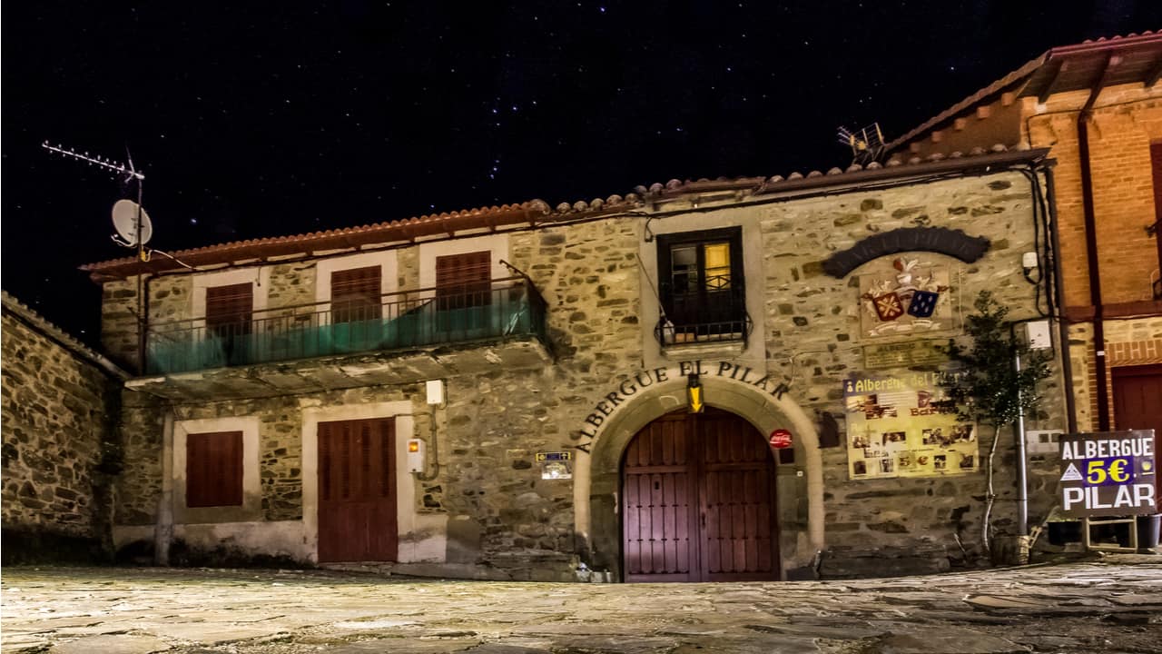
It is one of the lesser-walked Caminos, and that is both its great appeal and its main logistical challenge. The Asociación de Amigos del Camino de Madrid has done considerable work waymarking the trail and maintaining its pilgrim infrastructure, but you will not find the density of services that exist on the Francés or the Portugués. Some days you will walk for hours without passing a shop or a bar. Some nights you will sleep in a village so small that the albergue is a converted schoolhouse with four beds and a key you collect from the woman who runs the farmacia.
Why choose it? Because you live in Madrid, or you are flying into Madrid, and it feels right to begin where you are rather than taking a bus to somewhere else. Because you want to cross the Sierra de Guadarrama on foot, through pine forests that smell of resin and altitude, and come down the other side into the vast open tableland of Castilla y León. Because you want to walk for days without seeing another pilgrim and then, when you finally join the Francés at Sahagún, feel the strange jolt of suddenly being part of a crowd.
I will be honest. This route asks more of you logistically than the well-trodden paths. You need to plan your water. You need to confirm that albergues are open before you arrive. You need to be comfortable with the possibility that today’s stage has no café at the halfway point and no shade for the last twelve kilometres. But if you are the sort of person who finds that appealing rather than alarming, the Camino de Madrid will reward you with something the busier routes cannot always offer: the feeling that this walk is genuinely yours.
Where does the Camino de Madrid start and end (and how does it connect to other Caminos)?

The traditional starting point is the Iglesia de Santiago y San Juan Bautista in the Plaza de Santiago, a small square tucked just behind the Royal Palace in central Madrid. Some pilgrims begin at the Calle de Santiago. Others simply start walking from wherever they are staying. The Camino is not precious about these things.
From Madrid, the route heads north through the suburbs and satellite towns of the capital’s sprawl, which is, I will not pretend otherwise, the least picturesque section of the entire walk. You pass through Tres Cantos and Colmenar Viejo before the landscape begins to shift. The concrete gives way to scrub, then to the foothills of the Sierra de Guadarrama.
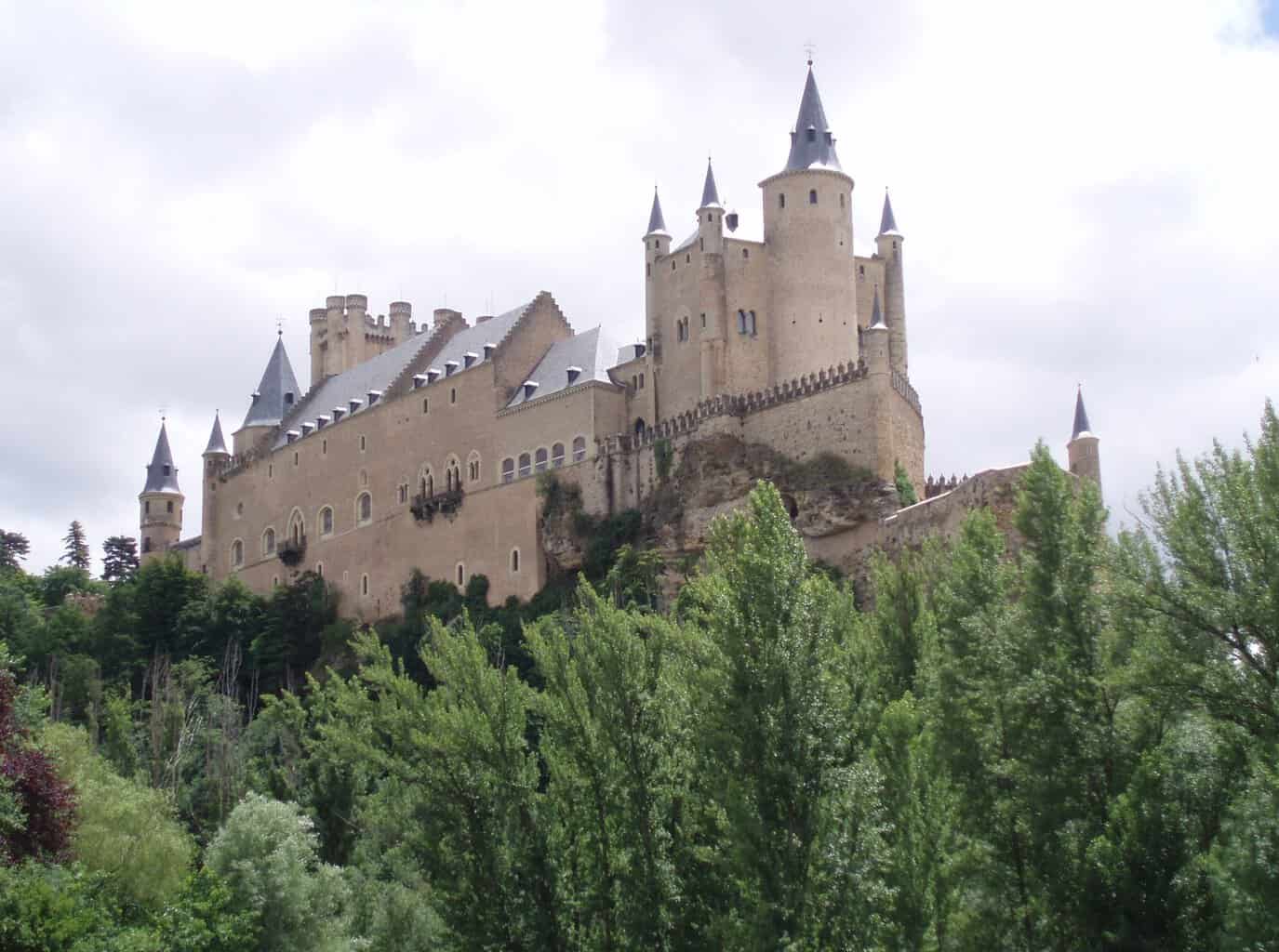
The route crosses the mountains via the Puerto de la Fuenfría or nearby passes, depending on which variant you follow, and descends into the province of Segovia. From here it continues northwest through small Castilian towns: Segovia itself (a worthy detour, with its Roman aqueduct and alcázar), Coca, Alcazarén, Medina del Campo, and onward across the meseta.
The endpoint is Sahagún, roughly 320 kilometres from Madrid. Sahagún sits on the Camino Francés, about two-thirds of the way from the French border to Santiago. When you arrive, you have a choice: turn left and walk the remaining stages to Santiago, or simply stop, sit in the Plaza Mayor, and have a glass of wine while you consider what you have just done.
For those continuing to Santiago, the Camino de Madrid effectively becomes a long approach route to the Francés. Your total walking distance from Madrid to Santiago would be approximately 690 kilometres, which at a moderate pace takes around four to five weeks.
The Camino de Madrid also intersects briefly with the route of the Camino de la Lana near Segovia, and pilgrims occasionally combine sections of both. But the primary connection that matters for planning is the junction at Sahagún.
How do you plan stages on the Camino de Madrid (with a practical stage-by-stage overview)?

Most pilgrims divide the Camino de Madrid into somewhere between 13 and 16 stages, depending on fitness, pace, and where accommodation is available. The stages are not uniform. Some are short and gentle; others are long, exposed, and demand that you carry extra water.
A reasonable stage plan, walking 20 to 28 kilometres per day, might look something like this:
|
Stage |
From |
To |
Approx. Distance |
|
1 |
Madrid |
Tres Cantos |
22 km |
|
2 |
Tres Cantos |
Manzanares el Real |
22 km |
|
3 |
Manzanares el Real |
Cercedilla |
28 km |
|
4 |
Cercedilla |
Segovia |
30 km |
|
5 |
Segovia |
Santa María la Real de Nieva |
30 km |
|
6 |
Santa María la Real de Nieva |
Coca |
27 km |
|
7 |
Coca |
Alcazarén |
22 km |
|
8 |
Alcazarén |
Medina del Campo |
22 km |
|
9 |
Medina del Campo |
Tordesillas (variant) |
30 km |
|
10 |
Tordesillas |
Villalpando |
30 km |
|
11 |
Villalpando |
Benavente (variant) or continue |
25 km |
|
12 |
Onward stages toward Sahagún |
Various |
20–28 km |
|
13–15 |
Final stages into Sahagún |
Sahagún |
Varies |
I should note that distances vary depending on the source you consult, and several stages have variant routes. The table above is a rough framework. Your actual stages will depend on where you find open accommodation and how your body feels on any given day.
The mountain stages around the Sierra de Guadarrama are the most physically demanding: significant elevation gain, rocky paths, and weather that can change quickly. The meseta stages are flat but long, and the psychological challenge of walking across an apparently featureless plain for hours should not be underestimated. The light out there does strange things. Distances deceive. A village that looks twenty minutes away can take an hour to reach.
What are the key towns and overnight stops pilgrims use most often?
The following towns appear most frequently in pilgrim accounts and stage plans as reliable overnight stops:
- Tres Cantos or Colmenar Viejo: End of the suburban stretch north of Madrid
- Manzanares el Real: A pleasant town at the foot of La Pedriza, with its medieval castle and reservoir
- Cercedilla: A mountain town in the Sierra de Guadarrama, popular with hikers and weekenders from Madrid
- Segovia: The largest town on the route before the meseta; full services, historic centre, excellent food
- Santa María la Real de Nieva: A small town with a notable Gothic cloister
- Coca: Famous for its spectacular Mudéjar castle, built in brick rather than stone
- Alcazarén: Quiet, small, functional
- Medina del Campo: A sizeable town with the imposing Castillo de la Mota and good services
- Tordesillas: Known for its historical significance (the Treaty of Tordesillas, 1494) and its position on the Duero river
- Sahagún: The endpoint, with its Romanesque brick churches and its place on the Francés
Between these towns, services thin out. Carry food. Carry water. Assume the bar you read about on a forum three years ago has closed.
What maps, GPX tracks, and guidebooks are most recommended for the Camino de Madrid?

The single most important resource for the Camino de Madrid is the work of the Asociación de Amigos del Camino de Madrid. They maintain route information, publish stage descriptions, and have been instrumental in waymarking the trail. Their website is the first place to check for current route conditions.
For guidebooks, options are limited compared to the Francés. The most commonly referenced guide is published by the Asociación themselves. It is in Spanish, which is worth noting if your Spanish is limited. As of my knowledge, there is no widely available English-language guidebook dedicated solely to the Camino de Madrid, though John Brierley’s broader Camino guides sometimes reference connecting routes.
For maps and GPX tracks:
- Wikiloc: The most reliable source for downloadable GPX tracks. Search for “Camino de Madrid” and look for tracks with high download counts and recent dates. Cross-reference multiple tracks, as the route has variants.
- Gronze.com: An excellent Spanish-language resource that covers most Camino routes, including the Madrid. Stage descriptions, accommodation listings, and elevation profiles.
- Buen Camino app: Includes the Camino de Madrid route with offline maps.
- Mapy.cz: A free offline map app that shows many Camino routes and is useful as a backup navigation tool.
I would strongly recommend downloading GPX tracks to your phone and carrying a backup method of navigation, whether that is a second device or printed stage maps. The waymarking on the Camino de Madrid has improved significantly in recent years, but there are still sections where arrows are faded, missing, or ambiguous. In agricultural areas, ploughing sometimes obscures path markers.
Where can you find updated, real-world route updates from other pilgrims?
The best sources for current, on-the-ground information are:
- The Camino de Madrid forum on the Camino de Santiago Forum (caminodesantiago.me): Active threads where recent pilgrims post about route conditions, albergue closures, and detours
- Facebook groups: Several Spanish-language groups dedicated to the Camino de Madrid share updates regularly
- Gronze.com comments: Users frequently add notes about changes to services or route conditions
- The Asociación de Amigos del Camino de Madrid: Contact them directly; they are often responsive to email enquiries about current conditions
The golden rule: information older than one year should be verified. Albergues open and close. Bars change hands. Paths are rerouted when landowners object. The Camino is a living thing, not a museum piece.
What permits, pilgrim credentials, and logistics do you need before you go?

You do not need a permit to walk the Camino de Madrid. You need legs, a willingness to use them, and a pilgrim credential (credencial del peregrino).
The credencial is a folding document that you get stamped at churches, albergues, bars, town halls, and occasionally random establishments along the way. It serves two purposes: it proves you walked the route (required if you want a Compostela in Santiago), and it grants you access to pilgrim-only albergues at reduced rates.
You can obtain a credencial from:
- The Asociación de Amigos del Camino de Madrid (they can issue one in Madrid before you start)
- The cathedral or parish in Madrid where you begin
- Various Camino associations across Spain and internationally
- Some albergues will issue one at the start of your walk, though this is not guaranteed
Getting to Madrid is straightforward. Madrid-Barajas Airport is one of Europe’s major hubs, with flights from across the world. From the airport, the metro takes you into the city centre in about 40 minutes. If you are already in Spain, high-speed trains (AVE) connect Madrid to Barcelona, Seville, and other major cities.
Getting home from Sahagún is easy enough. Sahagún has a train station on the Madrid-León line, with regular services. If you continue to Santiago, you can fly home from Santiago de Compostela airport or take the train back to Madrid.
Other logistics to consider:
- Travel insurance that covers long-distance walking
- A European Health Insurance Card (EHIC) or UK Global Health Insurance Card (GHIC) if applicable
- Your phone with offline maps, GPX tracks, and useful apps downloaded before you leave Madrid (mobile signal can be patchy in rural areas)
- A small amount of cash; some villages have no ATM, and tiny bars may not accept cards
What are accommodations like on the Camino de Madrid (and do you need reservations)?

Accommodation on the Camino de Madrid is a mix of municipal albergues, private albergues, hostales, casas rurales, and the occasional hotel. The experience is markedly different from the Camino Francés, where you can often walk into any town and find a bed.
Municipal albergues are the backbone of the route. They are typically simple: bunk beds, shared bathrooms, a basic kitchen or at least a microwave, and a communal area. Prices are low, often a donativo (donation) or a fixed rate of a few euros. Some are well maintained and charming. Others are functional in a way that tests your definition of the word. I stayed in one that had no hot water and a door that did not quite close. I slept well regardless, because I had walked 28 kilometres and my standards had been adjusted by exhaustion.
The critical issue on the Camino de Madrid is availability and opening times. Some albergues are only open during certain months, typically spring through autumn. Some require you to phone ahead. Some have a hospitalero (warden) who arrives at a set time, and if you arrive before that time, you wait. Others operate on a key-collection system where you pick up the key from a designated local business.
Do you need reservations? For municipal albergues, reservation is often not possible; they operate on a first-come, first-served basis. For private accommodation, booking ahead is wise, especially in smaller villages where there may be only one option. In larger towns like Segovia and Medina del Campo, you will have no trouble finding a room, but in villages between, you could find yourself with nowhere to sleep if you have not planned.
My advice: know where you intend to sleep each night and have a backup plan. Carry the phone number of your next accommodation. Call ahead if there is any doubt. And carry a lightweight bivvy or emergency shelter, not because you will necessarily need it, but because knowing you have it removes a layer of anxiety that would otherwise colour your entire day.
How do you handle food and water planning on quieter stages?
This is where the Camino de Madrid asks you to be a proper grown-up about planning. On the Francés, you can wander into a village every few kilometres and find a café serving bocadillos and café con leche. On the Madrid route, some stages have no services for 15 or 20 kilometres.
Water: Carry at least two litres on stages that cross open meseta. In summer, carry three. Fountains exist in most villages, but not all are potable; look for signs reading “agua potable” or “agua no potable.” When in doubt, use purification tablets or carry a filter. Dehydration on the meseta is not a theoretical risk; the sun is direct, shade is scarce, and the dry air wicks moisture from you faster than you realise.
Food: Buy supplies in any town large enough to have a shop. Segovia, Medina del Campo, and other larger stops are your best opportunities to stock up. Carry enough for at least one full day of self-sufficiency: bread, cheese, cured meat, nuts, dried fruit, and whatever else sustains you. In smaller villages, the local bar may serve a menú del día at lunchtime, but do not rely on this without checking first.
A small stove and a pot for making coffee or heating soup is a luxury worth the weight if you are comfortable carrying it. On mornings when you leave a village at dawn and the next town is four hours away, the ability to sit by the path and make a cup of coffee is worth more than you might imagine.
What terrain, weather, and safety issues should you prepare for on the Camino de Madrid?

The Camino de Madrid crosses three distinct landscapes, and each has its own character and its own demands.
The urban exit from Madrid (Stages 1–2): Pavement, suburban paths, and the occasional stretch of road walking. The main hazard is boredom, though traffic at certain crossings requires attention. The terrain is flat to gently rolling.
The Sierra de Guadarrama (Stages 3–4): This is the mountain section, with significant climbing. Paths are rocky, sometimes steep, and pass through pine and oak forest. The Fuenfría pass sits at roughly 1,800 metres. Weather can change rapidly at altitude: clear mornings can give way to cloud, rain, or even snow outside of high summer. Carry a waterproof layer, warm mid-layer, and hat and gloves if walking in spring or autumn. The descent toward Segovia is beautiful but hard on the knees.
The meseta (Stages 5 onward): Flat or gently undulating agricultural land. Wheat fields, sunflower fields (in season), and a sky so vast it can feel oppressive. Summer temperatures regularly exceed 35°C. The sun is relentless. A hat with a brim, sunscreen, and adequate water are not optional. In winter, the meseta is cold, with biting winds and occasional frost.
Safety considerations:
- Heat exhaustion and sunstroke are the primary risks in summer. Start early, rest during the hottest hours, and drink before you feel thirsty.
- Hunting season (roughly October to February) means you may hear gunshots in rural areas. Stay on marked paths.
- Dogs in rural villages are usually more bark than bite, but carry a walking pole and maintain calm confidence.
- Road walking is unavoidable on some stages. Walk facing traffic, wear visible clothing, and be especially alert on narrow roads without verges.
- Isolation is a feature, not a bug, but it means that if you injure yourself on a remote stretch, help may be distant. Carry a charged phone, know the emergency number (112), and tell someone your daily plan.
The weather on the meseta deserves particular respect. I have walked stages where the morning began in mist so thick I could not see the next waymark, then by noon the sun had burned everything to a white glare that made me squint even with sunglasses. Spring and autumn offer the most moderate conditions. Summer is doable but demands discipline about hydration and timing. Winter is quiet and atmospheric but cold.
Frequently Asked Questions
Is the Camino de Madrid well marked, or do I need a GPS track?
The route has been progressively waymarked by the Asociación de Amigos del Camino de Madrid, and in most sections you will find yellow arrows, tiles, or signposts. However, the marking is not as consistent or frequent as on the Camino Francés. There are stretches, particularly across open farmland and in some suburban areas, where markers are sparse, faded, or have been removed. I would rate the marking as adequate but not foolproof. Carry a GPX track on your phone as a backup. You will probably not need it on most stages, but on the two or three where you do, you will be very glad to have it.
How many days does the Camino de Madrid take, and what daily mileage is realistic?
Most pilgrims complete the Madrid to Sahagún section in 13 to 16 walking days, covering 20 to 28 kilometres per day. A fit walker with long-distance experience could do it in fewer days, but the accommodation spacing often dictates stage length regardless of fitness. Allow at least one rest day, ideally in Segovia, which deserves a full day of wandering. If you are continuing from Sahagún to Santiago, add roughly 14 to 16 further days on the Francés. Total walking days from Madrid to Santiago: approximately 28 to 35 days, depending on pace and rest days.
Are there enough albergues and services, or should I book accommodations in advance?
There are enough places to sleep, but only if you plan ahead. The Camino de Madrid does not have the abundance of accommodation found on the Francés. Some stages have only one accommodation option, and it may require a phone call to confirm it is open. In larger towns you will find multiple choices. In villages, you may have one albergue or one casa rural, and if it is full or closed, your options narrow quickly. Check current availability through Gronze.com, the Camino forums, or by phoning ahead. Booking private accommodation in advance during peak months is sensible. Municipal albergues generally cannot be booked but are rarely full given the low pilgrim numbers on this route.
What’s the best guidebook for the Camino de Madrid, and how do I know it’s up to date?
The guide published by the Asociación de Amigos del Camino de Madrid is the most route-specific resource available. It is in Spanish. For English-speaking pilgrims, the best approach is to combine the Asociación’s information with GPX tracks from Wikiloc, stage descriptions from Gronze.com, and recent pilgrim reports from the Camino de Santiago Forum. No guidebook is fully up to date the moment it is printed; services change, albergues open and close, and paths are occasionally rerouted. Cross-reference any guidebook with online sources dated within the last year.
Can I earn a Compostela if I start in Madrid and continue to Santiago?
Yes. The Compostela is awarded to pilgrims who walk at least the last 100 kilometres to Santiago (or cycle the last 200 kilometres) for religious or spiritual reasons. If you walk from Madrid to Sahagún and then continue on the Camino Francés to Santiago, you will have walked far more than the required 100 kilometres. You need to collect stamps in your credencial at least twice per day during the final 100 kilometres. Starting in Madrid and walking the full route to Santiago via Sahagún gives you approximately 690 kilometres of stamped pilgrimage, which more than satisfies the requirements. Collect your Compostela at the Pilgrim Office in Santiago. The queue is part of the experience.
The Camino de Madrid will not overwhelm you with scenery or charm you with the camaraderie of crowded albergues. What it will do is strip things back. You start in a city of three million people and within two days you are walking through a landscape where the only sound is wind in dry grass and the crunch of your own boots on gravel. You carry your water because there is no fountain for the next fifteen kilometres. You sleep in villages where the church bell is the loudest thing that happens all day.
It is not the easiest Camino. It is not the most famous. But it is real in a way that matters, and when you arrive in Sahagún and see the first yellow arrows of the Francés pointing west toward Santiago, you will know something about yourself that you did not know when you left Madrid. Whether that knowledge is useful or merely uncomfortable is, I suppose, between you and the road.