I asked in a newsletter for alternatives to the Camino, and I expected other pilgrimages routes. But, no, the following were the most popular.
Usually, spring is the time when the river of pilgrims arrives in Spain to experience the unique Camino de Santiago. That was when I asked for alternatives in the middle of lockdown. However, these alternatives to the Camino de Santiago have become popular with readers in the USA.
Yes, there’s only one Camino, but these incredible trails come pretty close. Here are 12 fascinating hiking routes that can also satisfy your wanderlust.
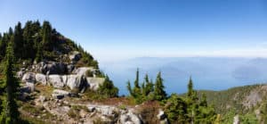
Superior Hiking Trail
Stretching across northeastern Minnesota, the Superior Hiking Trail (SHT) is an epic 300-mile hiking adventure. For most of its length, the SHT follows the rocky ridges that overlook Lake Superior.
It will lead you through forests of cedar, fir, pine, aspen, and birch. You will also come across gorgeous waterfalls, rock outcroppings, deep gorges, rushing rivers, and views of the Sawtooths.
You will travel through the lovely port city of Duluth as well as eight Minnesota state parks. The SHT has plenty of gorgeous vistas that will keep pushing you on.
You can complete the trail in two to four weeks. Although there are occasional short, steep climbs, the trail is fairly moderate.
The best time to hike the SHT is late august through September. When the fall foliage is at its peak, the scenery along the trail is absolutely stunning. The summer in the area is very humid, but it is still a good time to hike the trail. The rain season and the cold come with October.
If you want to avoid crowds on the trail, check the dates on the Superior Fall Trail Race when planning your adventure. When there aren’t such events going on in the area, the trail isn’t heavily trafficked. Like the Camino, it can be a perfect long journey of self-discovery.
The highest point of the path is about 1,800 ft above sea level and the lowest point is about 600 feet above sea level. Along the trail, you will find 92 free and perfectly spaced campsites. Although not directly on the trail, there are several small towns in the area where you can pick up supplies.
Pacific Crest Trail
One of the greatest long-distance trails of North America, the Pacific Crest Trail (PCT), runs from Mexico all the way to Canada. The entire trail is about 2,650 miles long.
If you want to witness some of America’s most varied and scenic terrain, take the high route through the Sierra Nevada. The PCT features everything from snowy mountains to scorching deserts. It passes through 4 national monuments, 5 state parks, 26 national forests, and 7 national parks.
It’s important to note that the PCT is a very challenging trail; you should only consider this alternative if you are an experienced hiker.
Bears and mountain lions are not common on the trail, but there are stretches where rattlesnakes and bees like to make frequent appearances. Even if you are a very experienced hiker, it will take you at least 2 months to complete the trial. Most people complete the trail in about 5 months.
Most of the trail is buried in snow from October into early July. Spring and fall are the best seasons to hike the low-lying parts of the trail. The best time to hike in the mountains is in summer and early fall. That said, you will likely experience all four seasons on the PCT in one way or another.
Most people choose to camp on the PCT. You can pitch a tent practically anywhere along the trail. However, you will need to obtain the PCT long-distance permit (it is free).
Occasionally, you may want to stay in a motel, hotel, or cabin. There are many small towns on the trail that offer cheap accommodation.
There are a few sections of the trail where you won’t come across a water source for up to 30 miles. Along with making sure you have a big enough hydration bladder in your backpack, it’s a good idea to bring a backpacking water filter.
Oregon Coast Trail
The Oregon Coastal is an excellent choice for those who are looking for a different kind of “beach vacation.” Along the 380-mile coast trail, the beauty of the Beaver State’s coastline unfolds around every bend.
Starting at the mouth of the Columbia River, and running all the way to California, the OCT winds through Sitka spruce forests, seaside cliffs, and smooth sandy shores. It samples some of the most beautiful coastal towns, beaches, national forests, and state parks of the US.
Like the Camino, the Oregon Coast Trail is great for those who want a social experience in the wilderness. Meeting fellow hikers, hitchhike-provides, shopkeepers, and other interesting characters is part of the appeal.
Along the northern section of the Oregon Coast Trail, there are many towns and state parks that offer grocery shops, water spouts, and bathrooms. However, towns are further spaced apart along the south coast, so this section requires more planning.
It is best to hike the OCT from June through September. During the summer, the infamous rain of the Pacific Northwest lets up. It is safer and easier to cross rivers and creeks this time of year.
Ranging from traditional hotels to cozy inns, Oregon’s beach communities and coastal towns offer a wide variety of lodging options.
You will find many designated campsites along the trail, but there are many dispersed camping areas in Oregon and along the trail. However, some of them are far apart, so you may need to hike 15 to 20-mile days. It’s important to map out your camping plans in advance. If you plan to camp on the beach, tide knowledge is very important.
You won’t find any camping options right by the Crissey Field station and the Oregon-California Border. If you don’t want to miss a single inch of the trail, especially at the end, it’s best to book accommodation in advance. Casa Rubio is just 0.3 miles from the border. And if you would rather go on an adventure in the Golden State, check our out picks for the best backpacking trips in California.
The Sunshine Coast Trail in British Columbia, Canada North Vancouver.
Stretching from panoramic mountaintops, through old-growth forest, along creeks and lakes, to coastal shorelines, the Sunshine Coast Trail is Canada’s most beautiful hut-to-hut hiking trail.
The SCT is a 112-mile trail with 12 sleeping huts. Calling it the Sunshine Coast may be a bit of a misnomer or at least a relative term, so the huts are probably a welcome respite.
May, July, August, and September are the driest months to hike the trail. The temperature in the cabins drops to 37°F by late September, so it’s best to plan your adventure for the summer. To be able to enjoy everything the area has to offer, without rush, allow yourself 10 to 12 days to hike the entire trail.
One couple’s journal had an interesting way to organize the hike by taking the ferry to one end of the trail and hiking back to Powell River, which is about mid-way on the trail, and then resupplying and ferrying to the opposite trail end and hiking back to Powell River.
The huts are first come first serve and are a one-only stay. You can stay in the huts for free. However, you may be sharing them with other hikers since they are made for shared public use.
There are a few campsites along the way if you think you won’t be able to hike the full distance between huts in one day. Some of them have picnic tables and fire rings; most have outhouses.
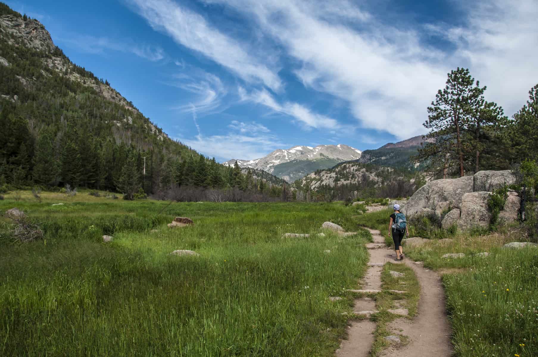
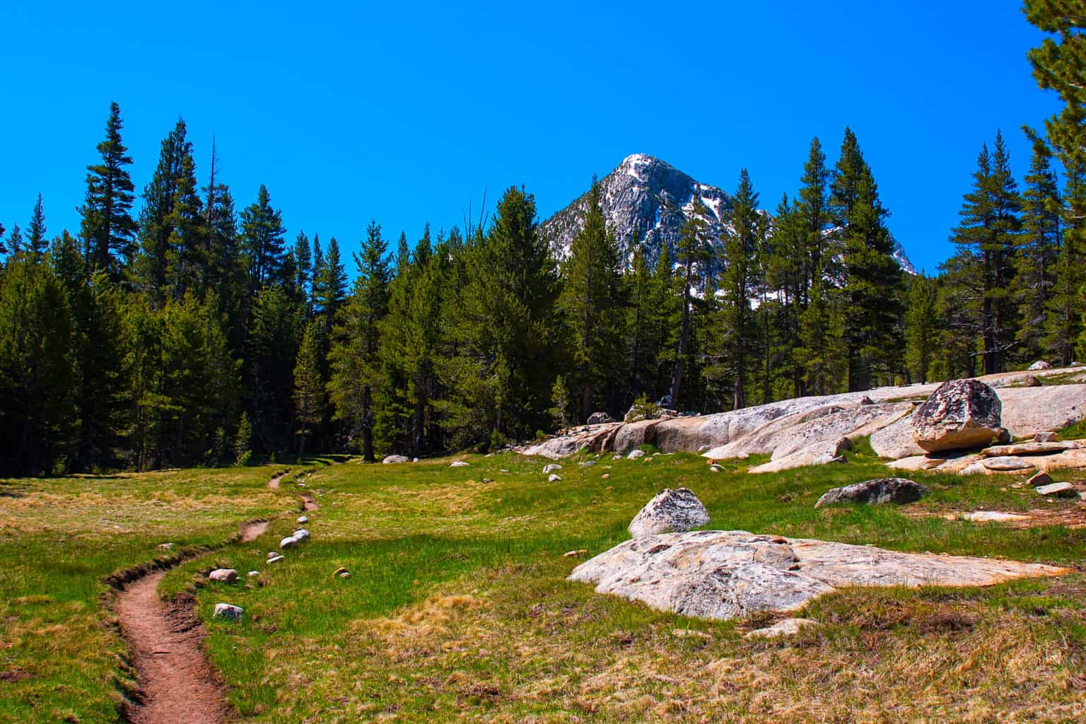
Yosemite High Country Trail
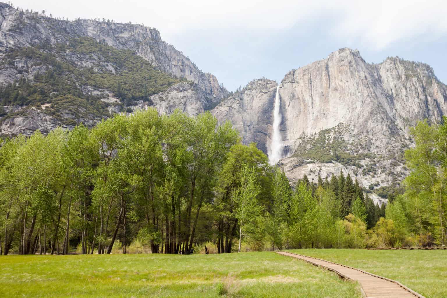
Surrounded by nothing by nature, high up in the mountains, the Yosemite High Country Trail is great for those who are new to wilderness hiking. The YHCT is about a 60-mile loop hike through the granite high country above Yosemite Valley. However, the Yosemite National Park has over 800 miles of trails in total, so you can easily customize your hiking adventure.
The amazing scenery is only made better by the five backcountry camps that are located a day’s hike apart around the loop. Since the campgrounds are spaced only 6 to 10 miles apart, you don’t need to carry a heavy backpack filled with tons of gear and several days’ worth of supplies. A daypack will suffice.
Summer staff at the camps serve up some amazing meals you can choose to purchase along with a stay in a tent cabin or buy a meal and backpack it nearby.
Stays at the camps are a little expensive but well worth it for a special experience. If things get too difficult for you, guided hiking and mule trips are available in the park.
The summer season is the best and most popular time to hike the Yosemite High Country Trail. Fall in Yosemite Park is also good for hiking as well as activities such as fishing, biking, and rock climbing.
When planning a trip to Yosemite, it’s important to know which roads will be open. Because of snow, Tioga Road and Glacier Point Road are typically closed from October to May.
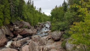
Ice Age Trail in Wisconsin
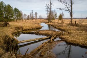
The Ice Age is a 1,200-mile scenic trail that is located entirely within the Badger State. To tell you the story of the last Ice Age, the trail follows the edge of the last continental glacier in Wisconsin.
The trail doesn’t easily connect yet; the IATA is still carving it out. So, one could say that everyone who embarks on this journey is making history.
It runs along river valleys, limestone bluffs, and the beautiful prairies of the Midwest. You can dunk your hands in kettle lakes along the trail, as well as track the glacier’s movements.
The IAT is one of the few trails in the US that are intended to be a conversation resource for outdoor and silent sport enthusiasts as well as a premier hiking trail.
The many state and county parks, and county, state, and national forests offer plenty of opportunities for camping. There are also some private campgrounds. Camps can vary from facilities complete with electric hookups to old-fashioned primitive walk-in campsites.
You can make campsite reservations here for most Wisconsin DNR campsites. If you want to stay somewhere where you’ll have a roof over your head, check the Ice Age Trail website.
While you can hike the Ice Age Trail any time of the year, it is best to do it in the fall. Another great time to hike the trail is spring, in April and May specifically. When planning your adventure, keep in mind that it generally takes 7 to 12 weeks to complete the trail.
Katy Trail, Missouri
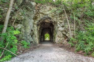
Spanning nearly the full width of Missouri, the Katy Trail is about 240 miles long. Similar to the Camino, the Katy Trail is a relatively flat, inn-to-inn footpath.
Since it parallels the Missouri River, the trail offers some of the most scenic vistas of the state. The Katy Trail also meanders through small, quaint towns, allowing you to discover the rich heritage and rural history of the state.
Some of the most notable points of interest you can find along the trail include the historic Katy Depot, the Rocheport Tunnel, and the state’s largest burr oak.
The flora and fauna in the area are also impressive. You will see turtles basking on logs and bats hunting over the river at dusk.
Make sure to stop in Augusta and stay in one of the town’s B&Bs for a couple of nights. Even though only a couple of hundred people live in Augusta, it offers a surprising number of lovely eateries, artisans, and craft shops.
Aside from numerous B&Bs, there are many public and private camps along the Katy Trail. You will never have to worry about finding a place to sleep.
Most of the designated trailheads have water fountains and restrooms. However, the flush restrooms are closed and the water is turned off from the beginning of November until the end of March. May, September, and October are the best months to hike the Katy Trail.
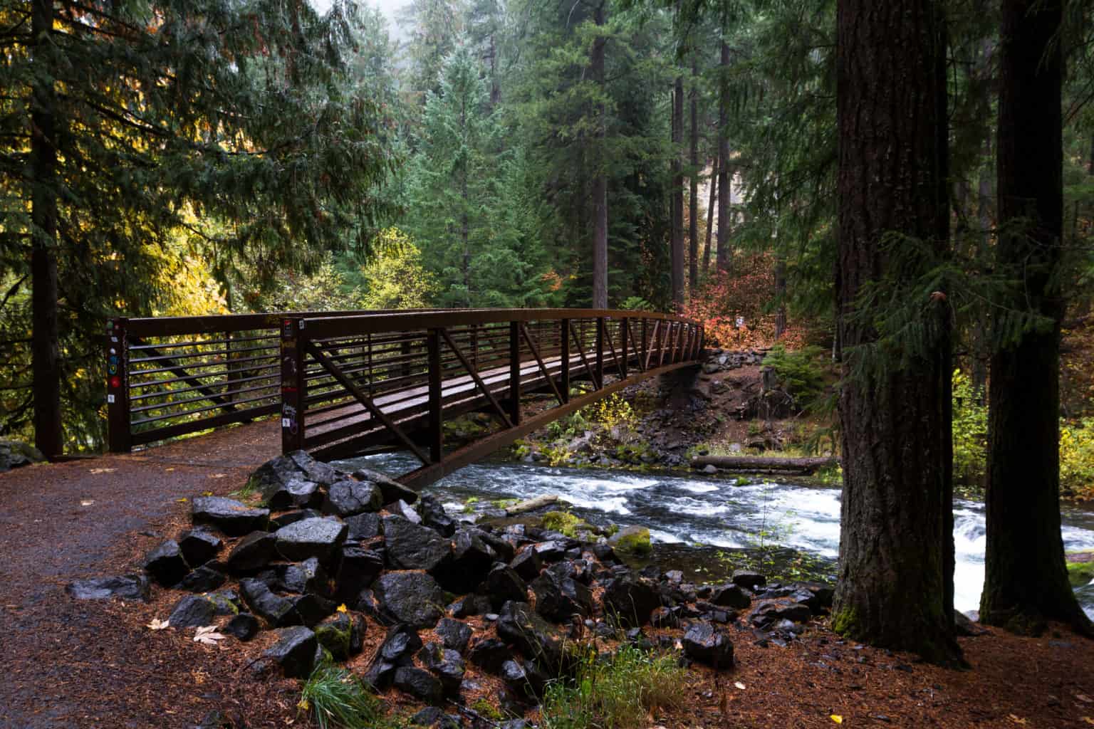
Chesapeake and Ohio Canal
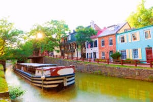
The trail stretches about 190 miles along a 200-year-old canal. It allows you to enjoy the fascinating scenery of the Potomac River Valley as well as explore the remnants of America’s transportation history.
The crushed stone pathways will lead you through forests of beeches, maples, and oaks. You will also encounter deer and a wide variety of different birds throughout your adventure. The trail is perfect for biking as well as hiking.
May through October is peak season on the trail, with weekends being particularly busy. If you want to enjoy spectacular river views, it is best to hike the C&O Canal trail in early spring or late fall.
Just like on the Camino, there are enumerable historical sites, restaurants, and cafes along the C&O trail. There are plenty of private and public campgrounds as well. Beginning at Mile Post 16, there’s a campsite about every 5 miles.
These campsites are generally first-come, first-serve. However, many campgrounds have started to require reservations since the pandemic started.
Because of the current situation, it’s a good idea to monitor the current park conditions when planning your hike.
Each campsite has a picnic table, grill, water pump, and a port-a-toilet. If you prefer something more comfortable, you can check thislist of lodging options along the trail.
St. Olav’s Path in Trondheim, Norway
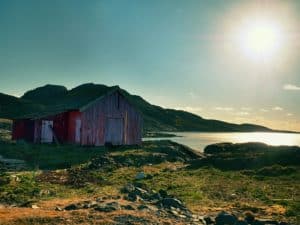
Regardless of your spirituality, the pilgrimage to the Shrine of Saint Olav can be a powerful experience. This epic, 1,000-year old hike through Sweden and Norway offers some of the best views of Scandinavia. Many consider St. Olav’s Path to be the northernmost pilgrimage in the world.
Similar to the Camino de Santiago routes, St. Olav’s pilgrimage is actually a network of different routes, all leading to the Nidaros Cathedral in Trondheim. All of them wind through some of the prettiest valleys of Scandinavia.
The 400-mile Gudbrandsdalsleden is the most popular one. It starts in the capital of Norway, Oslo. The 350-mile route that starts on the eastern coast of Sweden is also very popular and scenic.
Norway has something called “the right to roam,” so you can camp virtually anywhere in the open country, for free. The situation is almost the same in Sweden.
If you would rather sleep somewhere cozier, there are hundreds of Norwegian and Swedish farmers that offer accommodation to pilgrims. Many people that live along the St. Olav’s Way have converted their outbuildings into comfortable mini dorms.
Keep in mind that this is Scandinavia, one of the most expensive regions in Europe, so you won’t be paying Albergue prices for lodging.
You will also need to book accommodation in advance, so this list will be of great help. The best time to walk the St. Olav’s way is from June to September.
Pilgrim Routes in the UK

The Pilgrims’ Way to Canterbury
The Pilgrim’s Way has been the most important pilgrimage in Britain ever since the murder of the Bishop of Canterbury in the 12th century. It is the setting of one of the greatest literary touchstones of the English Language—the Canterbury Tales.
Taking in the picturesque woodlands and rivers of the North Downs Way, this historic pilgrimages route stretches from Winchester to Canterbury Cathedral. The Pilgrims’ Way is 153 miles long and takes 15 days to complete on average. It is divided into 15 stages of 5 to 14 miles.
Summer and fall are the best seasons to walk the Pilgrims’ Way. Then, you can see beautiful lavender fields, hillside vineyards, hops, and orchards bursting with growth. You will also come across lovely river crossings, castles, and chapels.
That said, you can walk the Pilgrims’ Way all year round. Many pilgrims time their journey to arrive in Canterbury on Dec 29th—Saint Thomas Becket’s Day. However, accommodation is limited at this time of year.
There is plenty of accommodation on the trail, especially in centers such as Winchester, Rochester, Dartford, London, Guildford, Farnham, and Alton. You can check out lodging options on the official site of the pilgrimage.
If you want to treat yourself to a bit of luxury at the end of your adventure, you can book a stay at the Canterbury Cathedral Lodge. Aside from many comfortable B&Bs, there are also three campsites along the Pilgrims’ Way.
St. Andrews Pilgrimage, St. Columba’s Way, Scotland

Stretching from the historic Isle of Iona to St. Andrews, St. Columba’s Way is one of the longest hikes in the UK. There are several routes that lead to St Andrew’s.
One of the longest routes through Scotland, St. Columba’s Way, is about 261 miles long and takes about one month to complete. It also includes two ferry journeys.
The route starts on the wild coast of the Isle of Mull, where you will see spectacular soaring cliffs and mesmerizing white-sand beaches. Before you set off into the wilderness, you can stay in the town of Oban, where you will find comfortable accommodation and good food.
Taking you from coast to coast, the trail covers friendly highland villages, glens, hills, and remote shores. The diverse and breathtaking scenery of the St. Columba’s Way leaves no one unimpressed.
The terrain includes a lot of rough walking, so it’s a good idea to train before your pilgrimage. It’s best to avoid walking the pilgrimage during the coldest months of the year (December to February).
You will find B&Bs, hostels, and hotels St Columbia’s Way along most of the trail. However, you may need to camp on certain sections. To help pilgrims find accommodation, the official site of the Way of Saint Andrews has compiled a list of useful links.
Wild camping is perfectly legal in Scotland. You can pitch your tent practically anywhere (there are only a few exceptions). However, it’s important to familiarize yourself with the Scottish Outdoor Access Code.
Rim of Africa
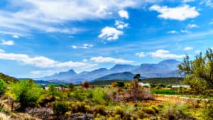
About 400 miles long, the Rim of Africa is one of the greatest long-distance hikes in the world. This majestic trail follows the valleys and crests of the Cape Fold Mountains. It takes about 9 weeks to complete the Rim of Africa.
The trail is only for experienced and fit adventurers that are up for a big challenge. One moment you’ll hike in the rain and cold winds, or searing heat the next.
What makes the Rim of Africa different from most other trails is the fact that it takes place on set dates annually. This year, the hike will take place from September through October. The route varies a bit each year since it is a wild traverse, but it is more or less the same.
If you want to participate, you will need to fill out an application on the official Rim of Africa website. Places are limited, so it’s important to apply on time.
If the entire trail is a bit too long for you, you can apply only for certain sections. If you want to hike the whole trail, the experience will cost you about $3,400.
Camping is the only option on the Rim of Africa. The organizers will supply tents. However, you will be responsible for your own food. You can take a freeze-dried or dehydrated backpacking meal with you that will provide you some energy at least.

I love hiking, backpacking, and camping. From the Camino de Santiago to the West Highland Way in Scotland or simply a great day hike on the weekend. Hiking refreshes me, my mind, and keeps my body reasonably fit. So far I have walked three Camino routes and many other long distance hikes in the UK, Canada, and around the rest of Europe. One of the best was my hike up Ben Nevis.
Great list! Thank you for compiling them here for us, I can’t wait to go!
And some pilgrimage paths in Ireland https://www.pilgrimpath.ie/
Hi Leslie, your St. Olav’s accommodation link covers only the Swedish leg. Here link to website and map with other paths https://pilegrimsleden.no/en/kart
OUTSTANDING LIST!!!!!!! Great job
Excellent alternatives. Many thanks for the routes mentioned in the article!!
South West Coast Path, UK: 630 miles from Minehead in West Somerset via North Devon, Cornwall (Land’s End), South & East Devon into Dorset, finishing in Poole. Stunning coastline, lots of interesting paths, assents and descents, really special and worth walking, easy to walk in sections.
Super alternatives. Some of these in the US I had never heard of but will be added to my lists.
Thanks you.
Try the Kumano Kodo and the Nakasendo in Japan. The KK is a sister to the Camino!
Hi
I have done the Portuguese Camino.
I am very interested in the KK, however I am battling to get information on accomodation. Are you able provide information on accomodation.
The Island Walk in Prince Edward Island in Canada is a new-ish 700 kilometre walk around the perimeter of our smallest province. Very scenic and relatively flat. There is a Facebook page and lots of information on the PEI tourism site.