What Is the Camino Francés, and Why Do Pilgrims Plan Around Its Towns?
The Camino Francés, also known as the French Way, is the most popular Camino de Santiago route. It stretches roughly 780 km across northern Spain, from the French border at the Pyrenees to the Cathedral in Santiago de Compostela in Galicia. Of the approximately 446,000 pilgrims who received a Compostela certificate in 2023, more than half walked this route. It is the most documented, the best waymarked, and the most richly served by pilgrim infrastructure.
But here is the thing that catches people off guard. The Camino Francés is not one seamless trail through open countryside. It is a chain of towns and villages, each with its own character, services, and quirks. Your daily planning revolves entirely around where to sleep, eat, and resupply. Some towns have eight albergues and a pharmacy. Others have a single bar and a dormitory above a church. Knowing which is which before you lace up your boots is the difference between a well-paced walk and an anxious scramble at dusk.
This guide is written primarily for planners based in the U.S. who are choosing a starting point, estimating trip length, or sorting out logistics. Use it to identify the major "service hubs" (cities with transport links, medical care, and gear shops) versus the smaller villages where the charm runs deep but the options run thin.
- Service hubs: Pamplona, Logroño, Burgos, León, Ponferrada, Santiago de Compostela
- Classic pilgrim towns: Puente la Reina, Estella, Frómista, Sahagún, Astorga, O Cebreiro
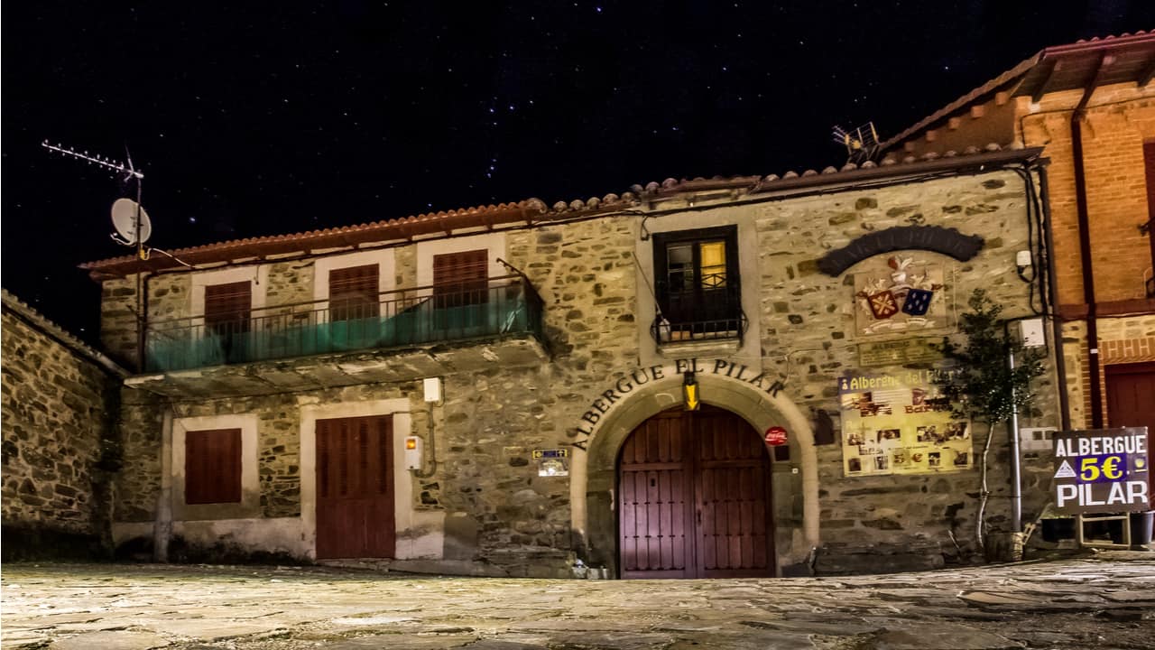
- Quiet village stops: Hornillos del Camino, Moratinos, Rabanal del Camino, Villafranca del Bierzo
Where Does the Camino Francés Start, and What Is the Traditional First Town?
Most pilgrims on the Camino begin in Saint-Jean-Pied-de-Port, a small walled town on the French side of the Pyrenees. Strictly speaking, it is not in Spain, but it is the traditional starting point for the full Camino Francés from Saint-Jean-Pied-de-Port to Santiago de Compostela. The pilgrim office there issues credentials (the pilgrim passport you will stamp along the way), offers route briefings, and provides weather updates for the Pyrenees crossing.
This is where the Camino experience begins in earnest. You will find a handful of gîtes, gear shops selling last-minute poles and rain covers, and more pilgrims per square metre than almost anywhere else on the route. The atmosphere is one of nervous energy and quiet anticipation, dozens of strangers who will become familiar faces over the coming weeks.
The crossing into Spain, via the Napoleon Route over the Pyrenees or the lower Valcarlos road, is one of the most physically demanding days on the entire Camino. It covers roughly 25 km with over 1,200 metres of ascent. In poor weather, the lower route is strongly recommended. Either way, you arrive into Spain and the region of Navarra feeling like you have already earned something.
What Are the Major Cities and Key Towns from the Pyrenees to Pamplona (Navarra)?
The first section of the Camino Francés in Spain sets the tone. The terrain is green, steep, and beautiful, and the towns are small enough that a pilgrim feels the rhythm of the walk almost immediately.
|
Town |
Distance from SJPP (approx.) |
Key Services |
|
Roncesvalles |
25 km |
Large albergue (183 beds), monastery, pilgrim blessing, limited dining |
|
Zubiri |
47 km |
Small albergues, bar-restaurants, pharmacy nearby |
|
Larrasoaña |
52 km |
Quiet hamlet, basic albergue, limited food options |
|
Pamplona |
67 km |
Full city services: hospitals, gear shops, transport links, restaurants |
Roncesvalles deserves a special note. The 12th-century collegiate church and its nightly pilgrim blessing create an atmosphere that stays with you. But the village itself is tiny. There are only a couple of places to eat, and if you arrive late, options narrow quickly. Plan accordingly.
Pamplona is the first major city on the Camino Francés. Famous for the running of the bulls during San Fermín, it is also a superb place to take a rest day, eat extraordinary pintxos along Calle Estafeta, and resupply anything you forgot. Navigating through a city on the Camino can feel disorienting after days of open trail, but the yellow arrows and brass scallop shells embedded in the pavement guide you reliably.
Beyond Pamplona, the route passes through several classic villages in Navarra worth knowing:
- Puente la Reina, where the Camino Francés joins the Camino Aragonés at an iconic Romanesque bridge
- Cirauqui, perched on a hilltop with Roman road remnants underfoot
- Estella (Lizarra), a lively town with good services and a beautiful old quarter along the river
Which Towns Should You Expect Between Pamplona and Logroño (Navarra to La Rioja)?
Leaving Navarra, the terrain softens into rolling hills and vineyards. The towns along the Camino here come more frequently, which makes stage planning flexible. You are approaching wine country, and the walking feels gentler.
- Los Arcos is a frequent stage endpoint, roughly 21 km beyond Estella. It has several albergues, a few restaurants, and a pleasant main square for an evening meal.
- Viana is the last town in Navarra before crossing into La Rioja, notable for its hilltop position and the tomb of Cesare Borgia in the church.
Logroño is a genuine highlight. It is the capital of La Rioja, Spain's most famous wine region, and the food culture here is outstanding. Calle del Laurel is lined with pintxos bars where a glass of Rioja and a mushroom tapa costs a few euros. For pilgrims on the Camino who need a rest day with good food, reliable transport links, and a proper bookshop, Logroño delivers. The city has excellent bus and train connections to Madrid, Bilbao, and other starting points on the Camino.
What Are the Key Towns and Cities from Logroño to Burgos (La Rioja to Castilla y León)?
This section of the Camino Francés carries you out of La Rioja and into the vast autonomy of Castilla y León. The distances between larger hubs increase, and you start to notice the landscape opening up, preparing you for the Meseta ahead.
|
Town |
Region |
Why Pilgrims Stop |
|
Nájera |
La Rioja |
Historic monastery of Santa María la Real; good albergue options |
|
Santo Domingo de la Calzada |
La Rioja |
Famous pilgrim legend (the rooster and hen in the cathedral); solid services |
|
Belorado |
Castilla y León |
Common staging town before the climb to San Juan de Ortega |
|
Burgos |
Castilla y León |
Major city; UNESCO World Heritage cathedral; rest day essential |
Santo Domingo de la Calzada is one of the best towns on the Camino for pilgrim history. The cathedral houses a pair of live chickens in a Gothic henhouse, commemorating a medieval miracle. It sounds absurd, and it is, in the most wonderful way.
Burgos is a city that stops you in your tracks. The cathedral, a UNESCO World Heritage Site, is staggering in its Gothic intricacy. The city was home to El Cid, and the historic centre is dense with excellent restaurants, pharmacies, outdoor gear shops, and medical services. If your boots are falling apart or your knees need attention, this is the place. Many pilgrims take a full rest day here, and it is well deserved.
A planning note: between Logroño and Burgos, the smaller villages (Grañón, Redecilla del Camino, Villafranca Montes de Oca) offer basic services, but you should not rely on finding a pharmacy or ATM in every stop. Carry enough cash and supplies for the quieter stretches.
What Are the Essential Villages and Towns Across the Meseta from Burgos to León?
The Meseta. People warn you about it. They tell you it is flat, featureless, boring. And then you walk it, and something unexpected happens. The emptiness rearranges things inside you. The sunrise starts at 6 a.m. across an unbroken horizon. The only sound is your footsteps on dry earth and the wind moving through wheat. It is not for everyone. But for many pilgrims, this part of the Camino Francés is where the real walking happens, where the body settles into a rhythm and the mind finally quiets down.
The villages here are small, sometimes no more than a church, a bar, and an albergue. But they are memorable:
- Hornillos del Camino: a quiet overnight option about 20 km from Burgos, with a peaceful albergue and not much else, which is exactly the point
- Castrojeriz: a long, stretched-out town beneath a ruined castle, with a notable climb approaching from the east
- Frómista: home to the Church of San Martín de Tours, one of the finest Romanesque churches in Spain
- Carrión de los Condes: a proper town with pilgrim infrastructure, a supermarket, and the beautiful Santa María del Camino church
- Villalcázar de Sirga: a small village with a striking Templar church, often used as a shorter stage option
- Moratinos: tiny, with a population of about 30, but pilgrims remember it for its cave-like bodegas and an extraordinary sense of stillness
Sahagún, roughly halfway between Burgos and León, serves as a key services hub. You will find banks, pharmacies, a train station, and reliable accommodation. Some pilgrims mark it as the halfway point of the entire Camino Francés.
León is the reward at the end of the Meseta. The city's Gothic cathedral, with its extraordinary stained glass windows, is one of the great buildings on any pilgrimage route in Europe. León is a UNESCO World Heritage city in its own right, and it offers everything a pilgrim could need: medical clinics, gear shops, a lively tapas scene in the Barrio Húmedo, excellent bus and train connections, and more hotel options than you can shake a walking pole at. This is the other classic rest day stop on the Camino Francés, alongside Burgos.
What Are the Most Important Towns from León to Santiago (Montes de León, El Bierzo, and Galicia)?
Leaving León, the Camino de Santiago route climbs towards the Montes de León and then descends into the lush valley of El Bierzo. The landscape shifts dramatically. Gone are the golden flatlands of the Meseta; in their place, green hills, chestnut forests, and villages where the stone is darker and the air smells of woodsmoke and damp earth.
|
Town |
Region |
Notable Feature |
|
Astorga |
Castilla y León |
Gaudí's Bishop's Palace; major junction town; chocolate heritage |
|
Rabanal del Camino |
Castilla y León |
Classic mountain village; Gregorian chant vespers at the Benedictine monastery |
|
Cruz de Ferro (Iron Cross) |
Castilla y León |
Highest point on the Camino (~1,500 m); stone-leaving ritual |
|
Ponferrada |
El Bierzo |
12th-century Templar castle; full city services |
|
Villafranca del Bierzo |
El Bierzo |
"Little Santiago"; Church of Santiago with its Door of Forgiveness |
|
O Cebreiro |
Galicia |
Iconic thatched pallozas; entry into Galicia; misty mountain atmosphere |
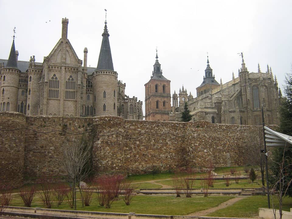
Astorga is where the Camino Francés meets the Vía de la Plata, the ancient Roman road coming north from Seville. It is a compact, walkable city with a stunning Gaudí building (the Bishop's Palace), a good cathedral, and excellent cocido maragato, the local stew served in reverse order, meat first, broth last.
The Cruz de Ferro is not a town but a moment. Pilgrims carry a stone from home and leave it at the foot of a simple iron cross on a wooden pole at the highest point on the Camino. The pile of stones is enormous. I watched a man place a small pebble, whisper something I could not hear, and walk on without looking back. There is nothing more to say about it than that.
O Cebreiro marks the entry into Galicia. The village is ancient, its round palloza dwellings dating back centuries. On a clear morning the views stretch for miles. On a misty one, which is more common, you walk into cloud and the village appears like something from a folk tale. This is frequently cited as one of the highlights of the Camino Francés.
From O Cebreiro, the final section of the Camino towards Santiago de Compostela passes through Galicia's green, rain-soaked hills. Villages come closer together here, often just 2 to 5 km apart, which gives you more flexibility in planning daily stages. Sarria, about 114 km from Santiago, is the most common starting point for pilgrims walking the last 100 km required for the Compostela. The trail from Sarria to Santiago is well served and frequently busy, particularly in summer.
The arrival into Santiago de Compostela, with its vast Praza do Obradoiro and the Romanesque Cathedral de Santiago de Compostela, is the destination of every pilgrim on this route. Whether you have walked 780 km or 115, the moment you step into the square and see the cathedral's façade is one you will remember with a clarity that surprises you.
How Do You Choose the Best Camino Francés Starting Point Based on Your Time?
Not everyone has five weeks of holiday. Most U.S. pilgrims plan around the leave they can take, and the Camino Francés is well suited to walking in sections over multiple trips.
|
Available Time |
Suggested Start Point |
Approximate Distance to Santiago |
|
4 to 6 weeks |
Saint-Jean-Pied-de-Port |
~780 km (the entire Camino) |
|
2 to 3 weeks |
León or Burgos |
~300 km or ~490 km |
|
10 to 14 days |
León or Ponferrada |
~300 km or ~210 km |
|
7 to 10 days |
Sarria (or O Cebreiro) |
~114 km or ~150 km |
- Airport access: Madrid is the most common U.S. arrival hub. From there, trains and buses connect to Pamplona (3 to 4 hours), Burgos (2.5 hours), León (3.5 hours), and Sarria (5 to 6 hours via Lugo). Bilbao airport is another option for starting in Pamplona or Logroño.
- Comfort level: Starting in a major city like Pamplona, Burgos, or León gives you easy access to gear, pharmacies, and accommodation variety. Starting in a small town like Sarria or O Cebreiro requires a bit more logistical forethought.
- The "last 100 km" concept: To earn the Compostela at the Pilgrim's Office in Santiago, you must walk at least the last 100 km (or cycle the last 200 km). Sarria is the most popular starting point for this shorter section of the Camino.
You can absolutely walk the Camino Francés in sections over multiple years. Many people do. Each section has its own character, and returning to pick up where you left off carries its own quiet satisfaction.
What Should You Know About Terrain, Waymarking, Seasons, and Services Between Towns?
The Camino Francés is among the best-waymarked long-distance trails in the world. Yellow arrows painted on walls, kerbs, trees, and rocks guide you almost the entire way. In towns, brass scallop shells set into the pavement point towards Santiago. You will occasionally lose the trail in a city, usually when a construction detour confuses things, but it rarely takes more than five minutes to find your way back.
- Pyrenees (Saint-Jean to Pamplona): Steep, green, potentially harsh weather. The hardest day on the Camino Francés is often the first, the Pyrenees crossing, with over 1,200 m of elevation gain.
- Navarra and La Rioja: Rolling hills, vineyards, moderate terrain. Comfortable walking with good services in most towns.
- The Meseta (Burgos to León): Flat, exposed, hot in summer. Limited shade. Carry water between villages and start early to avoid midday heat.
- Montes de León and El Bierzo: Mountain passes, the Cruz de Ferro area, and steep descents. More physically demanding than the Meseta but spectacularly scenic.
- Galicia: Green, hilly, frequently wet. Eucalyptus forests, granite villages, and mud. Bring rain gear. Always bring rain gear for Galicia.
When to go: The most popular months are April through October. Spring (April to June) and autumn (September to October) offer the best balance of mild weather and manageable crowds. July and August bring intense heat on the Meseta, sometimes exceeding 38°C, and packed albergues. Winter walking is possible but quiet; some mountain sections may see snow, and many rural albergues close from November to March.
Accommodation patterns: In cities like Pamplona, Burgos, and León, you will find everything from municipal albergues (6 to 12 euros per bed) to boutique hotels. In smaller villages, options narrow to one or two albergues and perhaps a casa rural. Sunday closures in small Spanish villages can catch you out; pack food the day before if your next stop is a hamlet.
For planning stages on the Camino, most pilgrims use a combination of guidebooks (John Brierley's guide is the most widely carried) and apps such as Gronze or Buen Camino. Offline maps are essential for areas with poor mobile signal, particularly in the mountains and parts of rural Galicia.
FAQ: Common Questions About Camino Francés Towns and Cities
What are the biggest cities on the Camino Francés in Spain?
The four major cities are Pamplona, Logroño, Burgos, and León. Each has full urban services including hospitals, transport hubs, gear shops, and a wide range of accommodation. Mid-sized hubs like Ponferrada and Astorga also offer strong services. Santiago de Compostela is the final destination and the largest city at the route's end.
How many towns and villages are on the Camino Francés?
The route passes through well over 100 villages, towns, and cities between Saint-Jean-Pied-de-Port and Santiago de Compostela. The exact number depends on your stage choices, as many pilgrims walk through some villages without stopping. Most guidebooks break the route into 30 to 35 stages, with each stage ending in a town or village with at least basic accommodation.
Which town is the best place to take a rest day?
Burgos and León are the two most popular rest day choices among pilgrims on the Camino, and for good reason. Both have world-class cathedrals, excellent food, and full city services. Pamplona and Logroño are also strong options earlier in the walk. Ponferrada works well as a rest stop in the later stages, particularly if you want to explore the Templar castle.
Are there long stretches without services between towns?
Yes, particularly across the Meseta, where you may walk 15 to 20 km between villages with open bars or shops. The stretch from Burgos to Hornillos del Camino (about 20 km) has limited shade and no services. Mountain sections near the Cruz de Ferro can also be sparse. Carry at least 1.5 litres of water and some food for any stage over 15 km in exposed terrain.
How do I get to the Camino Francés from the U.S.?
Most U.S. pilgrims fly into Madrid, Bilbao, or Paris, then connect by train or bus to their chosen starting point. From Madrid, RENFE trains and ALSA buses serve Pamplona, Burgos, León, and other cities along this route. For Saint-Jean-Pied-de-Port, fly into Biarritz or Paris and take a regional train. Budget a travel day on each end for connections and jet lag recovery.
Planning Your Camino Francés Town-by-Town Itinerary
You now have a working map of the major cities, best towns, and quiet villages along the Camino Francés. The next step is practical: pick your starting point based on the time you have, identify the service hubs where you will take rest days, and sketch out your daily stages between them.
- Use the tables in this guide to match your available days to a realistic section of the Camino
- Mark the cities where you can access transport, medical care, and gear if needed
- Build in at least one rest day for every seven to ten days of walking
- Download an offline app like Gronze or Buen Camino for stage distances and accommodation lists
If you are considering doing the Camino Francés, whether the full walk from Saint-Jean-Pied-de-Port or a shorter section starting in León or Sarria, the planning starts with the towns. They are where you sleep, eat, patch your blisters, and sit in a plaza at dusk with a cold beer, watching the other pilgrims arrive. That last part, I should mention, never gets old.